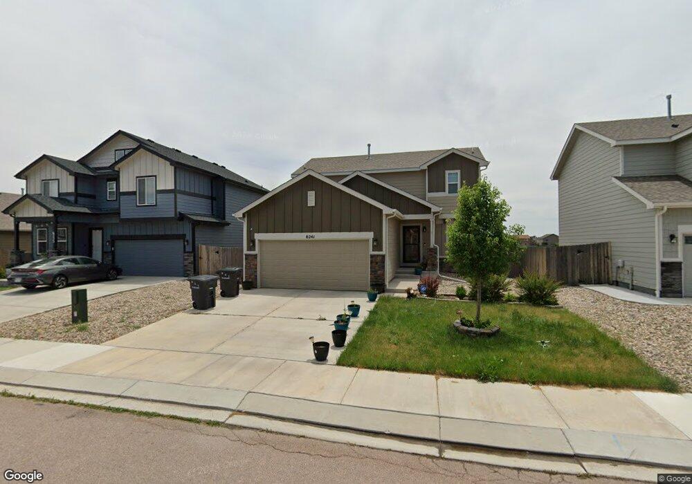
6241 Decker Dr Colorado Springs, CO 80925
Widefield NeighborhoodEstimated Value: $434,755 - $459,000
4
Beds
4
Baths
2,245
Sq Ft
$198/Sq Ft
Est. Value
About This Home
This home is located at 6241 Decker Dr, Colorado Springs, CO 80925 and is currently estimated at $444,689, approximately $198 per square foot. 6241 Decker Dr is a home located in El Paso County with nearby schools including Grand Mountain School, Widefield High School, and Valley Christian Academy.
Ownership History
Date
Name
Owned For
Owner Type
Purchase Details
Closed on
Oct 21, 2022
Sold by
Sfr Acquisitions 2 Llc
Bought by
Sfr Borrower 2022-A Llc
Current Estimated Value
Purchase Details
Closed on
Feb 19, 2021
Sold by
Terra Cameron Robert and Terra Ruthe Maria
Bought by
Bird Donald Patrick and Bird Andrea Suzanne
Home Financials for this Owner
Home Financials are based on the most recent Mortgage that was taken out on this home.
Original Mortgage
$415,000
Interest Rate
2.65%
Mortgage Type
VA
Purchase Details
Closed on
Jul 24, 2017
Sold by
Snint Aubyn Homes Llc
Bought by
Terra Cameron Robert and Terra Ruthe Maria
Home Financials for this Owner
Home Financials are based on the most recent Mortgage that was taken out on this home.
Original Mortgage
$285,356
Interest Rate
3.89%
Mortgage Type
VA
Create a Home Valuation Report for This Property
The Home Valuation Report is an in-depth analysis detailing your home's value as well as a comparison with similar homes in the area
Home Values in the Area
Average Home Value in this Area
Purchase History
| Date | Buyer | Sale Price | Title Company |
|---|---|---|---|
| Sfr Borrower 2022-A Llc | -- | -- | |
| Bird Donald Patrick | $418,000 | Unified Title Company | |
| Terra Cameron Robert | $279,350 | Unified Title Co |
Source: Public Records
Mortgage History
| Date | Status | Borrower | Loan Amount |
|---|---|---|---|
| Previous Owner | Bird Donald Patrick | $415,000 | |
| Previous Owner | Terra Cameron Robert | $285,356 |
Source: Public Records
Tax History Compared to Growth
Tax History
| Year | Tax Paid | Tax Assessment Tax Assessment Total Assessment is a certain percentage of the fair market value that is determined by local assessors to be the total taxable value of land and additions on the property. | Land | Improvement |
|---|---|---|---|---|
| 2025 | $4,464 | $30,210 | -- | -- |
| 2024 | $4,414 | $31,450 | $6,040 | $25,410 |
| 2022 | $3,611 | $24,330 | $4,810 | $19,520 |
| 2021 | $3,757 | $25,030 | $4,950 | $20,080 |
| 2020 | $3,137 | $20,690 | $4,330 | $16,360 |
| 2019 | $3,127 | $20,690 | $4,330 | $16,360 |
| 2018 | $3,005 | $19,730 | $4,360 | $15,370 |
| 2017 | $410 | $19,730 | $4,360 | $15,370 |
Source: Public Records
Map
Nearby Homes
- 6115 Fiddle Way
- 10648 Desert Bloom Way
- 6157 Cast Iron Dr
- 6116 Wacissa Dr
- 10604 Deer Meadow Cir
- 10525 Abrams Dr
- 10442 Abrams Dr
- 10420 Deer Meadow Cir
- 10463 Desert Bloom Way
- 10886 Matta Dr
- 10394 Abrams Dr
- 10867 Matta Dr
- 6484 Chaplin Dr
- 6152 Water Trough Trail
- 10405 Abrams Dr
- 11058 Tarbell Dr
- 6142 Mumford Dr
- 6579 Lamine Dr
- 6119 Mumford Dr
- 10634 Abrams Dr
- 6233 Decker Dr
- 6225 Decker Dr
- 6257 Decker Dr
- 6232 Decker Dr
- 6240 Decker Dr
- 6265 Decker Dr
- 6224 Decker Dr
- 6248 Decker Dr
- 6256 Decker Dr
- 6273 Decker Dr
- 6216 Decker Dr
- 6264 Decker Dr
- 10671 Cattle Baron Way
- 10681 Cattle Baron Way
- 10661 Cattle Baron Way
- 6272 Decker Dr
- 6280 Decker Dr
- 10624 Desert Bloom Way
- 10641 Cattle Baron Way
- 10636 Desert Bloom Way