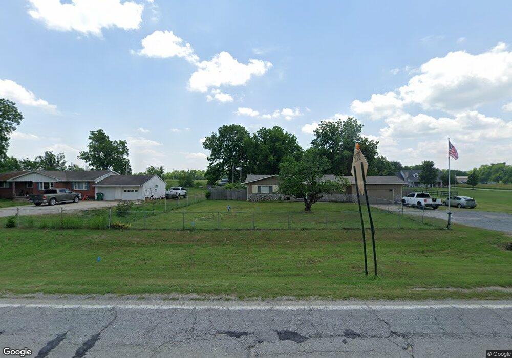
6242 W Rogers Blvd Skiatook, OK 74070
Estimated Value: $394,658 - $437,000
3
Beds
2
Baths
2,512
Sq Ft
$166/Sq Ft
Est. Value
About This Home
This home is located at 6242 W Rogers Blvd, Skiatook, OK 74070 and is currently estimated at $416,665, approximately $165 per square foot. 6242 W Rogers Blvd is a home located in Osage County with nearby schools including Marrs Elementary School, Newman Middle School, and Skiatook High School.
Ownership History
Date
Name
Owned For
Owner Type
Purchase Details
Closed on
Aug 12, 2005
Sold by
Jankauskas Kestutis P and Jankauskas Cheryl Y
Bought by
Jarrard Riceky Lee and Jarrard Janie Sue
Current Estimated Value
Purchase Details
Closed on
Nov 4, 1997
Sold by
Mcclure Clifford E and Mcclure Naomi M
Bought by
Jankauskas Kestutis P
Purchase Details
Closed on
Nov 26, 1993
Sold by
Mcclure R L
Bought by
Mcclure Clifford E and Mcclure Naomi M
Create a Home Valuation Report for This Property
The Home Valuation Report is an in-depth analysis detailing your home's value as well as a comparison with similar homes in the area
Home Values in the Area
Average Home Value in this Area
Purchase History
| Date | Buyer | Sale Price | Title Company |
|---|---|---|---|
| Jarrard Riceky Lee | $29,000 | None Available | |
| Jankauskas Kestutis P | $91,500 | -- | |
| Mcclure Clifford E | $8,500 | -- |
Source: Public Records
Tax History Compared to Growth
Tax History
| Year | Tax Paid | Tax Assessment Tax Assessment Total Assessment is a certain percentage of the fair market value that is determined by local assessors to be the total taxable value of land and additions on the property. | Land | Improvement |
|---|---|---|---|---|
| 2025 | $3,053 | $31,586 | $3,254 | $28,332 |
| 2024 | $3,053 | $31,586 | $3,254 | $28,332 |
| 2023 | $3,053 | $30,666 | $3,254 | $27,412 |
| 2022 | $2,850 | $28,906 | $3,254 | $25,652 |
| 2021 | $2,773 | $28,906 | $3,254 | $25,652 |
| 2020 | $2,706 | $28,064 | $3,254 | $24,810 |
| 2019 | $2,757 | $28,235 | $3,425 | $24,810 |
| 2018 | $2,746 | $28,235 | $3,425 | $24,810 |
| 2017 | $2,786 | $28,235 | $3,425 | $24,810 |
| 2016 | $2,798 | $28,245 | $3,425 | $24,820 |
| 2015 | $2,776 | $28,245 | $3,425 | $24,820 |
| 2014 | $2,639 | $28,245 | $3,425 | $24,820 |
| 2013 | $2,680 | $27,672 | $3,425 | $24,247 |
Source: Public Records
Map
Nearby Homes
- 401 S Buffalo
- 0 W Rogers Blvd Unit 2543424
- 7 Oklahoma 20
- 69 E Highway 20
- 0000 Oklahoma 20
- 4 N 52nd West Ave
- 8 N 52nd West Ave
- 3 N 52nd West Ave
- 5 N 52nd West Ave
- 2 N 52nd West Ave
- 12 Oklahoma 20
- 10 E Highway 20
- 15524 N 55th West Ave
- 0 N 46th West Ave
- 15373 N Javine Hill Rd
- 101 N Castle St
- 141 N Castle St
- 2 N Phillips St
- 1 N Phillips St
- 3 N Phillips St
- 6250 W Rogers Blvd
- 6214 W Rogers Blvd
- 6394 W Rogers Blvd
- 6408 W Rogers Blvd
- 6355 W Rogers Blvd
- 6275 W Rogers Blvd
- 6086 W Rogers Blvd
- 6502 W Rogers Blvd
- 6391 W Rogers Blvd
- 6303 W Oak St
- 6199 W Rogers Blvd
- 425 S Buffalo
- 6317 W Rogers Blvd
- 0 W Rogers Blvd Unit 2411943
- 0 W Rogers Blvd Unit 1633511
- 0 W Rogers Blvd Unit 1634344
- 0 W Rogers Blvd Unit 1700458
- 0 W Rogers Blvd Unit 1725503
- 0 W Rogers Blvd Unit 1800542
- 0 W Rogers Blvd Unit 1824626