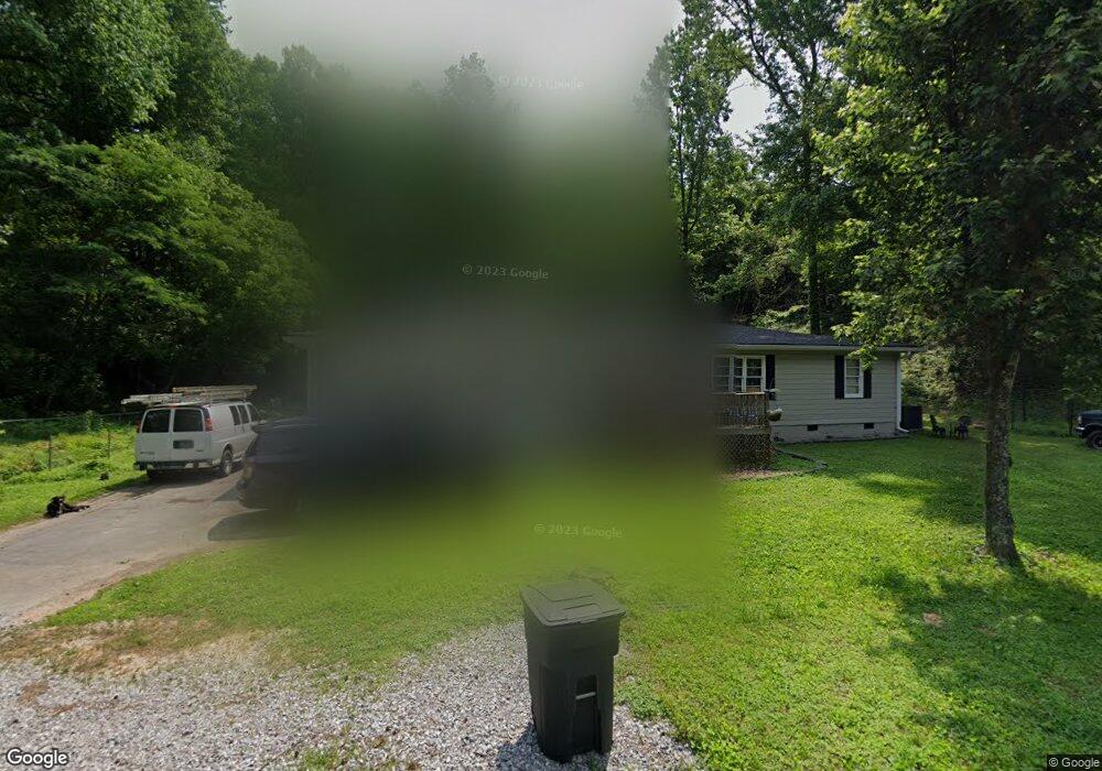
625 Burnt Mill Rd Flintstone, GA 30725
Flintstone NeighborhoodEstimated Value: $187,000 - $276,000
--
Bed
1
Bath
1,404
Sq Ft
$165/Sq Ft
Est. Value
About This Home
This home is located at 625 Burnt Mill Rd, Flintstone, GA 30725 and is currently estimated at $231,924, approximately $165 per square foot. 625 Burnt Mill Rd is a home located in Walker County with nearby schools including Stone Creek Elementary School, Rossville Middle School, and Ridgeland High School.
Ownership History
Date
Name
Owned For
Owner Type
Purchase Details
Closed on
Jul 25, 2024
Sold by
Cannon Thomas
Bought by
Cannon Thomas John
Current Estimated Value
Purchase Details
Closed on
Apr 28, 2022
Sold by
Cannon Thomas
Bought by
Cannon Thomas John
Purchase Details
Closed on
Oct 18, 2012
Sold by
Watkins Ronald F
Bought by
Cannon Thomas and Cannon Laura G
Purchase Details
Closed on
Dec 28, 2011
Sold by
Burks Ernestine
Bought by
Watkins Ronald F
Purchase Details
Closed on
Nov 3, 2000
Sold by
Freeman Lee and Freeman Arittie
Bought by
Davison William Jeffrey
Purchase Details
Closed on
Jan 1, 1972
Bought by
Freeman Lee and Freeman Arittie
Create a Home Valuation Report for This Property
The Home Valuation Report is an in-depth analysis detailing your home's value as well as a comparison with similar homes in the area
Home Values in the Area
Average Home Value in this Area
Purchase History
| Date | Buyer | Sale Price | Title Company |
|---|---|---|---|
| Cannon Thomas John | -- | -- | |
| Cannon Thomas John | -- | -- | |
| Cannon Thomas | -- | -- | |
| Watkins Ronald F | -- | -- | |
| Davison William Jeffrey | -- | -- | |
| Freeman Lee | -- | -- |
Source: Public Records
Tax History Compared to Growth
Tax History
| Year | Tax Paid | Tax Assessment Tax Assessment Total Assessment is a certain percentage of the fair market value that is determined by local assessors to be the total taxable value of land and additions on the property. | Land | Improvement |
|---|---|---|---|---|
| 2024 | $1,681 | $73,060 | $16,790 | $56,270 |
| 2023 | $1,577 | $66,635 | $13,325 | $53,310 |
| 2022 | $1,339 | $51,614 | $5,882 | $45,732 |
| 2021 | $960 | $31,899 | $5,882 | $26,017 |
| 2020 | $991 | $31,899 | $5,882 | $26,017 |
| 2019 | $1,008 | $31,899 | $5,882 | $26,017 |
| 2018 | $844 | $31,899 | $5,882 | $26,017 |
| 2017 | $1,096 | $31,899 | $5,882 | $26,017 |
| 2016 | $430 | $12,249 | $5,882 | $6,367 |
| 2015 | $669 | $20,678 | $7,264 | $13,414 |
| 2014 | $517 | $17,911 | $7,264 | $10,647 |
| 2013 | -- | $17,910 | $7,264 | $10,646 |
Source: Public Records
Map
Nearby Homes
- 5720 Saint Elmo Ave
- 1317 Thomas Ave Unit 8
- 1317 Thomas Ave
- 1297 Thomas Ave
- 724 Shelly Ln
- 5601 Alabama Ave
- 5413 Lee Ave
- 717 W James St
- 5422 Saint Elmo Ave
- 0 Slayton Ave Unit 1504633
- Lots 7 & 5 Slayton Ave
- 715 W James St
- 5405 Saint Elmo Ave
- 5342 Slayton Ave
- 1402 W 53rd St
- 635 N Sherry Dr
- 1303 W 53rd St
- 5301 Saint Elmo Ave
- 53 Charlsie Trail Unit 12
- 732 Salem Rd
- 625 Burnt Mill Rd
- 625 Burnt Mill Rd
- 1140 Lafayette Dr
- 747 Burnt Mill Rd
- 561 Burnt Mill Rd
- 0 Lafayette Dr Unit 1391033
- 0 Lafayette Dr Unit 1262796
- 0 Lafayette Dr Unit RTC2668661
- 0 Lafayette Dr
- 773 Burnt Mill Rd
- 1124 Lafayette Dr
- 717 Burnt Mill Rd
- 1122 Lafayette Dr
- 781 Burnt Mill Rd
- 513 Burnt Mill Rd
- 964 Seymour Ave
- 964 1/2 Seymour Ave
- 778 Burnt Mill Rd
- 783 Burnt Mill Rd
- 491 Burnt Mill Rd