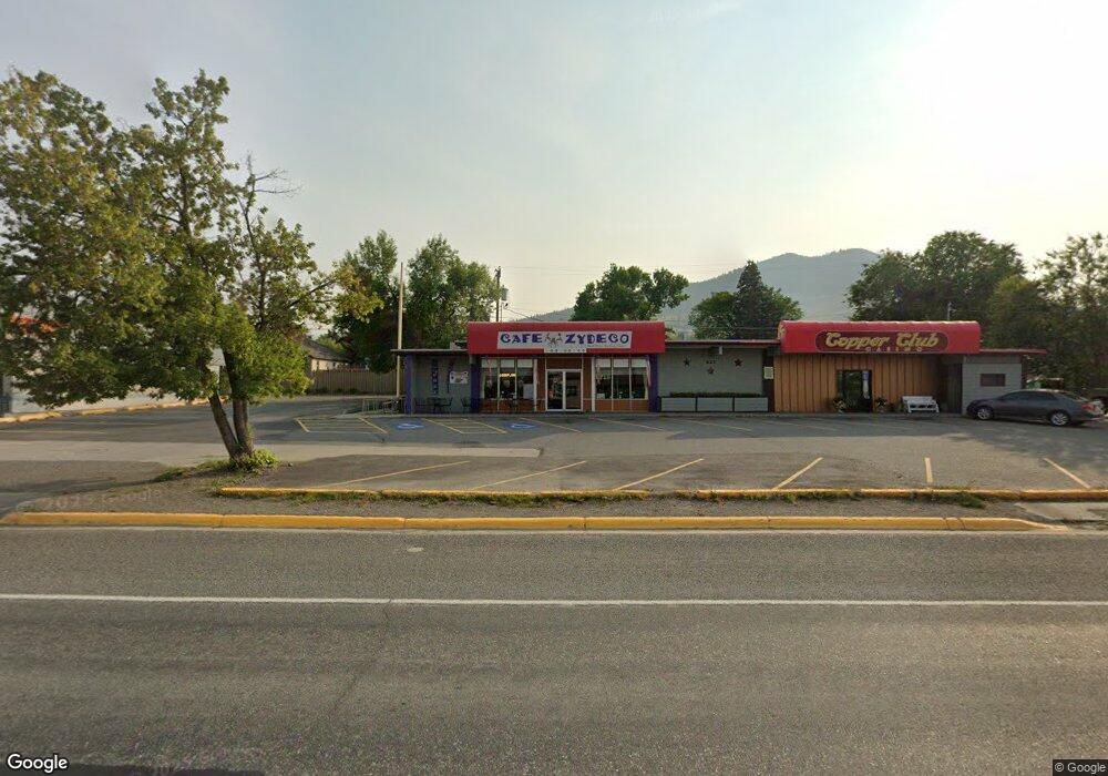
625 Euclid Ave Helena, MT 59601
Upper West Side Neighborhood
Studio
--
Bath
5,247
Sq Ft
0.46
Acres
About This Home
This home is located at 625 Euclid Ave, Helena, MT 59601. 625 Euclid Ave is a home located in Lewis and Clark County with nearby schools including Hawthorne Elementary School, C.R. Anderson Middle School, and Helena Christian Academy.
Ownership History
Date
Name
Owned For
Owner Type
Purchase Details
Closed on
Feb 20, 2014
Sold by
Andrews Jeffrey S
Bought by
Koko Llc
Home Financials for this Owner
Home Financials are based on the most recent Mortgage that was taken out on this home.
Original Mortgage
$1,045,627
Outstanding Balance
$551,260
Interest Rate
4.34%
Mortgage Type
Commercial
Purchase Details
Closed on
May 16, 2005
Sold by
Westside Properties Llc
Bought by
Andrews Jeffrey
Home Financials for this Owner
Home Financials are based on the most recent Mortgage that was taken out on this home.
Original Mortgage
$40,615
Interest Rate
6.02%
Mortgage Type
Commercial
Create a Home Valuation Report for This Property
The Home Valuation Report is an in-depth analysis detailing your home's value as well as a comparison with similar homes in the area
Home Values in the Area
Average Home Value in this Area
Purchase History
| Date | Buyer | Sale Price | Title Company |
|---|---|---|---|
| Koko Llc | -- | First Montana Land & Title C | |
| Andrews Jeffrey | -- | First Montana Title |
Source: Public Records
Mortgage History
| Date | Status | Borrower | Loan Amount |
|---|---|---|---|
| Open | Koko Llc | $1,045,627 | |
| Closed | Koko Llc | $583,659 | |
| Previous Owner | Andrews Jeffrey | $40,615 |
Source: Public Records
Tax History
| Year | Tax Paid | Tax Assessment Tax Assessment Total Assessment is a certain percentage of the fair market value that is determined by local assessors to be the total taxable value of land and additions on the property. | Land | Improvement |
|---|---|---|---|---|
| 2025 | $8,561 | $755,600 | $0 | $0 |
| 2024 | $9,702 | $724,000 | $0 | $0 |
| 2023 | $11,788 | $724,000 | $0 | $0 |
| 2022 | $12,264 | $650,900 | $0 | $0 |
| 2021 | $12,049 | $650,900 | $0 | $0 |
| 2020 | $10,729 | $550,800 | $0 | $0 |
| 2019 | $10,742 | $550,800 | $0 | $0 |
| 2018 | $10,371 | $568,200 | $0 | $0 |
| 2017 | $7,932 | $568,200 | $0 | $0 |
| 2016 | $8,619 | $541,700 | $0 | $0 |
| 2015 | $7,715 | $541,700 | $0 | $0 |
| 2014 | $7,613 | $414,271 | $0 | $0 |
Source: Public Records
Map
Nearby Homes
- 1108 Choteau St
- 1001 Hauser Blvd
- 814 N Park Ave
- 618 Madison Ave
- 1106 Hudson St
- 1415 Hauser Blvd
- 1624 Cannon St Unit 35
- 1624 Cannon St Unit 25
- 1624 Cannon St Unit 30
- 1616 Cannon St Unit 17
- 342 Clarke St
- 1 Deborah Ct
- 1701 Cannon St
- 804 Logan St
- 818 Logan St
- 1801 Cannon St
- 102 Jefferson St
- 1051 N Warren St
- 33 Carriage Ln
- 21 N Last Chance Gulch Unit 7G & 7H
- 622 Cannon St
- 620 Cannon St
- 640 Cannon St
- 614 Cannon St
- 632 Euclid Ave
- 632 Euclid Ave Unit Emiliano's
- 612 Cannon St
- 1200 Garfield St
- 1200 Garfield St Unit 1202 Garfield
- 601 Euclid Ave
- 601 Euclid Ave Unit Suite C
- 601 Euclid Ave Unit C
- 601 Euclid Ave Unit D
- 908 Cannon St
- 602 Cannon St
- 639 Cannon St
- 914 Cannon St
- 611 Cannon St
- 625 Wilder Ave
- 631 Wilder Ave
Your Personal Tour Guide
Ask me questions while you tour the home.