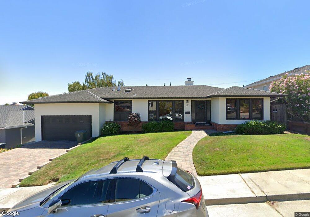
625 Hobart Ave San Mateo, CA 94402
Beresford Park NeighborhoodEstimated Value: $2,493,000 - $3,141,000
3
Beds
2
Baths
1,740
Sq Ft
$1,573/Sq Ft
Est. Value
About This Home
This home is located at 625 Hobart Ave, San Mateo, CA 94402 and is currently estimated at $2,736,181, approximately $1,572 per square foot. 625 Hobart Ave is a home located in San Mateo County with nearby schools including Baywood Elementary School, Borel Middle School, and Aragon High School.
Ownership History
Date
Name
Owned For
Owner Type
Purchase Details
Closed on
Sep 5, 2007
Sold by
Fok Winnie and Fok Winnie W
Bought by
Fok Winnie
Current Estimated Value
Purchase Details
Closed on
Nov 21, 2002
Sold by
Fok Winnie W
Bought by
Fok Winnie W
Home Financials for this Owner
Home Financials are based on the most recent Mortgage that was taken out on this home.
Original Mortgage
$600,000
Outstanding Balance
$253,162
Interest Rate
6.12%
Mortgage Type
Stand Alone First
Estimated Equity
$2,483,019
Purchase Details
Closed on
Oct 7, 1998
Sold by
Loesch Lila J
Bought by
Ng Norman S and Fok Winnie W
Home Financials for this Owner
Home Financials are based on the most recent Mortgage that was taken out on this home.
Original Mortgage
$395,000
Interest Rate
6.5%
Create a Home Valuation Report for This Property
The Home Valuation Report is an in-depth analysis detailing your home's value as well as a comparison with similar homes in the area
Home Values in the Area
Average Home Value in this Area
Purchase History
| Date | Buyer | Sale Price | Title Company |
|---|---|---|---|
| Fok Winnie | -- | None Available | |
| Fok Winnie W | -- | Financial Title Company | |
| Ng Norman S | $539,000 | Fidelity National Title Co |
Source: Public Records
Mortgage History
| Date | Status | Borrower | Loan Amount |
|---|---|---|---|
| Open | Fok Winnie W | $600,000 | |
| Previous Owner | Ng Norman S | $395,000 |
Source: Public Records
Tax History
| Year | Tax Paid | Tax Assessment Tax Assessment Total Assessment is a certain percentage of the fair market value that is determined by local assessors to be the total taxable value of land and additions on the property. | Land | Improvement |
|---|---|---|---|---|
| 2025 | $11,481 | $844,978 | $422,489 | $422,489 |
| 2023 | $11,481 | $812,168 | $406,084 | $406,084 |
| 2022 | $10,562 | $796,244 | $398,122 | $398,122 |
| 2021 | $10,958 | $780,632 | $390,316 | $390,316 |
| 2020 | $10,392 | $772,628 | $386,314 | $386,314 |
| 2019 | $11,096 | $757,480 | $378,740 | $378,740 |
| 2018 | $10,173 | $742,628 | $371,314 | $371,314 |
| 2017 | $9,571 | $728,068 | $364,034 | $364,034 |
| 2016 | $9,176 | $713,794 | $356,897 | $356,897 |
| 2015 | $9,634 | $703,074 | $351,537 | $351,537 |
| 2014 | $9,363 | $689,302 | $344,651 | $344,651 |
Source: Public Records
Map
Nearby Homes
- 1322 Ashwood Ct Unit 33
- 740 Clydesdale Dr
- 390 Hobart Ave
- 339 Hobart Ave
- 1919 Alameda de Las Pulgas Unit 140
- 307 Aragon Blvd
- 2001 Alameda de Las Pulgas Unit 172
- 229 Aragon Blvd
- 140 Tobin Clark Dr
- 115 Hobart Ave Unit E
- 112 Madison Ave Unit 109
- 370 Parrott Dr
- 250 Harvard Rd
- 0 Parrott Dr
- 1951 O'Farrell St Unit 415
- 200 Tobin Clark Dr
- 523 Maple St
- 815 Crystal Springs Rd
- 225 Virginia Ave Unit PH-D
- 225 Virginia Ave Unit 3D
- 621 Hobart Ave
- 629 Hobart Ave
- 628 Macarthur Ave
- 1211 Woodland Dr
- 620 Macarthur Ave
- 617 Hobart Ave
- 633 Hobart Ave
- 628 Hobart Ave
- 616 Macarthur Ave
- 632 Hobart Ave
- 624 Hobart Ave
- 620 Hobart Ave
- 636 Hobart Ave
- 615 Hobart Ave
- 612 Macarthur Ave
- 616 Hobart Ave
- 1303 Woodland Dr
- 1216 Woodland Dr
- 1208 Woodland Dr
- 640 Hobart Ave
Your Personal Tour Guide
Ask me questions while you tour the home.