Estimated Value: $81,000 - $167,000
6
Beds
4
Baths
1,800
Sq Ft
$73/Sq Ft
Est. Value
About This Home
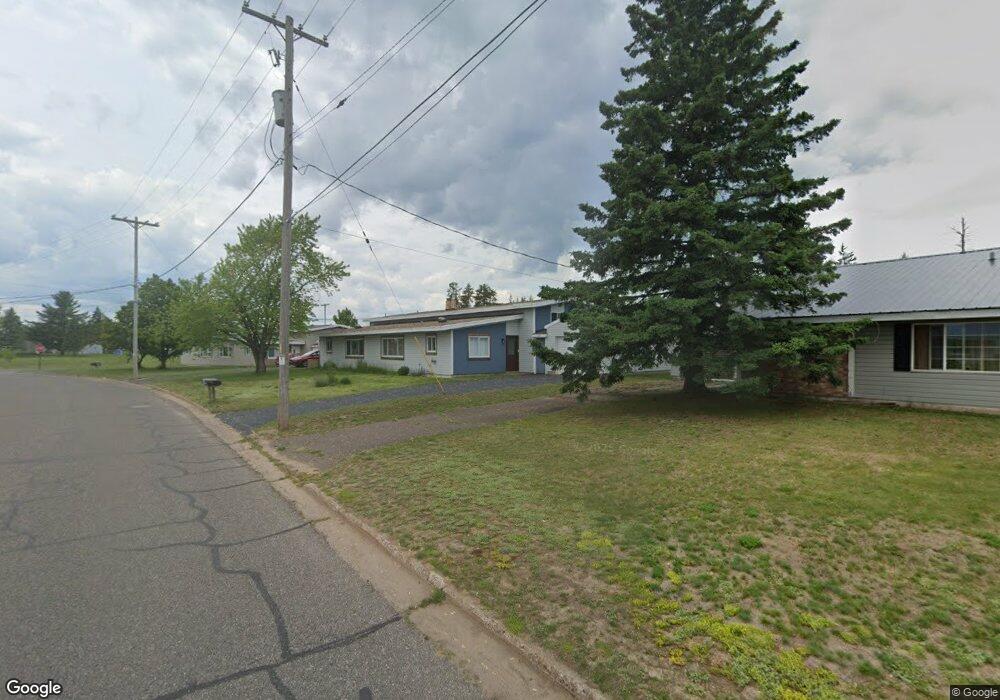
This home is located at 625 Liberator St Unit 627, Gwinn, MI 49841 and is currently estimated at $132,005, approximately $73 per square foot. 625 Liberator St Unit 627 is a home located in Marquette County with nearby schools including K.I. Sawyer Elementary School and Gwinn Middle/High School.
Ownership History
Date
Name
Owned For
Owner Type
Purchase Details
Closed on
May 30, 2023
Sold by
Peterson Dennis A and Peterson Judith A
Bought by
Peterson Dennis A and Peterson Dennis A
Current Estimated Value
Purchase Details
Closed on
Oct 17, 2022
Sold by
Fox Nicholas R
Bought by
Macfarlane Ian Michael
Home Financials for this Owner
Home Financials are based on the most recent Mortgage that was taken out on this home.
Original Mortgage
$130,950
Interest Rate
6.02%
Mortgage Type
New Conventional
Purchase Details
Closed on
May 10, 2010
Bought by
Lies Nicholas and Lies Janna
Create a Home Valuation Report for This Property
The Home Valuation Report is an in-depth analysis detailing your home's value as well as a comparison with similar homes in the area
Home Values in the Area
Average Home Value in this Area
Purchase History
| Date | Buyer | Sale Price | Title Company |
|---|---|---|---|
| Peterson Dennis A | -- | None Listed On Document | |
| Macfarlane Ian Michael | $146,000 | -- | |
| Lies Nicholas | $37,500 | -- |
Source: Public Records
Mortgage History
| Date | Status | Borrower | Loan Amount |
|---|---|---|---|
| Previous Owner | Macfarlane Ian Michael | $130,950 |
Source: Public Records
Tax History Compared to Growth
Tax History
| Year | Tax Paid | Tax Assessment Tax Assessment Total Assessment is a certain percentage of the fair market value that is determined by local assessors to be the total taxable value of land and additions on the property. | Land | Improvement |
|---|---|---|---|---|
| 2025 | $8 | $64,900 | $0 | $0 |
| 2024 | $8 | $51,900 | $0 | $0 |
| 2023 | $723 | $47,900 | $0 | $0 |
| 2022 | $674 | $31,400 | $0 | $0 |
| 2021 | $654 | $35,900 | $0 | $0 |
| 2020 | $644 | $31,400 | $0 | $0 |
| 2019 | $606 | $20,200 | $0 | $0 |
| 2018 | $605 | $20,200 | $0 | $0 |
| 2017 | $566 | $20,200 | $0 | $0 |
| 2016 | $564 | $19,800 | $0 | $0 |
| 2015 | -- | $19,800 | $0 | $0 |
| 2014 | -- | $20,100 | $0 | $0 |
| 2012 | -- | $21,500 | $0 | $0 |
Source: Public Records
Map
Nearby Homes
- 317 319 Skybolt St
- 136 Crusader Ave
- 117 Provider St
- 102 Caribou St
- TBD E Martin Lake Rd
- TBD E Provost Lake Rd
- 1591 Millyard Rd
- 2020 Cr456 Rd
- 1687 E M35
- 1681 E M35
- 1400 Setter Rd
- 1882 1st St
- 115 N Marshall Dr
- 171 E Sands St
- 148 E Sands St
- 115 N M553
- TBD Carlshend Little Lake Rd
- 215 Driftwood Dr
- 71 E Stephenson Ave
- TBD Co Rd Eeb Pohlman Rd
- 629 Liberator St Unit 631
- 624 Liberator St
- 624 Liberator St Unit 626
- 628 Liberator St Unit 630
- 600 Talon St Unit 602
- 601 Talon St Unit 603
- 221 Titan St
- 625 Liberator St
- 629 Liberator St
- 625 Liberator St
- 601 Liberator St
- 617 Liberator St Unit 619
- 621 Liberator St Unit 623
- 605 Talon St
- 605 Talon St
- 600 Valkyrie St
- 223 Titan St
- 219 Titan St
- 601 Hercules St
- 601 Hercules St Unit 603