Estimated Value: $106,000 - $161,000
Studio
1
Bath
1,540
Sq Ft
$89/Sq Ft
Est. Value
About This Home
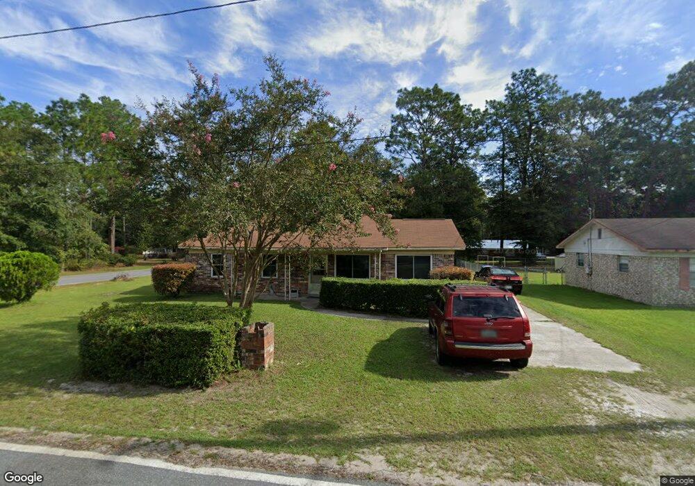
This home is located at 625 Maple St, Jesup, GA 31546 and is currently estimated at $137,513, approximately $89 per square foot. 625 Maple St is a home located in Wayne County with nearby schools including Jesup Elementary School, Arthur Williams Middle School, and Wayne County High School.
Ownership History
Date
Name
Owned For
Owner Type
Purchase Details
Closed on
Jan 4, 2007
Sold by
Carswell Kenneth R
Bought by
Thomas Harold and Thomas Ernestine
Current Estimated Value
Home Financials for this Owner
Home Financials are based on the most recent Mortgage that was taken out on this home.
Original Mortgage
$70,000
Outstanding Balance
$50,666
Interest Rate
10.75%
Mortgage Type
New Conventional
Estimated Equity
$86,847
Purchase Details
Closed on
Dec 28, 2006
Sold by
Rooks Arthur
Bought by
Thomas Harold
Home Financials for this Owner
Home Financials are based on the most recent Mortgage that was taken out on this home.
Original Mortgage
$70,000
Outstanding Balance
$50,666
Interest Rate
10.75%
Mortgage Type
New Conventional
Estimated Equity
$86,847
Purchase Details
Closed on
Sep 1, 2000
Purchase Details
Closed on
Mar 1, 2000
Purchase Details
Closed on
Aug 1, 1989
Purchase Details
Closed on
Aug 1, 1978
Purchase Details
Closed on
Aug 1, 1977
Create a Home Valuation Report for This Property
The Home Valuation Report is an in-depth analysis detailing your home's value as well as a comparison with similar homes in the area
Purchase History
| Date | Buyer | Sale Price | Title Company |
|---|---|---|---|
| Thomas Harold | -- | -- | |
| Carswell Kenneth R | -- | -- | |
| Thomas Harold | $70,000 | -- | |
| -- | -- | -- | |
| -- | $21,000 | -- | |
| -- | $65,000 | -- | |
| -- | $36,500 | -- | |
| -- | -- | -- | |
| -- | -- | -- |
Source: Public Records
Mortgage History
| Date | Status | Borrower | Loan Amount |
|---|---|---|---|
| Open | Thomas Harold | $70,000 |
Source: Public Records
Tax History
| Year | Tax Paid | Tax Assessment Tax Assessment Total Assessment is a certain percentage of the fair market value that is determined by local assessors to be the total taxable value of land and additions on the property. | Land | Improvement |
|---|---|---|---|---|
| 2025 | $1,142 | $41,291 | $1,536 | $39,755 |
| 2024 | $1,090 | $39,960 | $1,536 | $38,424 |
| 2023 | $936 | $26,465 | $1,536 | $24,929 |
| 2022 | $676 | $26,465 | $1,536 | $24,929 |
| 2021 | $724 | $26,465 | $1,536 | $24,929 |
| 2020 | $749 | $26,465 | $1,536 | $24,929 |
| 2019 | $771 | $26,465 | $1,536 | $24,929 |
| 2018 | $771 | $26,465 | $1,536 | $24,929 |
| 2017 | $664 | $26,465 | $1,536 | $24,929 |
| 2016 | $642 | $26,465 | $1,536 | $24,929 |
| 2014 | $644 | $26,465 | $1,536 | $24,929 |
| 2013 | -- | $26,465 | $1,536 | $24,929 |
Source: Public Records
Map
Nearby Homes
- 675 Fir St
- 548 N Cypress St
- 0 E Oak St
- Apt E Oak St
- 385 N Hickory St
- 447 NE Broad St
- 498 NE Broad St
- 436-441 Brunswick St
- 187 E Pine St
- 197 NW Broad St
- 661 E Plum St
- 1074 E Cherry St
- 169 Pine Ridge Rd
- 0 N 4th St Unit 1660016
- 0 N 4th St Unit 166837
- 0 N 4th St Unit 10697567
- 110 E Pine St
- 15 Bethlehem Rd
- 412 E Orange St
- 286 S Wayne St
Your Personal Tour Guide
Ask me questions while you tour the home.