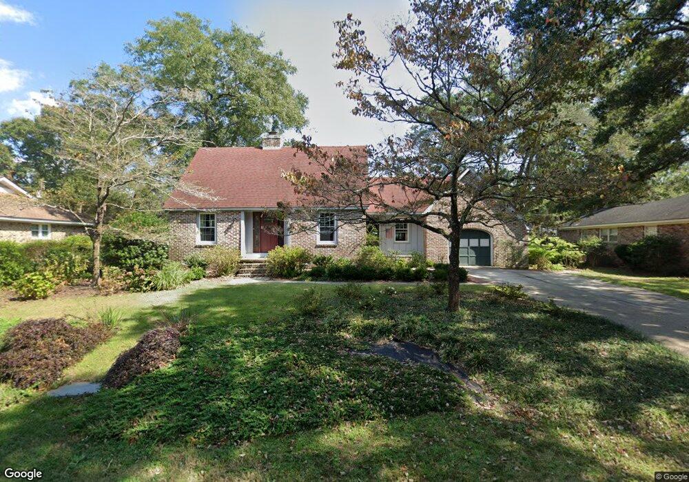
626 Beauregard St Charleston, SC 29412
James Island NeighborhoodEstimated Value: $707,000 - $806,000
3
Beds
2
Baths
2,194
Sq Ft
$347/Sq Ft
Est. Value
About This Home
This home is located at 626 Beauregard St, Charleston, SC 29412 and is currently estimated at $760,571, approximately $346 per square foot. 626 Beauregard St is a home located in Charleston County with nearby schools including Stiles Point Elementary School, Camp Road Middle, and James Island Charter High School.
Ownership History
Date
Name
Owned For
Owner Type
Purchase Details
Closed on
Mar 27, 2015
Sold by
Mcconnell Cynthia B
Bought by
Amis Nancy C and Leary Frederick J
Current Estimated Value
Home Financials for this Owner
Home Financials are based on the most recent Mortgage that was taken out on this home.
Original Mortgage
$279,000
Outstanding Balance
$193,749
Interest Rate
3.89%
Mortgage Type
New Conventional
Estimated Equity
$566,822
Purchase Details
Closed on
Jun 4, 2003
Sold by
Buero Harold I and Buero Betty H
Bought by
Mcconnell Cynthia B
Create a Home Valuation Report for This Property
The Home Valuation Report is an in-depth analysis detailing your home's value as well as a comparison with similar homes in the area
Home Values in the Area
Average Home Value in this Area
Purchase History
| Date | Buyer | Sale Price | Title Company |
|---|---|---|---|
| Amis Nancy C | $310,000 | -- | |
| Mcconnell Cynthia B | $100,000 | -- |
Source: Public Records
Mortgage History
| Date | Status | Borrower | Loan Amount |
|---|---|---|---|
| Open | Amis Nancy C | $279,000 |
Source: Public Records
Tax History Compared to Growth
Tax History
| Year | Tax Paid | Tax Assessment Tax Assessment Total Assessment is a certain percentage of the fair market value that is determined by local assessors to be the total taxable value of land and additions on the property. | Land | Improvement |
|---|---|---|---|---|
| 2024 | $1,499 | $12,260 | $0 | $0 |
| 2023 | $1,499 | $14,260 | $0 | $0 |
| 2022 | $1,557 | $14,260 | $0 | $0 |
| 2021 | $1,667 | $14,260 | $0 | $0 |
| 2020 | $1,686 | $14,260 | $0 | $0 |
| 2019 | $1,538 | $12,400 | $0 | $0 |
| 2017 | $1,634 | $12,400 | $0 | $0 |
| 2016 | $1,566 | $12,400 | $0 | $0 |
| 2015 | $1,585 | $12,040 | $0 | $0 |
| 2014 | $1,336 | $0 | $0 | $0 |
| 2011 | -- | $0 | $0 | $0 |
Source: Public Records
Map
Nearby Homes
- 734 Sterling Dr
- 679 Edmonds Dr
- 683 Edmonds Dr
- 762 Swanson Ave
- 562 Fort Johnson Rd
- 0 Fort Johnson Rd Unit 25005735
- 513 Sweetbay Rd
- 460 Trapier Dr
- 853 Whispering Marsh Dr
- 881 Evans Rd
- 897 Kushiwah Creek Ct
- 832 Robert e Lee Blvd
- 881 Kushiwah Creek Dr
- 865 Duvall St
- 939 Mikell Dr
- 1013 Jamsie Cove Dr
- 825 Shutes Folly Dr
- 525 Yellow Tower Terrace
- 969 Harbor View Rd
- 965 Mooring Dr
- 630 Beauregard St
- 622 Beauregard St
- 715 Sterling Dr
- 711 Sterling Dr
- 721 Sterling Dr
- 634 Beauregard St
- 625 Beauregard St
- 629 Beauregard St
- 618 Beauregard St
- 621 Beauregard St
- 725 Sterling Dr
- 633 Beauregard St
- 707 Sterling Dr Unit B
- 707 Sterling Dr Unit A
- 707 Sterling Dr Unit A & B
- 707 Sterling Dr
- 638 Beauregard St
- 637 Beauregard St
- 703 Sterling Dr
- 615 Beauregard St