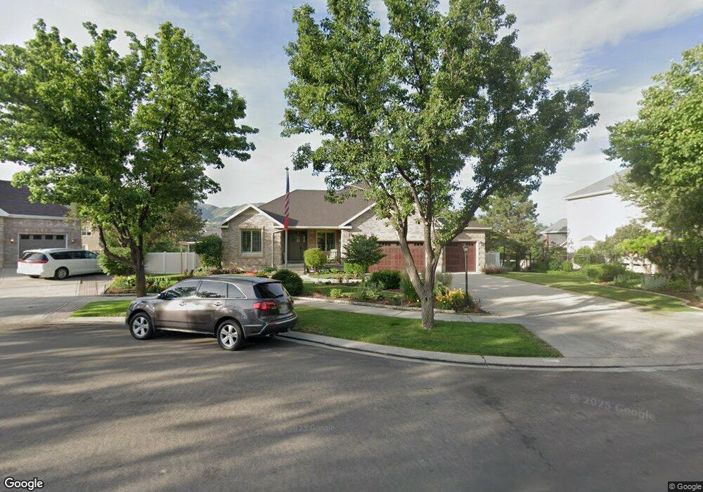
626 E Pheasant Haven Ct Draper, UT 84020
Estimated Value: $1,023,000 - $1,125,370
5
Beds
3
Baths
4,630
Sq Ft
$230/Sq Ft
Est. Value
About This Home
This home is located at 626 E Pheasant Haven Ct, Draper, UT 84020 and is currently estimated at $1,066,343, approximately $230 per square foot. 626 E Pheasant Haven Ct is a home located in Salt Lake County with nearby schools including Corner Canyon High School, Draper Park Middle School, and Summit Academy - Draper Elementary Campus.
Ownership History
Date
Name
Owned For
Owner Type
Purchase Details
Closed on
Sep 29, 2020
Sold by
Roberts Shannon L and Shannon L Roberts Trust
Bought by
Avellar Gilbert C and Avellar Sherry W
Current Estimated Value
Home Financials for this Owner
Home Financials are based on the most recent Mortgage that was taken out on this home.
Original Mortgage
$300,000
Outstanding Balance
$266,834
Interest Rate
2.9%
Mortgage Type
New Conventional
Estimated Equity
$799,509
Purchase Details
Closed on
Sep 28, 2020
Sold by
Avellar Gilbert C and Avellar Sherry W
Bought by
Avellar Gilbert C and Avellar Sherry W
Home Financials for this Owner
Home Financials are based on the most recent Mortgage that was taken out on this home.
Original Mortgage
$300,000
Outstanding Balance
$266,834
Interest Rate
2.9%
Mortgage Type
New Conventional
Estimated Equity
$799,509
Purchase Details
Closed on
Jun 12, 2020
Sold by
Roberts Brent D and Roberts Shannon L
Bought by
Roberts Shannon L and Shannon L Roberts Trust
Purchase Details
Closed on
Jul 8, 2009
Sold by
Roberts Brent and Roberts Shannon
Bought by
Roberts Brent D and Roberts Shannon L
Purchase Details
Closed on
Dec 20, 2001
Sold by
Spurgeon Colleen S and May Colleen S
Bought by
Roberts Brent and Roberts Shannon
Home Financials for this Owner
Home Financials are based on the most recent Mortgage that was taken out on this home.
Original Mortgage
$300,600
Interest Rate
6.51%
Purchase Details
Closed on
Jun 29, 1995
Sold by
Mst Builders Inc
Bought by
May Colleen S
Home Financials for this Owner
Home Financials are based on the most recent Mortgage that was taken out on this home.
Original Mortgage
$255,900
Interest Rate
7.88%
Purchase Details
Closed on
Mar 14, 1995
Sold by
Cannon Mcwood and Cannon Ii L C
Bought by
Mst Builders Inc
Home Financials for this Owner
Home Financials are based on the most recent Mortgage that was taken out on this home.
Original Mortgage
$213,700
Interest Rate
9.03%
Create a Home Valuation Report for This Property
The Home Valuation Report is an in-depth analysis detailing your home's value as well as a comparison with similar homes in the area
Home Values in the Area
Average Home Value in this Area
Purchase History
| Date | Buyer | Sale Price | Title Company |
|---|---|---|---|
| Avellar Gilbert C | -- | Us Title | |
| Avellar Gilbert C | -- | Novation Title Ins Agcy | |
| Roberts Shannon L | -- | None Available | |
| Roberts Brent D | -- | None Available | |
| Roberts Brent | -- | Surety Title Corporation | |
| May Colleen S | -- | -- | |
| Mst Builders Inc | -- | -- |
Source: Public Records
Mortgage History
| Date | Status | Borrower | Loan Amount |
|---|---|---|---|
| Open | Avellar Gilbert C | $300,000 | |
| Previous Owner | Roberts Brent | $300,600 | |
| Previous Owner | May Colleen S | $255,900 | |
| Previous Owner | Mst Builders Inc | $213,700 |
Source: Public Records
Tax History
| Year | Tax Paid | Tax Assessment Tax Assessment Total Assessment is a certain percentage of the fair market value that is determined by local assessors to be the total taxable value of land and additions on the property. | Land | Improvement |
|---|---|---|---|---|
| 2025 | $4,984 | $1,008,600 | $283,300 | $725,300 |
| 2024 | $4,984 | $952,100 | $272,800 | $679,300 |
| 2023 | $4,984 | $946,500 | $254,500 | $692,000 |
| 2022 | $5,276 | $966,400 | $249,500 | $716,900 |
| 2021 | $4,522 | $707,500 | $235,100 | $472,400 |
| 2020 | $3,821 | $566,700 | $206,300 | $360,400 |
| 2019 | $3,961 | $574,000 | $206,300 | $367,700 |
| 2018 | $3,784 | $560,400 | $194,400 | $366,000 |
| 2017 | $3,622 | $513,900 | $185,000 | $328,900 |
| 2016 | $3,586 | $494,500 | $177,700 | $316,800 |
| 2015 | $3,584 | $457,600 | $181,200 | $276,400 |
| 2014 | $3,366 | $419,800 | $167,000 | $252,800 |
Source: Public Records
Map
Nearby Homes
- 13208 Sunset Glen Way
- 13160 S 300 E
- 13176 Day Ct
- 847 E Willow Springs Ln
- 12959 S Fort St
- 265 E 13275 S
- 13520 S Lone Rock Dr
- 902 E 12650 S
- 633 E Vandalay Ln
- 13216 S Telemark Ln
- 963 Old English Rd
- 528 E 13710 S
- 296 E Ireland Ln Unit 101
- 261 E Concord Farm Ln Unit 6
- 13469 S Mule Creek Cove
- 13554 Bella Monte Dr Unit 113
- 919 E 13800 S
- 13898 Summerset Cir
- 248 E 13800 S Unit 27
- 13050 S 1300 E
- 626 Pheasant Haven Ct
- 612 Pheasant Haven Ct
- 612 E Pheasant Haven Ct
- 638 Pheasant Haven Ct
- 638 E Pheasant Haven Ct
- 633 E Fitz Ln
- 633 Fitz Ln
- 619 E Fitz Ln
- 619 Fitz Ln
- 641 E Pheasant Haven Ct
- 641 Pheasant Haven Ct
- 649 Fitz Ln
- 607 E Fitz Ln
- 607 E Fitz Ln
- 607 Fitz Ln
- 623 Pheasant Haven Ct
- 592 Pheasant Haven Ct
- 637 E Pheasant Haven Ct
- 637 Pheasant Haven Ct
- 611 Pheasant Haven Ct
Your Personal Tour Guide
Ask me questions while you tour the home.