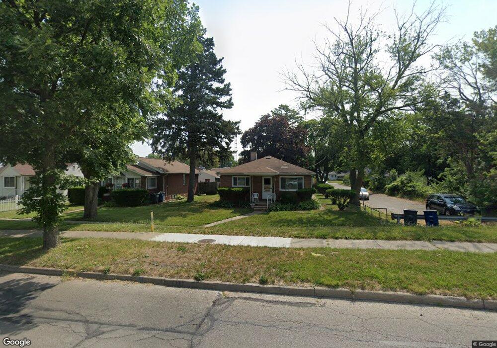
626 Parkside Blvd Toledo, OH 43607
Scott Park NeighborhoodEstimated Value: $78,647 - $121,000
2
Beds
1
Bath
1,008
Sq Ft
$95/Sq Ft
Est. Value
About This Home
This home is located at 626 Parkside Blvd, Toledo, OH 43607 and is currently estimated at $95,662, approximately $94 per square foot. 626 Parkside Blvd is a home located in Lucas County with nearby schools including Jesup W. Scott High School, Explorers Academy, and Explorers Academy of Science and Technology.
Ownership History
Date
Name
Owned For
Owner Type
Purchase Details
Closed on
Sep 15, 2008
Sold by
Lepiarz Edward A
Bought by
Odoms Theresa Y
Current Estimated Value
Home Financials for this Owner
Home Financials are based on the most recent Mortgage that was taken out on this home.
Original Mortgage
$43,200
Interest Rate
5.5%
Mortgage Type
Purchase Money Mortgage
Purchase Details
Closed on
Dec 18, 1991
Sold by
Lepiarz Edward and Lepiarz Virginia
Create a Home Valuation Report for This Property
The Home Valuation Report is an in-depth analysis detailing your home's value as well as a comparison with similar homes in the area
Home Values in the Area
Average Home Value in this Area
Purchase History
| Date | Buyer | Sale Price | Title Company |
|---|---|---|---|
| Odoms Theresa Y | $54,000 | Louisville Title Agency For | |
| -- | -- | -- |
Source: Public Records
Mortgage History
| Date | Status | Borrower | Loan Amount |
|---|---|---|---|
| Previous Owner | Odoms Theresa Y | $43,200 |
Source: Public Records
Tax History Compared to Growth
Tax History
| Year | Tax Paid | Tax Assessment Tax Assessment Total Assessment is a certain percentage of the fair market value that is determined by local assessors to be the total taxable value of land and additions on the property. | Land | Improvement |
|---|---|---|---|---|
| 2024 | $660 | $16,975 | $3,045 | $13,930 |
| 2023 | $1,199 | $14,455 | $2,695 | $11,760 |
| 2022 | $1,176 | $14,455 | $2,695 | $11,760 |
| 2021 | $1,156 | $14,455 | $2,695 | $11,760 |
| 2020 | $1,131 | $11,900 | $2,170 | $9,730 |
| 2019 | $1,100 | $11,900 | $2,170 | $9,730 |
| 2018 | $1,072 | $11,900 | $2,170 | $9,730 |
| 2017 | $1,145 | $11,655 | $2,135 | $9,520 |
| 2016 | $1,112 | $33,300 | $6,100 | $27,200 |
| 2015 | $1,060 | $33,300 | $6,100 | $27,200 |
| 2014 | $754 | $11,660 | $2,140 | $9,520 |
| 2013 | $754 | $11,660 | $2,140 | $9,520 |
Source: Public Records
Map
Nearby Homes
- 605 Waverly Ave
- 908 Coventry Ave
- 913 Coventry Ave
- 2307 Avondale Ave
- 1215 Woodstock Ave
- 2145 Dorr St
- 1131 Montrose Ave
- 1318 Addington Rd
- 2033 Crosswell Place
- 1329 Parkside Blvd
- 1940 Crosswell Place
- 1513 Waverly Ave
- 1420 Upton Ave
- 721 N Detroit Ave
- 1532 Nebraska Ave
- 2000 Oakwood Ave
- 1423 Roosevelt Ave
- 1723 Potomac Dr
- 221 Somerset St
- 1534 Indiana Ave
- 632 Parkside Blvd
- 634 Parkside Blvd
- 619 Evesham Ave
- 638 Parkside Blvd
- 625 Evesham Ave
- 627 Evesham Ave
- 633 Evesham Ave
- 646 Parkside Blvd
- 637 Evesham Ave
- 609 Evesham Ave
- 639 Evesham Ave
- 702 Parkside Blvd
- 2100 Nebraska Ave
- 643 Evesham Ave
- 605 Evesham Ave
- 645 Evesham Ave
- 706 Parkside Blvd
- 701 Evesham Ave
- 623 Parkside Blvd
- 603 Evesham Ave