Estimated Value: $397,000 - $508,000
4
Beds
3
Baths
1,877
Sq Ft
$239/Sq Ft
Est. Value
About This Home
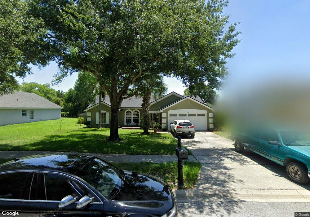
This home is located at 626 Safeharbour Dr, Ocoee, FL 34761 and is currently estimated at $447,850, approximately $238 per square foot. 626 Safeharbour Dr is a home located in Orange County with nearby schools including Ocoee Elementary School, Ocoee Middle School, and Ocoee High School.
Ownership History
Date
Name
Owned For
Owner Type
Purchase Details
Closed on
Jul 30, 2015
Sold by
Saldias Pozo Pablo Andres and De Saldias Erika Cecilia Cortez
Bought by
Mccollum John A and Alves Elaine T
Current Estimated Value
Purchase Details
Closed on
May 31, 2011
Sold by
Pendleton Howard M and Pendleton Billie G
Bought by
Saldias Pozo Pablo Andres and Saldias Erika Cecilia
Purchase Details
Closed on
Jan 7, 2002
Sold by
Ernest C Boyd M and Robin L Boyd M
Bought by
Pendleton Howard M and Pendleton Billie G
Home Financials for this Owner
Home Financials are based on the most recent Mortgage that was taken out on this home.
Original Mortgage
$18,000
Interest Rate
7.16%
Mortgage Type
Credit Line Revolving
Purchase Details
Closed on
Jul 28, 1994
Sold by
Hallmark Bldr Inc
Bought by
Boyd Ernest C and Boyd Robin L
Create a Home Valuation Report for This Property
The Home Valuation Report is an in-depth analysis detailing your home's value as well as a comparison with similar homes in the area
Home Values in the Area
Average Home Value in this Area
Purchase History
| Date | Buyer | Sale Price | Title Company |
|---|---|---|---|
| Mccollum John A | $222,100 | Equitable Title Celebration | |
| Saldias Pozo Pablo Andres | $158,000 | Exceptional Title Insuran | |
| Pendleton Howard M | $149,900 | -- | |
| Boyd Ernest C | $100,500 | -- |
Source: Public Records
Mortgage History
| Date | Status | Borrower | Loan Amount |
|---|---|---|---|
| Previous Owner | Pendleton Howard M | $124,500 | |
| Previous Owner | Pendleton Howard M | $18,000 | |
| Previous Owner | Pendleton Howard M | $119,900 | |
| Previous Owner | Pendleton Howard M | $36,733 |
Source: Public Records
Tax History
| Year | Tax Paid | Tax Assessment Tax Assessment Total Assessment is a certain percentage of the fair market value that is determined by local assessors to be the total taxable value of land and additions on the property. | Land | Improvement |
|---|---|---|---|---|
| 2025 | $3,874 | $239,776 | -- | -- |
| 2024 | $3,471 | $233,018 | -- | -- |
| 2023 | $3,471 | $219,855 | $0 | $0 |
| 2022 | $3,358 | $213,451 | $0 | $0 |
| 2021 | $3,321 | $207,234 | $0 | $0 |
| 2020 | $3,175 | $204,373 | $0 | $0 |
| 2019 | $3,286 | $199,778 | $0 | $0 |
| 2018 | $3,281 | $196,053 | $0 | $0 |
| 2017 | $3,262 | $192,021 | $45,000 | $147,021 |
| 2016 | $3,279 | $188,456 | $45,000 | $143,456 |
| 2015 | $2,261 | $179,462 | $45,000 | $134,462 |
| 2014 | $2,247 | $159,202 | $45,000 | $114,202 |
Source: Public Records
Map
Nearby Homes
- 1007 Featherstone Cir
- 630 Olympic Dr Unit 9B
- 750 Crooked Creek Dr
- 813 Lancer Cir
- 970 Davenwood Ct
- 946 Davenwood Ct
- 952 Davenwood Ct
- 774 Lancer Cir
- 111 Bismark Ct
- 131 Bismark Ct
- 607 E Lakeshore Dr
- 618 Statenville Ct
- 410 E Orlando Ave Unit 4
- 404 E Orlando Ave Unit B-3
- 404 E Orlando Ave Unit 8B
- 404 E Orlando Ave Unit 1B
- 112 Olympus Dr
- 1339 Olympia Park Cir
- 1500 Acropolis Cir
- 573 Neumann Village Ct
- 642 Safeharbour Dr
- 612 Safeharbour Dr
- 1154 Turnbuckle Ct
- 1134 Turnbuckle Ct
- 658 Safeharbour Dr
- 596 Safeharbour Dr
- 623 Safeharbour Dr
- 639 Safeharbour Dr
- 609 Safeharbour Dr
- 1118 Turnbuckle Ct
- 655 Safeharbour Dr
- 676 Safeharbour Dr
- 584 Safeharbour Dr
- 593 Safeharbour Dr
- 1104 Turnbuckle Ct
- 671 Safeharbour Dr
- 581 Safeharbour Dr
- 1161 Turnbuckle Ct
- 570 Safeharbour Dr
- 686 Safeharbour Dr
Your Personal Tour Guide
Ask me questions while you tour the home.