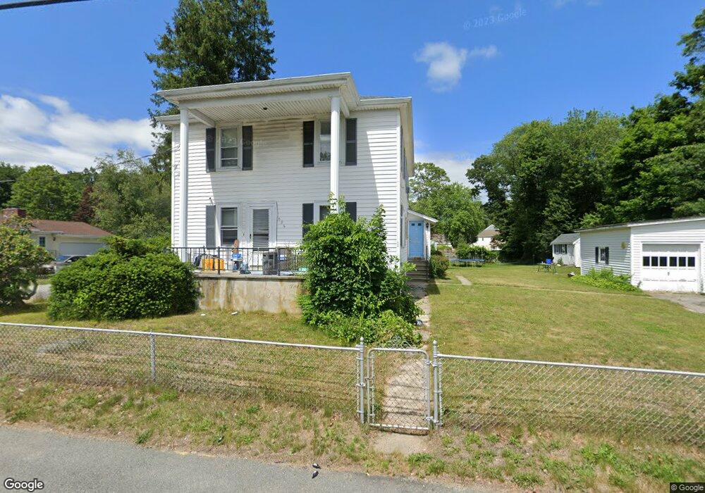
626 State Rd Unit 2 Westport, MA 02790
North Westport NeighborhoodEstimated Value: $369,000 - $444,000
2
Beds
1
Bath
1,200
Sq Ft
$346/Sq Ft
Est. Value
About This Home
This home is located at 626 State Rd Unit 2, Westport, MA 02790 and is currently estimated at $415,312, approximately $346 per square foot. 626 State Rd Unit 2 is a home located in Bristol County with nearby schools including Alice A. Macomber Primary School, Westport Elementary School, and Westport Middle-High School.
Ownership History
Date
Name
Owned For
Owner Type
Purchase Details
Closed on
Apr 15, 2025
Sold by
Fernandes Jeffrey A and Fernandes Gary R
Bought by
Fernandes Michael J
Current Estimated Value
Home Financials for this Owner
Home Financials are based on the most recent Mortgage that was taken out on this home.
Original Mortgage
$402,750
Outstanding Balance
$400,286
Interest Rate
6.76%
Mortgage Type
Purchase Money Mortgage
Estimated Equity
$15,026
Create a Home Valuation Report for This Property
The Home Valuation Report is an in-depth analysis detailing your home's value as well as a comparison with similar homes in the area
Home Values in the Area
Average Home Value in this Area
Purchase History
| Date | Buyer | Sale Price | Title Company |
|---|---|---|---|
| Fernandes Michael J | $425,000 | None Available | |
| Fernandes Michael J | $425,000 | None Available | |
| Fernandes Michael J | $425,000 | None Available |
Source: Public Records
Mortgage History
| Date | Status | Borrower | Loan Amount |
|---|---|---|---|
| Open | Fernandes Michael J | $402,750 | |
| Closed | Fernandes Michael J | $402,750 |
Source: Public Records
Tax History Compared to Growth
Tax History
| Year | Tax Paid | Tax Assessment Tax Assessment Total Assessment is a certain percentage of the fair market value that is determined by local assessors to be the total taxable value of land and additions on the property. | Land | Improvement |
|---|---|---|---|---|
| 2025 | $2,111 | $283,300 | $133,700 | $149,600 |
| 2024 | $2,104 | $272,200 | $123,800 | $148,400 |
| 2023 | $1,985 | $243,200 | $105,500 | $137,700 |
| 2022 | $2,006 | $236,600 | $105,500 | $131,100 |
| 2021 | $1,957 | $227,000 | $95,900 | $131,100 |
| 2020 | $1,882 | $223,200 | $92,100 | $131,100 |
| 2019 | $1,915 | $231,600 | $97,500 | $134,100 |
| 2018 | $1,850 | $226,400 | $116,600 | $109,800 |
| 2017 | $1,787 | $224,200 | $116,600 | $107,600 |
| 2016 | $1,773 | $224,200 | $116,600 | $107,600 |
| 2015 | $1,657 | $208,900 | $116,600 | $92,300 |
Source: Public Records
Map
Nearby Homes
- 20 Faulkner St
- 116 Gifford Rd
- 0 Van Buren St
- 9 Kyle Jacob Rd
- 3 Diane Way
- 15 S Breault St
- 100 D Dr
- 16 S Berryman St
- 565 Highland Ave
- 1276 Old Fall River Rd
- 9 Register Ave
- 92 Benoit St
- 33 William St
- 6 Beaulieu St
- 19 Charles Joseph Dr
- 25 Beaulieu St
- 2 Donna Marie Dr
- 27 Dias Ave
- 771 Sanford Rd
- 128 Old Bedford Rd