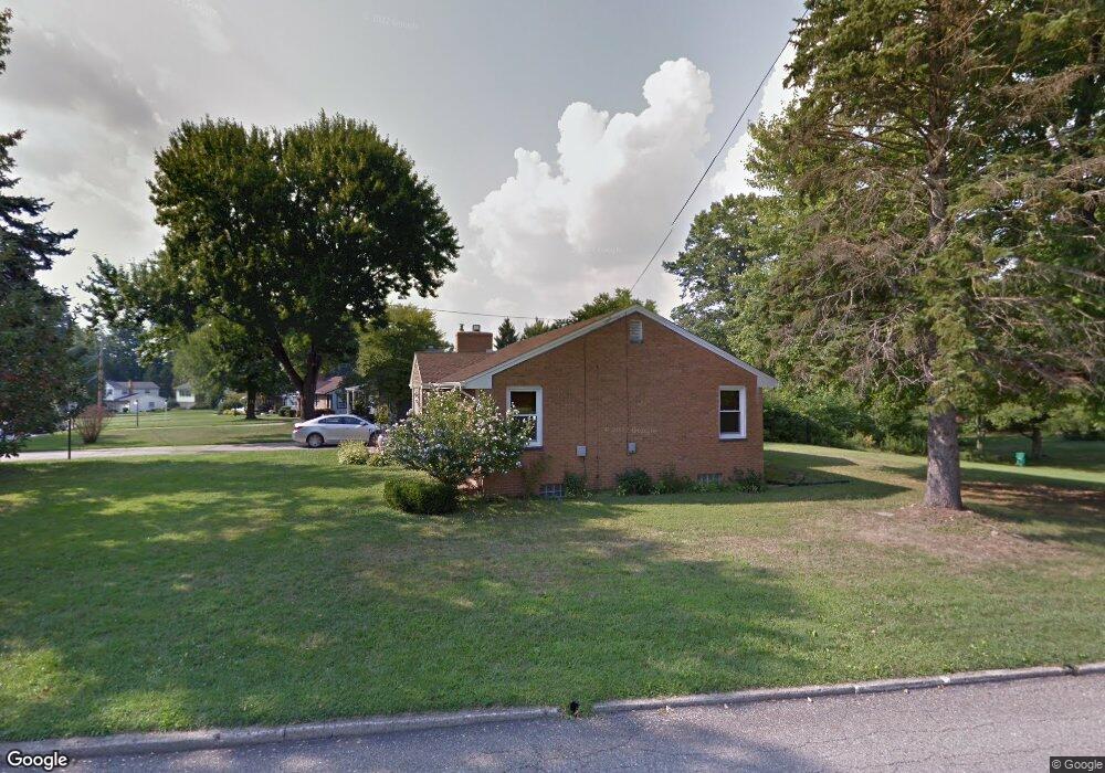
6261 Duncan Dr Youngstown, OH 44514
Estimated Value: $186,000 - $235,000
3
Beds
2
Baths
1,224
Sq Ft
$175/Sq Ft
Est. Value
About This Home
This home is located at 6261 Duncan Dr, Youngstown, OH 44514 and is currently estimated at $214,710, approximately $175 per square foot. 6261 Duncan Dr is a home located in Mahoning County with nearby schools including Poland Union Elementary School, Poland Middle School, and Poland Seminary High School.
Ownership History
Date
Name
Owned For
Owner Type
Purchase Details
Closed on
Feb 18, 2010
Sold by
Merrill Lynch Credit Corporation
Bought by
Williams Sherri L
Current Estimated Value
Home Financials for this Owner
Home Financials are based on the most recent Mortgage that was taken out on this home.
Original Mortgage
$73,150
Outstanding Balance
$48,606
Interest Rate
5.11%
Mortgage Type
New Conventional
Estimated Equity
$166,104
Purchase Details
Closed on
Feb 24, 2009
Sold by
Wilson John
Bought by
Merrill Lynch Credit Corporation
Purchase Details
Closed on
Aug 21, 2002
Sold by
Miller Patrick J and Miller Karen L
Bought by
Wilson John
Home Financials for this Owner
Home Financials are based on the most recent Mortgage that was taken out on this home.
Original Mortgage
$103,265
Interest Rate
6.56%
Purchase Details
Closed on
Mar 5, 1990
Bought by
Sterling Estelle and Sterling Roger
Create a Home Valuation Report for This Property
The Home Valuation Report is an in-depth analysis detailing your home's value as well as a comparison with similar homes in the area
Home Values in the Area
Average Home Value in this Area
Purchase History
| Date | Buyer | Sale Price | Title Company |
|---|---|---|---|
| Williams Sherri L | $77,000 | Attorney | |
| Merrill Lynch Credit Corporation | $76,000 | Attorney | |
| Wilson John | $108,700 | -- | |
| Sterling Estelle | -- | -- |
Source: Public Records
Mortgage History
| Date | Status | Borrower | Loan Amount |
|---|---|---|---|
| Open | Williams Sherri L | $73,150 | |
| Previous Owner | Wilson John | $103,265 |
Source: Public Records
Tax History Compared to Growth
Tax History
| Year | Tax Paid | Tax Assessment Tax Assessment Total Assessment is a certain percentage of the fair market value that is determined by local assessors to be the total taxable value of land and additions on the property. | Land | Improvement |
|---|---|---|---|---|
| 2024 | $2,882 | $58,760 | $11,270 | $47,490 |
| 2023 | $2,815 | $58,760 | $11,270 | $47,490 |
| 2022 | $2,408 | $42,010 | $11,270 | $30,740 |
| 2021 | $2,297 | $42,010 | $11,270 | $30,740 |
| 2020 | $2,307 | $42,010 | $11,270 | $30,740 |
| 2019 | $2,082 | $35,280 | $11,270 | $24,010 |
| 2018 | $1,951 | $35,280 | $11,270 | $24,010 |
| 2017 | $1,948 | $35,280 | $11,270 | $24,010 |
| 2016 | $1,632 | $28,080 | $11,270 | $16,810 |
| 2015 | $1,597 | $28,080 | $11,270 | $16,810 |
| 2014 | $1,603 | $28,080 | $11,270 | $16,810 |
| 2013 | $1,583 | $28,080 | $11,270 | $16,810 |
Source: Public Records
Map
Nearby Homes
- 6074 Frontier Dr
- 2721 Algonquin Dr
- 2667 Center Rd
- 2379 Clyde St
- 154 Rocky Ledge Dr
- 2831 Center Rd
- 2856 Heatherbrae Dr
- 2295 Bel Aire Ln
- 5838 Poland Struthers Rd
- 2959 Algonquin Dr
- 2985 Algonquin Dr
- 20 Nesbitt St
- 2959 Holyoke Dr
- 0 Clingan Rd Unit 4461196
- 2307 Hamilton Ave
- 6137 Acatello Place
- 43 Venloe Dr
- 3151 Heatherbrae Dr
- 34 Venloe Dr
- 25 Lakeshore Dr
- 6247 Duncan Dr
- 6283 Duncan Dr
- 6009 Frontier Dr
- 6235 Duncan Dr
- 6033 Frontier Dr
- 6004 Frontier Dr
- 6301 Duncan Dr
- 6221 Duncan Dr
- 6199 Circle Dr
- 6262 Duncan Dr
- 6284 Duncan Dr
- 6236 Duncan Dr
- 6047 Frontier Dr
- 6018 Frontier Dr
- 6311 Duncan Dr
- 6308 Duncan Dr
- 6189 Circle Dr
- 6028 Frontier Dr
- 60 Duncan Dr
- 6327 Duncan Dr