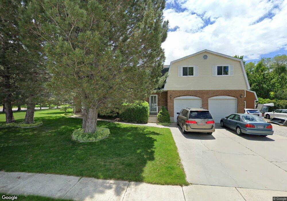
6261 W 10570 N Highland, UT 84003
Estimated Value: $869,000 - $1,224,000
6
Beds
5
Baths
3,222
Sq Ft
$314/Sq Ft
Est. Value
About This Home
This home is located at 6261 W 10570 N, Highland, UT 84003 and is currently estimated at $1,012,971, approximately $314 per square foot. 6261 W 10570 N is a home located in Utah County with nearby schools including Highland Elementary School, Mountain Ridge Junior High School, and Lone Peak High School.
Ownership History
Date
Name
Owned For
Owner Type
Purchase Details
Closed on
Feb 19, 2025
Sold by
Kujanpaa Pauli A and Kujanpaa Lorna R
Bought by
Kujanpaa Irrevocable Trust and Wade
Current Estimated Value
Purchase Details
Closed on
May 1, 1999
Sold by
Marjean Westwood Family Protection Trust and Westwood Russell C
Bought by
Kujanpaa Pauli A and Kujanpaa Lorna R
Home Financials for this Owner
Home Financials are based on the most recent Mortgage that was taken out on this home.
Original Mortgage
$220,000
Interest Rate
6.94%
Create a Home Valuation Report for This Property
The Home Valuation Report is an in-depth analysis detailing your home's value as well as a comparison with similar homes in the area
Home Values in the Area
Average Home Value in this Area
Purchase History
| Date | Buyer | Sale Price | Title Company |
|---|---|---|---|
| Kujanpaa Irrevocable Trust | -- | None Listed On Document | |
| Kujanpaa Pauli A | -- | First American Title Ins Co |
Source: Public Records
Mortgage History
| Date | Status | Borrower | Loan Amount |
|---|---|---|---|
| Previous Owner | Kujanpaa Pauli A | $220,000 |
Source: Public Records
Tax History Compared to Growth
Tax History
| Year | Tax Paid | Tax Assessment Tax Assessment Total Assessment is a certain percentage of the fair market value that is determined by local assessors to be the total taxable value of land and additions on the property. | Land | Improvement |
|---|---|---|---|---|
| 2025 | $3,804 | $463,870 | $353,000 | $490,400 |
| 2024 | $3,804 | $469,920 | $0 | $0 |
| 2023 | $3,742 | $498,630 | $0 | $0 |
| 2022 | $3,512 | $453,805 | $0 | $0 |
| 2021 | $3,090 | $594,600 | $200,200 | $394,400 |
| 2020 | $2,932 | $553,300 | $174,100 | $379,200 |
| 2019 | $2,579 | $509,200 | $174,100 | $335,100 |
| 2018 | $2,413 | $452,800 | $161,400 | $291,400 |
| 2017 | $2,347 | $235,015 | $0 | $0 |
| 2016 | $2,527 | $236,500 | $0 | $0 |
| 2015 | $2,507 | $222,420 | $0 | $0 |
| 2014 | $2,196 | $193,105 | $0 | $0 |
Source: Public Records
Map
Nearby Homes
- 6373 W 10500 N
- 10434 N 6400 W
- 6372 W 10400 N
- 6271 W 10830 St N
- 10818 N 6000 W
- 6399 W 10150 N
- 11337 N 5950 W Unit 7
- 6190 W 10050 N
- 11124 N 6000 W
- 11248 Hawkstone Way Unit 109
- 6024 Hawkstone Way Unit 108
- 11228 Hawkstone Way Unit 110
- 10197 N 5750 W
- 1610 E Center Pointe Dr
- 1602 E Center Pointe Dr
- 1602 E Center Pointe Dr Unit 1
- 5973 W 9960 N
- 9924 N 6630 W Unit 9
- 9967 N 6670 W
- 10507 N 5470 W
- 6287 W 10570 N
- 10527 N 6250 W
- 10562 N 6250 W
- 10538 N 6250 W
- 10579 N 6250 W
- 6302 W 10500 N
- 10578 N 6250 W
- 6286 W 10570 N
- 6297 W 10570 N
- 10503 N 6250 W
- 6324 W 10500 N
- 10514 N 6250 St W
- 10596 N 6250 W Unit M
- 10605 N 6250 W
- 6328 W 10570 N
- 6349 W 10570 N
- 6254 W 10480 N
- 10622 N 6250 W
- 6327 W 10630 N
- 6231 W 10500 St N Unit 11