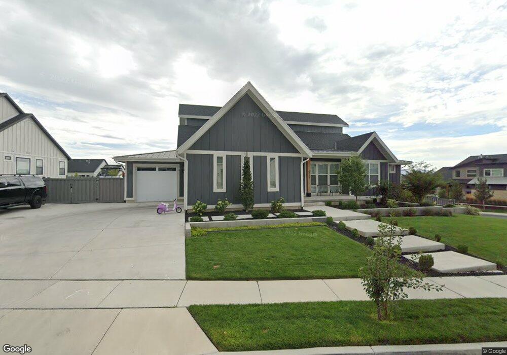
6265 W Grant Cir Highland, UT 84003
Estimated Value: $1,153,000 - $1,685,434
3
Beds
3
Baths
3,036
Sq Ft
$460/Sq Ft
Est. Value
About This Home
This home is located at 6265 W Grant Cir, Highland, UT 84003 and is currently estimated at $1,395,859, approximately $459 per square foot. 6265 W Grant Cir is a home with nearby schools including Ridgeline Elementary School, Timberline Middle School, and Lone Peak High School.
Ownership History
Date
Name
Owned For
Owner Type
Purchase Details
Closed on
Jan 19, 2023
Sold by
Clark John W
Bought by
John And Amy Clark Family Trust
Current Estimated Value
Purchase Details
Closed on
May 25, 2018
Sold by
Clark John W
Bought by
Clark John W and Clark Amy Lee
Home Financials for this Owner
Home Financials are based on the most recent Mortgage that was taken out on this home.
Original Mortgage
$728,986
Interest Rate
5.12%
Mortgage Type
Adjustable Rate Mortgage/ARM
Purchase Details
Closed on
May 3, 2018
Sold by
D R Horton Inc
Bought by
Clark John W
Home Financials for this Owner
Home Financials are based on the most recent Mortgage that was taken out on this home.
Original Mortgage
$728,986
Interest Rate
5.12%
Mortgage Type
Adjustable Rate Mortgage/ARM
Create a Home Valuation Report for This Property
The Home Valuation Report is an in-depth analysis detailing your home's value as well as a comparison with similar homes in the area
Home Values in the Area
Average Home Value in this Area
Purchase History
| Date | Buyer | Sale Price | Title Company |
|---|---|---|---|
| John And Amy Clark Family Trust | -- | -- | |
| Clark John W | -- | Cottonwood Title Ins Agency | |
| Clark John W | -- | Cottonwood Title Ins Ag Inc |
Source: Public Records
Mortgage History
| Date | Status | Borrower | Loan Amount |
|---|---|---|---|
| Previous Owner | Clark John W | $728,986 |
Source: Public Records
Tax History Compared to Growth
Tax History
| Year | Tax Paid | Tax Assessment Tax Assessment Total Assessment is a certain percentage of the fair market value that is determined by local assessors to be the total taxable value of land and additions on the property. | Land | Improvement |
|---|---|---|---|---|
| 2025 | $5,477 | $748,770 | $533,700 | $827,700 |
| 2024 | $5,477 | $676,445 | $0 | $0 |
| 2023 | $5,295 | $705,595 | $0 | $0 |
| 2022 | $4,902 | $633,270 | $0 | $0 |
| 2021 | $4,168 | $802,000 | $284,900 | $517,100 |
| 2020 | $3,972 | $749,700 | $247,700 | $502,000 |
| 2019 | $3,562 | $703,300 | $247,700 | $455,600 |
| 2018 | $2,327 | $240,100 | $240,100 | $0 |
Source: Public Records
Map
Nearby Homes
- 11987 N Cyprus Dr
- 12184 N Bridgegate Way
- 12179 N Creek Meadow Ct
- 12219 N Bridgegate Way
- 11825 N 6260 W
- Holly Plan at Beacon Hill
- Hudson Plan at Beacon Hill
- McKinley Plan at Beacon Hill
- Potomac Plan at Beacon Hill
- Juniper Plan at Beacon Hill
- Reagan Plan at Beacon Hill
- Eleanor Plan at Beacon Hill
- Willow Plus Plan at Beacon Hill
- Linden Plan at Beacon Hill
- Cottonwood Plan at Beacon Hill
- Chapman Plan at Beacon Hill
- Redwood Plan at Beacon Hill
- Harrison Plan at Beacon Hill
- Harmony Plan at Beacon Hill
- Basswood Plan at Beacon Hill
- 6245 W Grant Cir Unit 329
- 12109 N Shettlestone Dr
- 6252 W Applecross Cir
- 6274 W Grant Cir
- 6258 W Grant Cir Unit 322
- 6233 W Grant Cir Unit 328
- 12095 N Shettlestone Dr Unit 702
- 6238 W Grant Cir
- 6242 W Applecross Cir
- 12133 N Shettlestone Dr
- 6226 W Applecross Cir
- 6263 W Sutherland Dr Unit 319
- 6219 W Grant Cir Unit 327
- 6228 W Grant Cir Unit 324
- 6228 W Grant Cir
- 6247 W Sutherland Dr Unit 318
- 6277 W Sutherland Dr Unit 320
- 12145 N Shettlestone Dr
- 12063 N Shettlestone Dr
- 12076 N Royal Troon Rd Unit 116