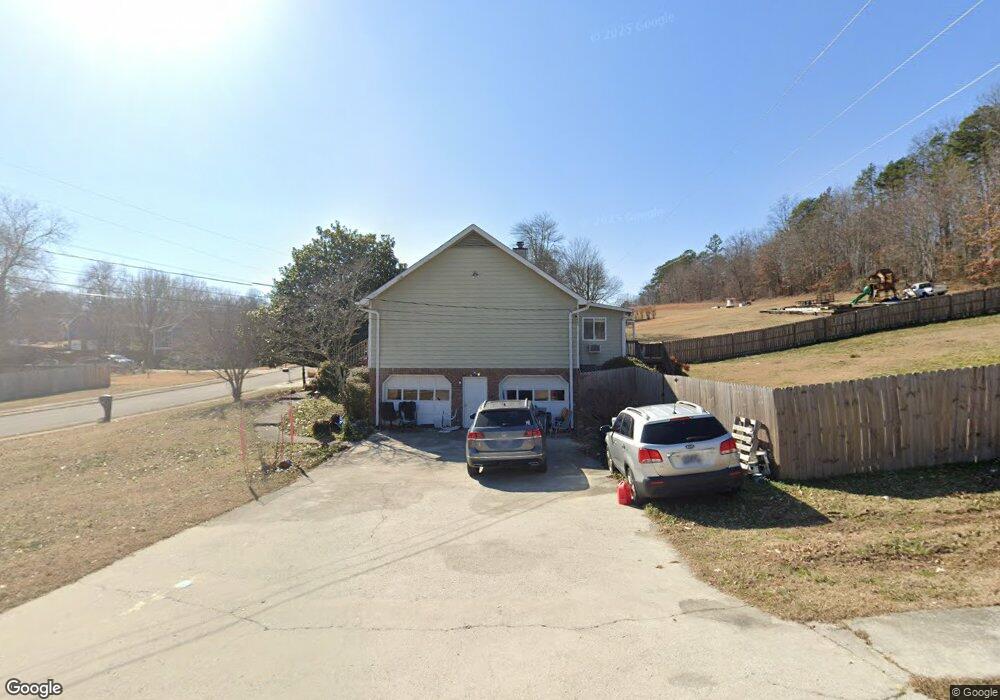
627 Ashbrook Dr Hixson, TN 37343
Estimated Value: $396,654 - $441,000
4
Beds
3
Baths
2,436
Sq Ft
$170/Sq Ft
Est. Value
About This Home
This home is located at 627 Ashbrook Dr, Hixson, TN 37343 and is currently estimated at $414,164, approximately $170 per square foot. 627 Ashbrook Dr is a home located in Hamilton County with nearby schools including Ivy Academy Inc and New South Daisy Christian Academy.
Ownership History
Date
Name
Owned For
Owner Type
Purchase Details
Closed on
Sep 27, 2023
Sold by
Priest Elizabeth A
Bought by
Priest Elizabeth A and Smith Angela
Current Estimated Value
Purchase Details
Closed on
Jul 1, 2003
Sold by
Blanchard Troy A and Blanchard Deanna M
Bought by
Priest Curtis W and Priest Elizabeth A
Home Financials for this Owner
Home Financials are based on the most recent Mortgage that was taken out on this home.
Original Mortgage
$158,000
Interest Rate
5.3%
Mortgage Type
Unknown
Purchase Details
Closed on
Jun 15, 1999
Sold by
Green Thomas H and Green Frances F
Bought by
Blanchard Troy A and Blanchard Deanna M
Home Financials for this Owner
Home Financials are based on the most recent Mortgage that was taken out on this home.
Original Mortgage
$126,350
Interest Rate
7.04%
Mortgage Type
Balloon
Create a Home Valuation Report for This Property
The Home Valuation Report is an in-depth analysis detailing your home's value as well as a comparison with similar homes in the area
Home Values in the Area
Average Home Value in this Area
Purchase History
| Date | Buyer | Sale Price | Title Company |
|---|---|---|---|
| Priest Elizabeth A | -- | Title Services Of Tennessee | |
| Priest Elizabeth A | -- | Title Services Of Tennessee | |
| Priest Curtis W | $158,000 | -- | |
| Blanchard Troy A | $133,000 | -- |
Source: Public Records
Mortgage History
| Date | Status | Borrower | Loan Amount |
|---|---|---|---|
| Previous Owner | Priest Curtis W | $158,000 | |
| Previous Owner | Blanchard Troy A | $126,350 |
Source: Public Records
Tax History
| Year | Tax Paid | Tax Assessment Tax Assessment Total Assessment is a certain percentage of the fair market value that is determined by local assessors to be the total taxable value of land and additions on the property. | Land | Improvement |
|---|---|---|---|---|
| 2025 | $1,438 | $94,875 | $0 | $0 |
| 2024 | $1,285 | $57,425 | $0 | $0 |
| 2023 | $1,935 | $57,425 | $0 | $0 |
| 2022 | $1,935 | $57,425 | $0 | $0 |
| 2021 | $1,935 | $57,425 | $0 | $0 |
| 2020 | $1,855 | $44,825 | $0 | $0 |
| 2019 | $1,855 | $44,825 | $0 | $0 |
| 2018 | $1,855 | $44,825 | $0 | $0 |
| 2017 | $1,855 | $44,825 | $0 | $0 |
| 2016 | $1,749 | $0 | $0 | $0 |
| 2015 | $1,749 | $42,250 | $0 | $0 |
| 2014 | $1,749 | $0 | $0 | $0 |
Source: Public Records
Map
Nearby Homes
- 8805 Shady Wood Ln
- 419 Benton Ln
- 802 Northbrook Dr
- 8834 Gann Rd
- 8927 Wings Way
- 8815 Gann Rd
- 8819 Gann Rd
- 8813 Gann Rd
- 8821 Gann Rd
- 9061 Daisy Dallas Rd
- 914 Hickory Ave
- 8434 W Crabtree Rd
- 405 Classic Dr
- 396 Olivia Ln
- 400 Olivia Ln
- 8509 Fair Oaks Rd
- 8415 Fair Oaks Rd
- 674 Charbell St
- 8610 Daisy Dallas Rd
- 9034 Wood Dale Ln
- 623 Ashbrook Dr
- 701 Ashbrook Dr
- 619 Ashbrook Dr
- 8809 Brookhill Dr
- 622 Ashbrook Dr
- 8907 Brookhill Dr
- 705 Ashbrook Dr
- 8910 Brookhill Dr
- 702 Ashbrook Dr
- 615 Ashbrook Dr
- 8810 Brookhill Dr
- 707 Ashbrook Dr
- 623 Northbrook Dr
- 8909 Brookhill Dr
- 627 Northbrook Dr
- 621 Northbrook Dr
- 616 Ashbrook Dr
- 8706 Brook Hill Dr
- 706 Ashbrook Dr
- 8806 Brookhill Dr
Your Personal Tour Guide
Ask me questions while you tour the home.