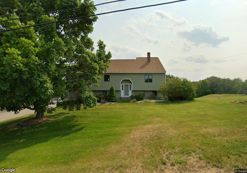
627 Loudon Ridge Rd Loudon, NH 03307
Estimated Value: $558,000 - $649,000
3
Beds
3
Baths
2,150
Sq Ft
$277/Sq Ft
Est. Value
About This Home
This home is located at 627 Loudon Ridge Rd, Loudon, NH 03307 and is currently estimated at $596,314, approximately $277 per square foot. 627 Loudon Ridge Rd is a home located in Merrimack County with nearby schools including Loudon Elementary School, Merrimack Valley Middle School, and Merrimack Valley High School.
Ownership History
Date
Name
Owned For
Owner Type
Purchase Details
Closed on
Jan 3, 2000
Sold by
Ramsay Brian D and Ramsay Penny V
Bought by
Charron John P and Charron Shelly J
Current Estimated Value
Home Financials for this Owner
Home Financials are based on the most recent Mortgage that was taken out on this home.
Original Mortgage
$152,900
Interest Rate
7.71%
Create a Home Valuation Report for This Property
The Home Valuation Report is an in-depth analysis detailing your home's value as well as a comparison with similar homes in the area
Home Values in the Area
Average Home Value in this Area
Purchase History
| Date | Buyer | Sale Price | Title Company |
|---|---|---|---|
| Charron John P | $179,900 | -- |
Source: Public Records
Mortgage History
| Date | Status | Borrower | Loan Amount |
|---|---|---|---|
| Open | Charron John P | $100,000 | |
| Closed | Charron John P | $152,900 |
Source: Public Records
Tax History Compared to Growth
Tax History
| Year | Tax Paid | Tax Assessment Tax Assessment Total Assessment is a certain percentage of the fair market value that is determined by local assessors to be the total taxable value of land and additions on the property. | Land | Improvement |
|---|---|---|---|---|
| 2024 | $8,819 | $379,300 | $102,900 | $276,400 |
| 2023 | $7,802 | $374,400 | $102,900 | $271,500 |
| 2022 | $6,945 | $374,400 | $102,900 | $271,500 |
| 2021 | $7,283 | $379,300 | $102,900 | $276,400 |
| 2020 | $6,019 | $261,800 | $87,200 | $174,600 |
| 2019 | $6,016 | $261,800 | $87,200 | $174,600 |
| 2018 | $5,775 | $261,800 | $87,200 | $174,600 |
| 2017 | $5,828 | $261,800 | $87,200 | $174,600 |
| 2016 | $5,493 | $261,800 | $87,200 | $174,600 |
| 2015 | $5,424 | $262,400 | $87,200 | $175,200 |
| 2014 | $5,461 | $262,400 | $87,200 | $175,200 |
| 2013 | $5,434 | $262,400 | $87,200 | $175,200 |
Source: Public Records
Map
Nearby Homes
- Map 132 Lot 115 Arrowhead Ln
- 9 Warbonnet Ln
- 19 Abnaki Path
- 153 Lakeshore Dr
- 4 Penobscott Path
- 000 Pocumtuck Way Unit 35
- 0000 Cedar Dr Unit 10000
- 00 Cedar Dr Unit 60000
- 0000 Cedar Dr Unit 11000
- 00 Winter St Unit 42
- 00 Intervale Dr Unit 51
- 1005 New Hampshire 106
- 628 Province Rd
- 585 Province Rd
- 0 Province Rd Unit 5068495
- 19 Sherwood Forest Dr
- 16 Sherwood Forest Dr
- 55 Whitehouse Rd
- 143 Shaker Rd
- 22 Abberton Rd
- 637 Loudon Ridge Rd
- 644 Loudon Ridge Rd
- 643 Loudon Ridge Rd
- 17 Madison Way
- 21 Madison Way
- 36 Madison Way
- 54 Madison Way
- 37 Madison Way
- 50 Madison Way
- 653 Loudon Ridge Rd
- 656 Loudon Ridge Rd
- 662 Loudon Ridge Rd
- 595 Loudon Ridge Rd
- 601 Loudon Ridge Rd
- 592 Loudon Ridge Rd
- 636 Lower Ridge Rd
- 668 Loudon Ridge Rd
- 669 Loudon Ridge Rd
- 677 Loudon Ridge Rd
- 585 Loudon Ridge Rd