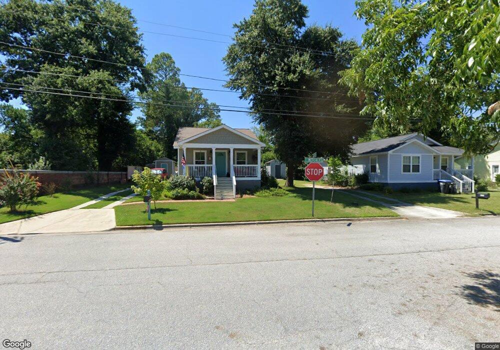
627 Metcalf St Augusta, GA 30904
Harrisburg NeighborhoodEstimated Value: $159,359 - $184,000
2
Beds
2
Baths
1,064
Sq Ft
$162/Sq Ft
Est. Value
About This Home
This home is located at 627 Metcalf St, Augusta, GA 30904 and is currently estimated at $171,840, approximately $161 per square foot. 627 Metcalf St is a home with nearby schools including Lamar Elementary School, W.S. Hornsby Elementary School, and Johnson Magnet.
Ownership History
Date
Name
Owned For
Owner Type
Purchase Details
Closed on
Jun 30, 2017
Sold by
Turn Back The Block Inc
Bought by
Rose Martin Lynn
Current Estimated Value
Home Financials for this Owner
Home Financials are based on the most recent Mortgage that was taken out on this home.
Original Mortgage
$97,000
Outstanding Balance
$73,866
Interest Rate
3.94%
Mortgage Type
New Conventional
Estimated Equity
$97,974
Purchase Details
Closed on
Aug 1, 2014
Sold by
Marble Investments Llc
Bought by
Augusta-Harrisburg Fuller Center For Hou
Purchase Details
Closed on
Jul 30, 2014
Sold by
Augusta-Harrisburg Fuller Center For Hou
Bought by
Turn Back The Block Incorporated
Create a Home Valuation Report for This Property
The Home Valuation Report is an in-depth analysis detailing your home's value as well as a comparison with similar homes in the area
Home Values in the Area
Average Home Value in this Area
Purchase History
| Date | Buyer | Sale Price | Title Company |
|---|---|---|---|
| Rose Martin Lynn | $97,000 | -- | |
| Augusta-Harrisburg Fuller Center For Hou | -- | -- | |
| Turn Back The Block Incorporated | -- | -- | |
| Turn Back The Block Inc | -- | -- |
Source: Public Records
Mortgage History
| Date | Status | Borrower | Loan Amount |
|---|---|---|---|
| Open | Rose Martin Lynn | $97,000 |
Source: Public Records
Tax History
| Year | Tax Paid | Tax Assessment Tax Assessment Total Assessment is a certain percentage of the fair market value that is determined by local assessors to be the total taxable value of land and additions on the property. | Land | Improvement |
|---|---|---|---|---|
| 2025 | $385 | $69,688 | $3,125 | $66,563 |
| 2024 | $385 | $67,532 | $3,125 | $64,407 |
| 2023 | $321 | $60,100 | $3,125 | $56,975 |
| 2022 | $311 | $51,692 | $3,125 | $48,567 |
| 2021 | $233 | $35,234 | $3,130 | $32,104 |
| 2020 | $233 | $30,227 | $3,960 | $26,267 |
| 2019 | $233 | $30,227 | $3,960 | $26,267 |
| 2018 | $233 | $30,227 | $3,960 | $26,267 |
| 2017 | $451 | $3,960 | $3,960 | $0 |
| 2016 | $451 | $3,960 | $3,960 | $0 |
| 2015 | $452 | $3,960 | $3,960 | $0 |
| 2014 | $668 | $9,978 | $3,960 | $6,018 |
Source: Public Records
Map
Nearby Homes
- 1929 Watkins St
- 1915 Watkins St
- 2015 Starnes St
- 1932 Fenwick St
- 531 Carr St
- 2012 Starnes St
- 1940 Starnes St
- 1933 Telfair St
- 1938 Starnes St
- 1936 Starnes St
- 605 Eve St
- 1934 Starnes St
- 1916 Walker St
- 1918 Walker St
- 1902 Fenwick St
- 1858 Walker St
- 608 Eve St
- 1944 Warren St
- 600 Hickman Rd
- 1838 Watkins St
- 2004 Battle Row
- 625 Metcalf St
- 635 Metcalf St
- 1937 Watkins St
- 2008 Battle Row
- 2006 Battle Row
- 621 Metcalf St
- 1935 Watkins St
- 1940 Watkins St
- 1980 Battle Row
- 637 Metcalf St
- 0 Battle Row & Hickman
- 1978 Battle Row
- 1933 Watkins St
- 1938 Watkins St
- 1976 Battle Row
- 2014 Battle Row
- 1931 Watkins St
- 1936 Watkins St
- 2005 Fenwick St
Your Personal Tour Guide
Ask me questions while you tour the home.