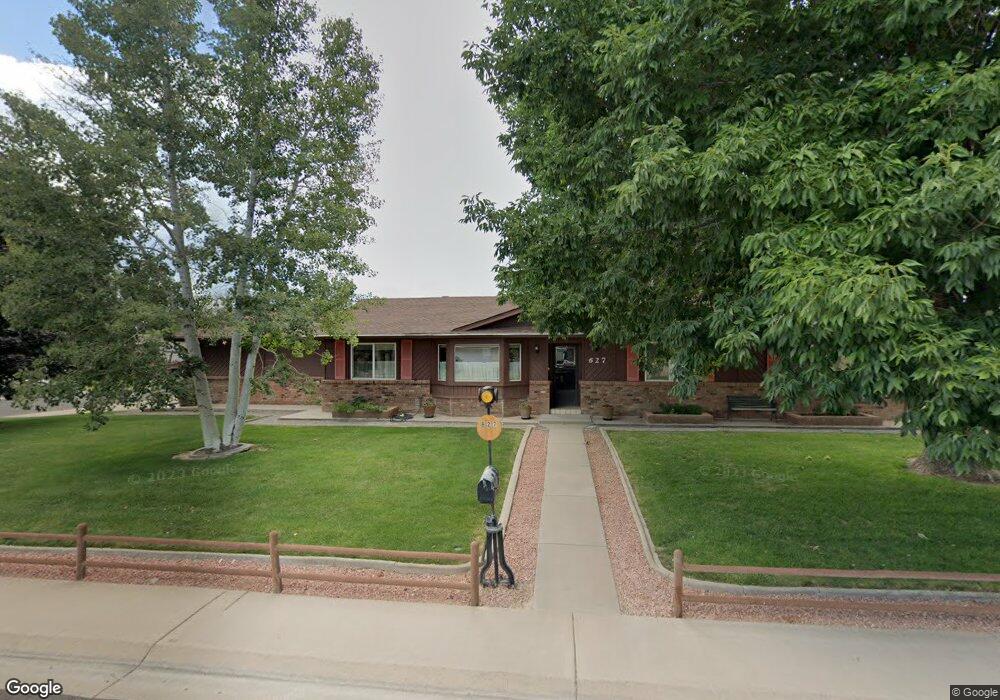
627 Oxbow Rd Grand Junction, CO 81504
Northeast Grand Junction NeighborhoodEstimated Value: $355,000 - $373,000
3
Beds
2
Baths
1,559
Sq Ft
$235/Sq Ft
Est. Value
About This Home
This home is located at 627 Oxbow Rd, Grand Junction, CO 81504 and is currently estimated at $366,039, approximately $234 per square foot. 627 Oxbow Rd is a home located in Mesa County with nearby schools including Thunder Mountain Elementary School, Bookcliff Middle School, and Central High School.
Ownership History
Date
Name
Owned For
Owner Type
Purchase Details
Closed on
Aug 22, 2014
Sold by
Price Daniel E
Bought by
Daniel Edward Price Trust
Current Estimated Value
Purchase Details
Closed on
Mar 18, 2014
Sold by
Price Daniel E
Bought by
Price Daniel E
Purchase Details
Closed on
Oct 3, 1997
Sold by
Price Daniel E
Bought by
Price Daniel E
Purchase Details
Closed on
Jul 21, 1978
Sold by
Green Ivan
Bought by
Price Daniel Edward Trust
Create a Home Valuation Report for This Property
The Home Valuation Report is an in-depth analysis detailing your home's value as well as a comparison with similar homes in the area
Home Values in the Area
Average Home Value in this Area
Purchase History
| Date | Buyer | Sale Price | Title Company |
|---|---|---|---|
| Daniel Edward Price Trust | -- | None Available | |
| Price Daniel E | -- | None Available | |
| Price Daniel E | -- | -- | |
| Price Daniel Edward Trust | $55,000 | -- |
Source: Public Records
Tax History Compared to Growth
Tax History
| Year | Tax Paid | Tax Assessment Tax Assessment Total Assessment is a certain percentage of the fair market value that is determined by local assessors to be the total taxable value of land and additions on the property. | Land | Improvement |
|---|---|---|---|---|
| 2024 | $993 | $19,390 | $4,790 | $14,600 |
| 2023 | $993 | $19,390 | $4,790 | $14,600 |
| 2022 | $795 | $16,710 | $4,170 | $12,540 |
| 2021 | $777 | $17,190 | $4,290 | $12,900 |
| 2020 | $567 | $14,360 | $3,580 | $10,780 |
| 2019 | $523 | $14,360 | $3,580 | $10,780 |
| 2018 | $501 | $12,300 | $3,240 | $9,060 |
| 2017 | $474 | $12,300 | $3,240 | $9,060 |
| 2016 | $447 | $12,970 | $3,180 | $9,790 |
| 2015 | $449 | $12,970 | $3,180 | $9,790 |
| 2014 | $362 | $10,140 | $2,790 | $7,350 |
Source: Public Records
Map
Nearby Homes
- 623 Broken Spoke Rd
- 631 Hudson Bay Dr
- 616 N Sunset Ct
- 608 1/2 Broken Spoke Rd
- 622 Hudson Bay Dr
- 2961 Brookside Dr
- 631 29 1 2 Rd
- 648 Hudson Bay Ct
- 2948 Joan Way
- 2990 Summerbrook Dr
- 590 Darby Dr
- 616 Darren Way
- 2990 1/2 Brookwood Dr
- 2997 Brookwood Ct
- 2984 1/2 Kia Dr
- 2951 Bret Dr
- 581 Heidel St
- 657 Starlight Dr
- 585 29 1 2 Rd
- 2953 Heron Dr
- 2968 F 1/4 Rd
- 629 Oxbow Rd
- 626 Ox-Bow Rd
- 626 Broken Spoke Rd
- 0 Ox-Bow Rd Unit 597962
- 0 Ox-Bow Rd Unit 600864
- 0 Ox-Bow Rd Unit 607649
- 0 Ox-Bow Rd Unit 619067
- 0 Ox-Bow Rd Unit 625173
- 0 Ox-Bow Rd Unit 635421
- 0 Ox-Bow Rd Unit 638159
- 0 Ox-Bow Rd Unit 649250
- 0 Ox-Bow Rd Unit 664556
- 2967 F 1/4 Rd
- 628 Broken Spoke Rd
- 631 1/2 Oxbow Rd
- 631 Oxbow Rd
- 630 Broken Spoke Rd
- 628 Oxbow Rd
- 624 Broken Spoke Rd