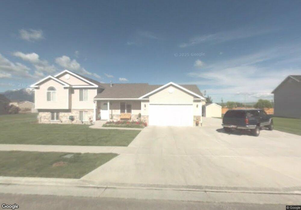
627 S 1250 W Logan, UT 84321
Woodruff NeighborhoodEstimated Value: $414,000 - $430,000
3
Beds
2
Baths
1,740
Sq Ft
$242/Sq Ft
Est. Value
About This Home
This home is located at 627 S 1250 W, Logan, UT 84321 and is currently estimated at $420,804, approximately $241 per square foot. 627 S 1250 W is a home located in Cache County with nearby schools including Woodruff School, Mount Logan Middle School, and Logan High School.
Ownership History
Date
Name
Owned For
Owner Type
Purchase Details
Closed on
Mar 3, 2014
Sold by
Lawin Charles Theodore and Lawin Leah L
Bought by
Charles Theodore & Leah L Lawin Family T
Current Estimated Value
Purchase Details
Closed on
Feb 13, 2001
Sold by
Lawin Charles T
Bought by
Lawin Charles T and Lawin Leah L
Home Financials for this Owner
Home Financials are based on the most recent Mortgage that was taken out on this home.
Original Mortgage
$132,050
Outstanding Balance
$47,094
Interest Rate
7.08%
Estimated Equity
$373,710
Create a Home Valuation Report for This Property
The Home Valuation Report is an in-depth analysis detailing your home's value as well as a comparison with similar homes in the area
Home Values in the Area
Average Home Value in this Area
Purchase History
| Date | Buyer | Sale Price | Title Company |
|---|---|---|---|
| Charles Theodore & Leah L Lawin Family T | -- | None Available | |
| Lawin Charles T | -- | Cache Title Company Inc | |
| Lawin Charles T | -- | Cache Title Company Inc |
Source: Public Records
Mortgage History
| Date | Status | Borrower | Loan Amount |
|---|---|---|---|
| Open | Lawin Charles T | $132,050 |
Source: Public Records
Tax History Compared to Growth
Tax History
| Year | Tax Paid | Tax Assessment Tax Assessment Total Assessment is a certain percentage of the fair market value that is determined by local assessors to be the total taxable value of land and additions on the property. | Land | Improvement |
|---|---|---|---|---|
| 2025 | $16 | $210,165 | $0 | $0 |
| 2024 | $1,680 | $210,465 | $0 | $0 |
| 2023 | $1,736 | $207,275 | $0 | $0 |
| 2022 | $1,543 | $172,075 | $0 | $0 |
| 2021 | $1,509 | $259,890 | $48,000 | $211,890 |
| 2020 | $1,540 | $238,785 | $48,000 | $190,785 |
| 2019 | $1,610 | $238,785 | $48,000 | $190,785 |
| 2018 | $1,580 | $213,900 | $48,000 | $165,900 |
| 2017 | $1,330 | $95,260 | $0 | $0 |
| 2016 | $1,379 | $95,260 | $0 | $0 |
| 2015 | $1,214 | $83,740 | $0 | $0 |
| 2014 | $1,097 | $83,740 | $0 | $0 |
| 2013 | -- | $83,740 | $0 | $0 |
Source: Public Records
Map
Nearby Homes
- 1239 W 575 S Unit 152
- Hemlock Plan at Sugar Creek - Logan
- Eucalyptus Plan at Sugar Creek - Logan
- Blackberry Plan at Sugar Creek - Logan
- Magnolia Plan at Sugar Creek - Logan
- 548 S 1225 W Unit 115
- 542 S 1225 W Unit 116
- 1220 W 575 S
- 518 S 1225 W
- 506 S 1225 W
- 1227 W 500 S Unit 151
- 1506 Silver Canoe Loop
- 1506 Silver Canoe Loop Unit 102
- 552 Rivergate Dr
- 1585 W Silver Canoe Way
- 524 Rivergate Dr
- 1615 Silver Canoe Way
- 1603 Silver Canoe Way
- 763 S 1500 W
- 1099 Three Pointe Ave
- 627 S 1250 W Unit 63
- 603 S 1250 W
- 641 S 1250 W
- 1296 Stuart Ct
- 604 S 1250 W
- 1300 Stuart Ct
- 1244 W 630 S
- 1294 Stuart Ct
- 667 S 1250 W
- 1235 W 630 S
- 1230 W 630 S
- 1297 Stuart Ct
- 1295 Stuart Ct
- 1301 Stuart Ct
- 1292 Stuart Ct
- 1255 W Henrys Pt Dr
- 1223 W 630 S
- 10 Stuart Ct Unit 26
- 15 Stuart Ct Unit 36
- 4301 W 600 South Mendon Rd