Estimated Value: $397,000 - $420,000
5
Beds
3
Baths
1,307
Sq Ft
$311/Sq Ft
Est. Value
About This Home
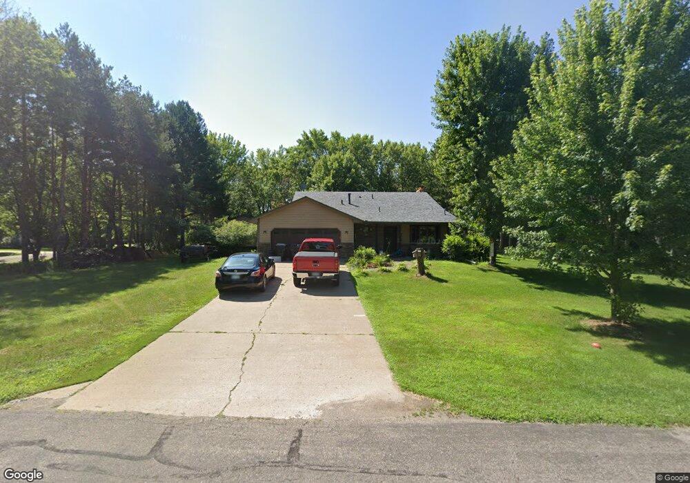
This home is located at 6270 163rd Ln NW, Anoka, MN 55303 and is currently estimated at $406,399, approximately $310 per square foot. 6270 163rd Ln NW is a home located in Anoka County with nearby schools including Brookside Elementary School, Anoka Middle School for the Arts - Fred Moor Campus, and Anoka Senior High School.
Ownership History
Date
Name
Owned For
Owner Type
Purchase Details
Closed on
Oct 22, 2020
Sold by
Cornell Tiffany
Bought by
Cornell Tiffany and Clay Robert
Current Estimated Value
Home Financials for this Owner
Home Financials are based on the most recent Mortgage that was taken out on this home.
Original Mortgage
$216,000
Outstanding Balance
$191,770
Interest Rate
2.8%
Mortgage Type
New Conventional
Estimated Equity
$214,629
Purchase Details
Closed on
Feb 18, 2011
Sold by
Schneld Matthew and Prasad Nadia
Bought by
Cornell Tiffany
Home Financials for this Owner
Home Financials are based on the most recent Mortgage that was taken out on this home.
Original Mortgage
$184,208
Interest Rate
4.87%
Mortgage Type
FHA
Purchase Details
Closed on
Sep 28, 2000
Sold by
Spah Gregory J and Spah Lisa A
Bought by
Dawson Jeffrey A and Dawson Terese A
Purchase Details
Closed on
May 30, 1996
Sold by
Lo Way James F
Bought by
Spah Gregory J and Spah Lisa A
Create a Home Valuation Report for This Property
The Home Valuation Report is an in-depth analysis detailing your home's value as well as a comparison with similar homes in the area
Home Values in the Area
Average Home Value in this Area
Purchase History
| Date | Buyer | Sale Price | Title Company |
|---|---|---|---|
| Cornell Tiffany | -- | Liberty Title & Escrow Co | |
| Cornell Tiffany | $189,000 | -- | |
| Dawson Jeffrey A | $199,900 | -- | |
| Spah Gregory J | $143,000 | -- |
Source: Public Records
Mortgage History
| Date | Status | Borrower | Loan Amount |
|---|---|---|---|
| Open | Cornell Tiffany | $216,000 | |
| Closed | Cornell Tiffany | $184,208 |
Source: Public Records
Tax History Compared to Growth
Tax History
| Year | Tax Paid | Tax Assessment Tax Assessment Total Assessment is a certain percentage of the fair market value that is determined by local assessors to be the total taxable value of land and additions on the property. | Land | Improvement |
|---|---|---|---|---|
| 2025 | $4,339 | $385,600 | $110,500 | $275,100 |
| 2024 | $4,339 | $390,300 | $116,000 | $274,300 |
| 2023 | $3,920 | $381,900 | $100,500 | $281,400 |
| 2022 | $3,527 | $379,600 | $88,400 | $291,200 |
| 2021 | $3,287 | $312,000 | $75,500 | $236,500 |
| 2020 | $3,139 | $292,600 | $66,700 | $225,900 |
| 2019 | $3,064 | $272,400 | $57,800 | $214,600 |
| 2018 | $3,046 | $259,600 | $0 | $0 |
| 2017 | $2,691 | $250,200 | $0 | $0 |
| 2016 | $2,691 | $218,100 | $0 | $0 |
| 2015 | $2,554 | $218,100 | $57,100 | $161,000 |
| 2014 | -- | $189,600 | $46,400 | $143,200 |
Source: Public Records
Map
Nearby Homes
- 5695 160th Ln NW
- 6308 170th Ave NW
- 6222 170th Ave NW
- 16042 Iodine St NW
- 6603 168th Ln NW
- 16810 Coquina St NW
- 6627 168th Ln NW
- Walker Plan at Harmony Farms
- Baxter Plan at Harmony Farms
- Emily Plan at Harmony Farms
- Courtland II Plan at Harmony Farms
- Courtland Plan at Harmony Farms
- 17030 Potassium St NW
- 16140 Jasper St NW
- 14XXX Sunfish Lake Blvd NW
- 6314 172nd Ln NW
- 16327 Marble St NW
- 15495 Sodium St NW
- TBD 158th Ln NW
- 15363 Radium St NW
- 6290 163rd Ln NW
- 6271 163rd Ln NW
- 16361 Uranium St NW
- 16320 Uranium St NW
- 6291 163rd Ln NW
- 16421 Uranium St NW
- 16331 Uranium St NW
- 6311 163rd Ln NW
- 6310 163rd Ln NW
- 16431 Uranium St NW
- 6270 164th Ln NW
- 16300 Uranium St NW
- 6321 163rd Ln NW
- 16431 Wolfram St NW
- 6310 164th Ln NW
- 16301 Uranium St NW
- 16401 Wolfram St NW
- 6320 163rd Ln NW
- 16321 Wolfram St NW
- 6271 164th Ln NW