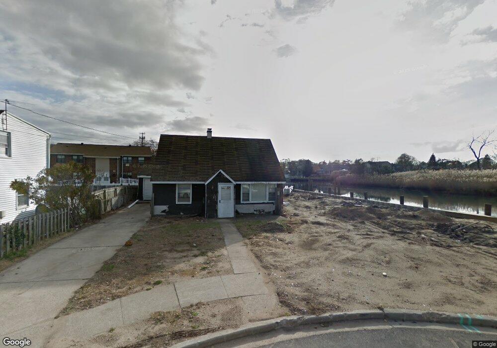
628 Barnes Ave Unit House Baldwin, NY 11510
Estimated Value: $767,000 - $1,002,945
3
Beds
2
Baths
2,107
Sq Ft
$420/Sq Ft
Est. Value
About This Home
This home is located at 628 Barnes Ave Unit House, Baldwin, NY 11510 and is currently estimated at $884,973, approximately $420 per square foot. 628 Barnes Ave Unit House is a home located in Nassau County with nearby schools including Baldwin Senior High School.
Ownership History
Date
Name
Owned For
Owner Type
Purchase Details
Closed on
Feb 13, 2017
Sold by
P Investment Trust
Bought by
Cibellis Anthony
Current Estimated Value
Purchase Details
Closed on
Aug 23, 2016
Sold by
Housing Trust Fund Corporation
Bought by
Pjr Investment Trust
Purchase Details
Closed on
Nov 25, 2014
Sold by
Swinton Joseph L and Swinton Patricia
Bought by
Housing Trust Fund Corporation
Purchase Details
Closed on
Apr 19, 2000
Create a Home Valuation Report for This Property
The Home Valuation Report is an in-depth analysis detailing your home's value as well as a comparison with similar homes in the area
Home Values in the Area
Average Home Value in this Area
Purchase History
| Date | Buyer | Sale Price | Title Company |
|---|---|---|---|
| Cibellis Anthony | $155,000 | Pioneer Land Services Inc | |
| Cibellis Anthony | $155,000 | Pioneer Land Services Inc | |
| Cibellis Anthony | $155,000 | Pioneer Land Services Inc | |
| Pjr Investment Trust | $153,700 | Stewart Title | |
| Pjr Investment Trust | $153,700 | Stewart Title | |
| Pjr Investment Trust | $153,700 | Stewart Title | |
| Housing Trust Fund Corporation | $429,294 | Multiple | |
| Housing Trust Fund Corporation | $429,294 | Multiple | |
| Housing Trust Fund Corporation | $429,294 | Multiple | |
| -- | -- | -- | |
| -- | -- | -- |
Source: Public Records
Tax History
| Year | Tax Paid | Tax Assessment Tax Assessment Total Assessment is a certain percentage of the fair market value that is determined by local assessors to be the total taxable value of land and additions on the property. | Land | Improvement |
|---|---|---|---|---|
| 2025 | $5,181 | $576 | $265 | $311 |
| 2024 | $979 | $585 | $274 | $311 |
Source: Public Records
Map
Nearby Homes
- 25 Sunnybrook Dr E
- 704 Barnes Ave
- 2910 Yale Place
- 2847 Grand Ave
- 2929 Yale Place
- 689 Arlington Ave
- 2899 Grand Ave Unit 5
- 2941 Moreland Ave
- 647 Lincoln St
- 2962 Grand Ave
- 2730 Remsen St
- 613 Smith Place
- 3004 Harbor St
- 817 Southard St
- 702 Fishermans Rd
- 890 Clay St
- 3066 Ann St
- 3051 Grand Ave
- 2970 Grand Blvd
- 3014 Western Blvd
Your Personal Tour Guide
Ask me questions while you tour the home.