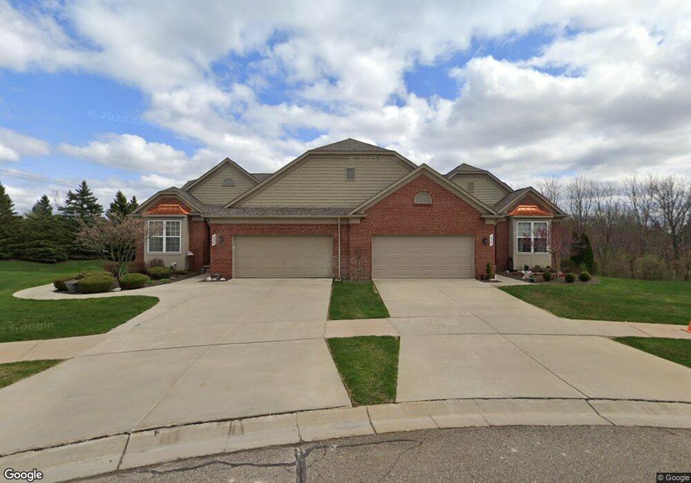
628 Zion Ct Unit Bldg-Unit Howell, MI 48843
Estimated Value: $458,000 - $480,000
2
Beds
3
Baths
1,706
Sq Ft
$274/Sq Ft
Est. Value
About This Home
This home is located at 628 Zion Ct Unit Bldg-Unit, Howell, MI 48843 and is currently estimated at $466,687, approximately $273 per square foot. 628 Zion Ct Unit Bldg-Unit is a home located in Livingston County with nearby schools including Northwest Elementary School, Highlander Way Middle School, and Howell High School.
Ownership History
Date
Name
Owned For
Owner Type
Purchase Details
Closed on
Jun 8, 2018
Sold by
Vorves Michael
Bought by
Edoff Dennis M and Edoff Mary C
Current Estimated Value
Home Financials for this Owner
Home Financials are based on the most recent Mortgage that was taken out on this home.
Original Mortgage
$271,700
Outstanding Balance
$232,658
Interest Rate
4.5%
Mortgage Type
New Conventional
Estimated Equity
$234,029
Purchase Details
Closed on
Oct 23, 2017
Sold by
Vorves Kathleen
Bought by
Vorves Michael
Purchase Details
Closed on
Aug 22, 2016
Sold by
Riordan Corinne I and Riordan Richard E
Bought by
Vorves Michael and Vorves Kathleen
Create a Home Valuation Report for This Property
The Home Valuation Report is an in-depth analysis detailing your home's value as well as a comparison with similar homes in the area
Home Values in the Area
Average Home Value in this Area
Purchase History
| Date | Buyer | Sale Price | Title Company |
|---|---|---|---|
| Edoff Dennis M | $302,000 | -- | |
| Vorves Michael | -- | -- | |
| Vorves Michael | $280,000 | None Available |
Source: Public Records
Mortgage History
| Date | Status | Borrower | Loan Amount |
|---|---|---|---|
| Open | Edoff Dennis M | $271,700 |
Source: Public Records
Tax History Compared to Growth
Tax History
| Year | Tax Paid | Tax Assessment Tax Assessment Total Assessment is a certain percentage of the fair market value that is determined by local assessors to be the total taxable value of land and additions on the property. | Land | Improvement |
|---|---|---|---|---|
| 2025 | $4,345 | $225,900 | $0 | $0 |
| 2024 | $2,791 | $218,700 | $0 | $0 |
| 2023 | $2,666 | $186,400 | $0 | $0 |
| 2022 | $1,226 | $160,400 | $0 | $0 |
| 2021 | $3,955 | $176,700 | $0 | $0 |
| 2020 | $3,800 | $160,400 | $0 | $0 |
| 2019 | $3,767 | $144,200 | $0 | $0 |
| 2018 | $3,684 | $138,400 | $0 | $0 |
| 2017 | $3,692 | $137,000 | $0 | $0 |
| 2016 | $2,840 | $112,900 | $0 | $0 |
| 2014 | $2,775 | $100,100 | $0 | $0 |
| 2012 | $2,775 | $95,000 | $0 | $0 |
Source: Public Records
Map
Nearby Homes
- 636 Zion Ct
- 3991 Rainier Dr Unit 1
- 3905 Rainier Dr
- 3765 Silver Charm Ln
- 3224 Waverly Woods Ln
- 840 Eager Rd
- 3020 Brookline
- 3429 Snowden Ln Unit 108
- 4059 Ash Tree Ln
- 3659 Sugarbush Dr Unit 116
- 452 Cloverview Ln
- 475 Cannonade Loop
- 530 Cannonade Loop
- 458 Cannonade Loop
- The Bloomington Plan at Broadmoor
- The Charlotte Plan at Broadmoor
- The Harrison Plan at Broadmoor
- The Austin Plan at Broadmoor
- The Columbia Plan at Broadmoor
- 559 Cannonade Loop