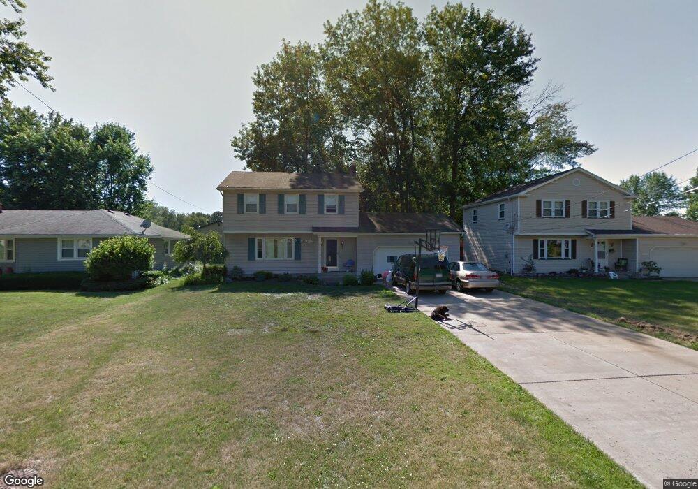
6280 Sheridan Rd Youngstown, OH 44514
Estimated Value: $210,000 - $279,000
3
Beds
2
Baths
1,842
Sq Ft
$133/Sq Ft
Est. Value
About This Home
This home is located at 6280 Sheridan Rd, Youngstown, OH 44514 and is currently estimated at $244,523, approximately $132 per square foot. 6280 Sheridan Rd is a home located in Mahoning County with nearby schools including Poland Union Elementary School, Poland Middle School, and Poland Seminary High School.
Ownership History
Date
Name
Owned For
Owner Type
Purchase Details
Closed on
Nov 21, 2012
Sold by
Delisio Joseph A and Delisio Lori A
Bought by
Delisio Lori A
Current Estimated Value
Home Financials for this Owner
Home Financials are based on the most recent Mortgage that was taken out on this home.
Original Mortgage
$76,000
Outstanding Balance
$33,212
Interest Rate
3.35%
Mortgage Type
New Conventional
Estimated Equity
$211,311
Purchase Details
Closed on
Aug 30, 1996
Sold by
Pompili Joseph L
Bought by
Delisio Joseph A and Delisio Lori A
Home Financials for this Owner
Home Financials are based on the most recent Mortgage that was taken out on this home.
Original Mortgage
$93,600
Interest Rate
8.3%
Mortgage Type
New Conventional
Purchase Details
Closed on
Jul 23, 1991
Bought by
Pompile Jos and Pompile Diane E
Create a Home Valuation Report for This Property
The Home Valuation Report is an in-depth analysis detailing your home's value as well as a comparison with similar homes in the area
Home Values in the Area
Average Home Value in this Area
Purchase History
| Date | Buyer | Sale Price | Title Company |
|---|---|---|---|
| Delisio Lori A | -- | Attorney | |
| Delisio Joseph A | $117,000 | -- | |
| Pompile Jos | $76,500 | -- |
Source: Public Records
Mortgage History
| Date | Status | Borrower | Loan Amount |
|---|---|---|---|
| Open | Delisio Lori A | $76,000 | |
| Closed | Delisio Joseph A | $93,600 |
Source: Public Records
Tax History Compared to Growth
Tax History
| Year | Tax Paid | Tax Assessment Tax Assessment Total Assessment is a certain percentage of the fair market value that is determined by local assessors to be the total taxable value of land and additions on the property. | Land | Improvement |
|---|---|---|---|---|
| 2024 | $3,200 | $59,500 | $9,320 | $50,180 |
| 2023 | $3,163 | $59,500 | $9,320 | $50,180 |
| 2022 | $3,258 | $53,740 | $6,830 | $46,910 |
| 2021 | $3,116 | $53,740 | $6,830 | $46,910 |
| 2020 | $3,129 | $53,740 | $6,830 | $46,910 |
| 2019 | $2,881 | $45,920 | $6,830 | $39,090 |
| 2018 | $2,792 | $45,920 | $6,830 | $39,090 |
| 2017 | $2,789 | $45,920 | $6,830 | $39,090 |
| 2016 | $2,423 | $37,960 | $6,200 | $31,760 |
| 2015 | $2,300 | $37,960 | $6,200 | $31,760 |
| 2014 | $2,308 | $37,960 | $6,200 | $31,760 |
| 2013 | $2,280 | $37,960 | $6,200 | $31,760 |
Source: Public Records
Map
Nearby Homes
- 1894 Lealand Ave
- 1804 Alverne Dr
- 1859 Mathews Rd
- 1827 Alverne Dr
- 1890 Mathews Rd
- 2035 Woodward Ave
- 1738 Island Dr
- 0 Mathews Rd Unit 5149232
- 0 Mathews Rd Unit 5143059
- 0 Oles Ave
- 34 Venloe Dr
- 43 Venloe Dr
- 5710 Youngstown Poland Rd
- 0 Woodlawn Ave
- 2128 Lyon Blvd
- 1841 Wingate Rd
- 1919 Wingate Rd
- 2153 Lyon Blvd
- 2089 Shetland Ln
- 2307 Hamilton Ave
- 6270 Sheridan Rd
- 6290 Sheridan Rd
- 1846 Canavan Dr
- 1842 Canavan Dr
- 6052 Sheridan Rd
- 6300 Sheridan Rd
- 1853 Lemont Dr
- 1849 Lemont Dr
- 1838 Canavan Dr
- 6044 Sheridan Rd
- 1845 Lemont Dr
- 6310 Sheridan Rd
- 1857 Lemont Dr
- 1845 Canavan Dr
- 1914 Woodward Ave
- 6036 Sheridan Rd
- 1834 Canavan Dr
- 1916 Woodward Ave
- 1841 Canavan Dr
- 1841 Lemont Dr