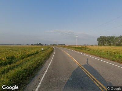
Estimated Value: $357,000 - $391,000
3
Beds
2
Baths
1,809
Sq Ft
$206/Sq Ft
Est. Value
About This Home
This home is located at 62801 U S 40, Craig, CO 81625 and is currently estimated at $372,488, approximately $205 per square foot. 62801 U S 40 is a home located in Moffat County with nearby schools including Moffat County High School.
Ownership History
Date
Name
Owned For
Owner Type
Purchase Details
Closed on
May 24, 2018
Sold by
Patton Kevin L
Bought by
Patton Kevin L and Wey Anthony W Van
Current Estimated Value
Home Financials for this Owner
Home Financials are based on the most recent Mortgage that was taken out on this home.
Original Mortgage
$211,105
Outstanding Balance
$184,096
Interest Rate
4.5%
Mortgage Type
FHA
Estimated Equity
$210,276
Purchase Details
Closed on
Oct 9, 2015
Sold by
Scott Leonard
Bought by
Steele Darryl L and Steele Sharon L
Home Financials for this Owner
Home Financials are based on the most recent Mortgage that was taken out on this home.
Original Mortgage
$149,719
Interest Rate
3.85%
Mortgage Type
Unknown
Purchase Details
Closed on
Dec 7, 2006
Sold by
Perry Ernest J
Bought by
Scott Leonard
Purchase Details
Closed on
May 16, 2005
Sold by
Steele Bret L and Steele Sheli A
Bought by
Perry Ernest J
Create a Home Valuation Report for This Property
The Home Valuation Report is an in-depth analysis detailing your home's value as well as a comparison with similar homes in the area
Home Values in the Area
Average Home Value in this Area
Purchase History
| Date | Buyer | Sale Price | Title Company |
|---|---|---|---|
| Patton Kevin L | -- | None Available | |
| Patton Kevin L | $215,000 | None Available | |
| Steele Darryl L | -- | None Available | |
| Steele Darryl L | $183,700 | None Available | |
| Scott Leonard | $182,000 | None Available | |
| Perry Ernest J | $157,500 | None Available |
Source: Public Records
Mortgage History
| Date | Status | Borrower | Loan Amount |
|---|---|---|---|
| Open | Patton Kevin L | $211,105 | |
| Previous Owner | Steele Darryl L | $149,719 | |
| Previous Owner | Scott Leonard | $166,760 |
Source: Public Records
Tax History Compared to Growth
Tax History
| Year | Tax Paid | Tax Assessment Tax Assessment Total Assessment is a certain percentage of the fair market value that is determined by local assessors to be the total taxable value of land and additions on the property. | Land | Improvement |
|---|---|---|---|---|
| 2024 | $1,129 | $17,520 | $1,310 | $16,210 |
| 2023 | $1,129 | $17,520 | $1,310 | $16,210 |
| 2022 | $972 | $15,680 | $1,650 | $14,030 |
| 2021 | $976 | $16,130 | $1,700 | $14,430 |
| 2020 | $845 | $14,210 | $1,700 | $12,510 |
| 2019 | $834 | $14,210 | $1,700 | $12,510 |
| 2018 | $759 | $12,840 | $1,710 | $11,130 |
| 2017 | $789 | $12,840 | $1,710 | $11,130 |
| 2016 | $794 | $13,490 | $1,890 | $11,600 |
| 2015 | -- | $13,490 | $1,890 | $11,600 |
Source: Public Records
Map
Nearby Homes
- TBD W Highway 40
- 0 53 Ct Rd Unit REC9289806
- 261 Ellis Ave
- 84 Veatch Ave
- TBD Highway 40 W
- 5050 County Road 53
- 0 Tbd County Road 77
- TBD County Road 77
- 0 Tbd County Road 17
- 14243 County Road 17
- 0 County Road 17 Unit 11274371
- TBD County Road 103
- TBD W Victory Way
- 81695 U S Highway 40
- TBD Us Hwy 40
- 37 Pronghorn Rd
- 85 County Road 81
- TBD Westridge Road & W Hwy 40
- 100 Sage Brush Ct
- 125 Knoll Ave
- 62801 U S 40
- 62679 Highway 40
- 62619 Highway 40
- 62468 W Highway 40
- 62468 U S 40
- 62468 Highway 40
- 900 Collum St
- 62648 Highway 40
- 62648 U S 40
- 62405 Highway 40
- 900 Mack Place
- 62646 U S 40
- 62802 W Highway 40
- 62802 U S 40
- 63321 U S 40
- 63322 U S 40
- 63322 W Highway 40
- 63322 U S 40
- 73338 U S 40
- 63410 W Highway 40
