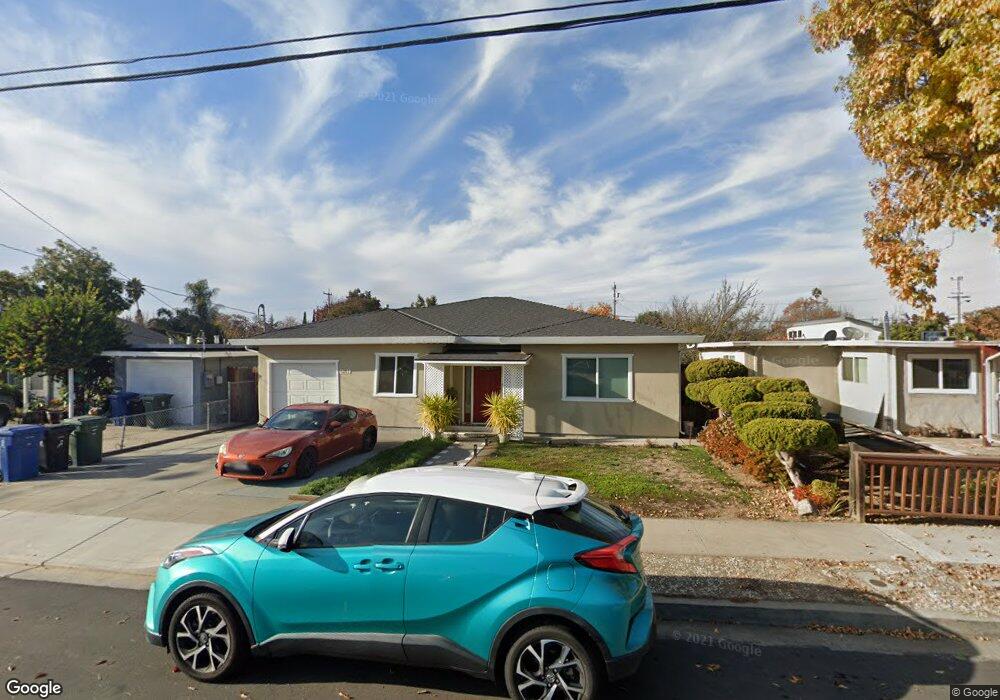
6281 Zulmida Ave Newark, CA 94560
Estimated Value: $1,024,000 - $1,139,000
3
Beds
2
Baths
1,300
Sq Ft
$834/Sq Ft
Est. Value
About This Home
This home is located at 6281 Zulmida Ave, Newark, CA 94560 and is currently estimated at $1,084,546, approximately $834 per square foot. 6281 Zulmida Ave is a home located in Alameda County with nearby schools including Coyote Hills Elementary School, Newark Junior High School, and Newark Memorial High School.
Ownership History
Date
Name
Owned For
Owner Type
Purchase Details
Closed on
Sep 20, 2013
Sold by
Ding & Lejoy Llc
Bought by
Adamos Anthony D and Adamos Crisanta G
Current Estimated Value
Home Financials for this Owner
Home Financials are based on the most recent Mortgage that was taken out on this home.
Original Mortgage
$393,750
Outstanding Balance
$294,525
Interest Rate
4.46%
Mortgage Type
New Conventional
Estimated Equity
$790,021
Purchase Details
Closed on
Feb 15, 2013
Sold by
Community First Development Fund Iii Llc
Bought by
Ding & Lejoy Llc
Purchase Details
Closed on
Nov 27, 2012
Sold by
Kupau Samuel K and Kupau April
Bought by
Community First Development Fund Iii Llc
Home Financials for this Owner
Home Financials are based on the most recent Mortgage that was taken out on this home.
Original Mortgage
$170,000
Interest Rate
3.36%
Mortgage Type
New Conventional
Create a Home Valuation Report for This Property
The Home Valuation Report is an in-depth analysis detailing your home's value as well as a comparison with similar homes in the area
Home Values in the Area
Average Home Value in this Area
Purchase History
| Date | Buyer | Sale Price | Title Company |
|---|---|---|---|
| Adamos Anthony D | $525,000 | Fidelity National Title Co | |
| Ding & Lejoy Llc | $105,000 | None Available | |
| Community First Development Fund Iii Llc | $227,000 | Fidelity National Title Co |
Source: Public Records
Mortgage History
| Date | Status | Borrower | Loan Amount |
|---|---|---|---|
| Open | Adamos Anthony D | $393,750 | |
| Previous Owner | Community First Development Fund Iii Llc | $170,000 |
Source: Public Records
Tax History
| Year | Tax Paid | Tax Assessment Tax Assessment Total Assessment is a certain percentage of the fair market value that is determined by local assessors to be the total taxable value of land and additions on the property. | Land | Improvement |
|---|---|---|---|---|
| 2025 | $7,954 | $636,550 | $193,065 | $450,485 |
| 2024 | $7,954 | $623,934 | $189,280 | $441,654 |
| 2023 | $7,735 | $618,564 | $185,569 | $432,995 |
| 2022 | $7,634 | $599,437 | $181,931 | $424,506 |
| 2021 | $7,443 | $587,551 | $178,365 | $416,186 |
| 2020 | $7,336 | $588,456 | $176,537 | $411,919 |
| 2019 | $7,231 | $576,921 | $173,076 | $403,845 |
| 2018 | $7,122 | $565,613 | $169,684 | $395,929 |
| 2017 | $6,940 | $554,525 | $166,357 | $388,168 |
| 2016 | $6,868 | $543,652 | $163,095 | $380,557 |
| 2015 | $6,844 | $535,488 | $160,646 | $374,842 |
| 2014 | $6,657 | $525,000 | $157,500 | $367,500 |
Source: Public Records
Map
Nearby Homes
- 6328 Zulmida Ave
- 6364 Noel Ave
- 6252 Bennington Dr
- 6169 Thornton Ave Unit B
- 36605 Hafner St
- 6245 Thornton Ave
- 36465 Hafner St
- 5912 Mayhews Landing Rd
- 36563 Beutke Dr
- 36637 Burdick St
- 36057 Dalewood Dr
- 37029 Olive St
- 36347 Colbert Place
- 36184 Toulouse St
- 35926 Newark Blvd
- 5585 Fernwood Dr
- 6417/6433 Thornton Ave
- 6241 Cotton Ave
- 36188 Fig Tree Ln
- 36871 Locust St
- 6287 Zulmida Ave
- 6275 Zulmida Ave
- 6305 Zulmida Ave
- 6269 Zulmida Ave
- 6278 Mayhews Landing Rd
- 6286 Mayhews Landing Rd
- 6270 Mayhews Landing Rd
- 6282 Zulmida Ave
- 6292 Mayhews Landing Rd
- 6262 Mayhews Landing Rd
- 6313 Zulmida Ave
- 36543 Christine St
- 6298 Mayhews Landing Rd
- 6264 Zulmida Ave
- 36525 Christine St
- 6312 Zulmida Ave
- 36552 Leone St
- 6321 Zulmida Ave
- 36545 Leone St
- 6302 Mayhews Landing Rd
Your Personal Tour Guide
Ask me questions while you tour the home.