Estimated Value: $327,000 - $378,000
4
Beds
2
Baths
2,019
Sq Ft
$176/Sq Ft
Est. Value
About This Home
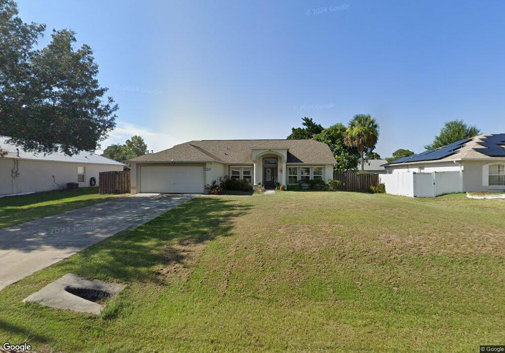
This home is located at 6284 Brandt St, Cocoa, FL 32927 and is currently estimated at $356,263, approximately $176 per square foot. 6284 Brandt St is a home located in Brevard County with nearby schools including Enterprise Elementary School and Space Coast Junior/Senior High School.
Ownership History
Date
Name
Owned For
Owner Type
Purchase Details
Closed on
Aug 8, 2016
Sold by
Joseph Yosiff John
Bought by
Joseph Rosemary Cherylenne
Current Estimated Value
Purchase Details
Closed on
Aug 1, 2016
Bought by
Joseph Rosemary
Purchase Details
Closed on
Jul 30, 1999
Sold by
Maronda Homes Inc Fl
Bought by
Joseph Yosiff J and Joseph Rosemay C
Home Financials for this Owner
Home Financials are based on the most recent Mortgage that was taken out on this home.
Original Mortgage
$81,250
Interest Rate
7.66%
Purchase Details
Closed on
Oct 5, 1998
Sold by
Hee Susan and Hee Daisy
Bought by
Maronda Homes Inc Fl
Create a Home Valuation Report for This Property
The Home Valuation Report is an in-depth analysis detailing your home's value as well as a comparison with similar homes in the area
Home Values in the Area
Average Home Value in this Area
Purchase History
| Date | Buyer | Sale Price | Title Company |
|---|---|---|---|
| Joseph Rosemary Cherylenne | -- | None Available | |
| Joseph Rosemary | $100 | -- | |
| Joseph Yosiff J | $101,800 | -- | |
| Maronda Homes Inc Fl | $10,000 | -- |
Source: Public Records
Mortgage History
| Date | Status | Borrower | Loan Amount |
|---|---|---|---|
| Previous Owner | Joseph Yosiff J | $81,250 |
Source: Public Records
Tax History Compared to Growth
Tax History
| Year | Tax Paid | Tax Assessment Tax Assessment Total Assessment is a certain percentage of the fair market value that is determined by local assessors to be the total taxable value of land and additions on the property. | Land | Improvement |
|---|---|---|---|---|
| 2025 | $1,609 | $113,310 | -- | -- |
| 2024 | $1,570 | $110,120 | -- | -- |
| 2023 | $1,570 | $106,920 | $0 | $0 |
| 2022 | $1,466 | $103,810 | $0 | $0 |
| 2021 | $1,466 | $100,790 | $0 | $0 |
| 2020 | $1,390 | $99,400 | $0 | $0 |
| 2019 | $1,325 | $97,170 | $0 | $0 |
| 2018 | $1,317 | $95,360 | $0 | $0 |
| 2017 | $1,309 | $93,400 | $0 | $0 |
| 2016 | $1,231 | $91,480 | $18,000 | $73,480 |
| 2015 | $1,243 | $90,850 | $15,000 | $75,850 |
| 2014 | $1,243 | $90,130 | $11,000 | $79,130 |
Source: Public Records
Map
Nearby Homes
- 6295 Banyan St
- 6115 Allmont St
- 6105 Banyan St
- 6530 Bethel St
- 6481 Muller Ave
- 6545 Addie Ave
- 6665 Addie Ave
- 23-35-21-JX-B-2 Aruin St
- 6365 Homestead Ave
- 6470 Aberdeen Ave
- 6198 Dees Rd
- 5915 Akers St
- 00000 Golfview Ave
- 6118 Dees Rd
- 6010 Fay Blvd
- 6070 Baltimore Ave
- 5715 Fairbridge St
- 4650 N Highway 1 Hwy
- 6643 Emil Ave
- 0 Golfview Ave
- 6272 Brandt St
- 6296 Brandt St
- 6285 Allmont St
- 6275 Allmont St
- 6295 Allmont St
- 6285 Brandt St
- 6273 Brandt St
- 6305 Allmont St
- 6265 Allmont St
- 6309 Brandt St
- 6261 Brandt St
- 6320 Brandt St
- 6248 Brandt St
- 0000 Bethel St
- 6255 Allmont St
- 6321 Brandt St
- 6249 Brandt St
- 6280 Allmont St
- 6260 Corsica Blvd
- 6325 Allmont St