Estimated Value: $336,648 - $377,000
--
Bed
2
Baths
1,504
Sq Ft
$240/Sq Ft
Est. Value
About This Home
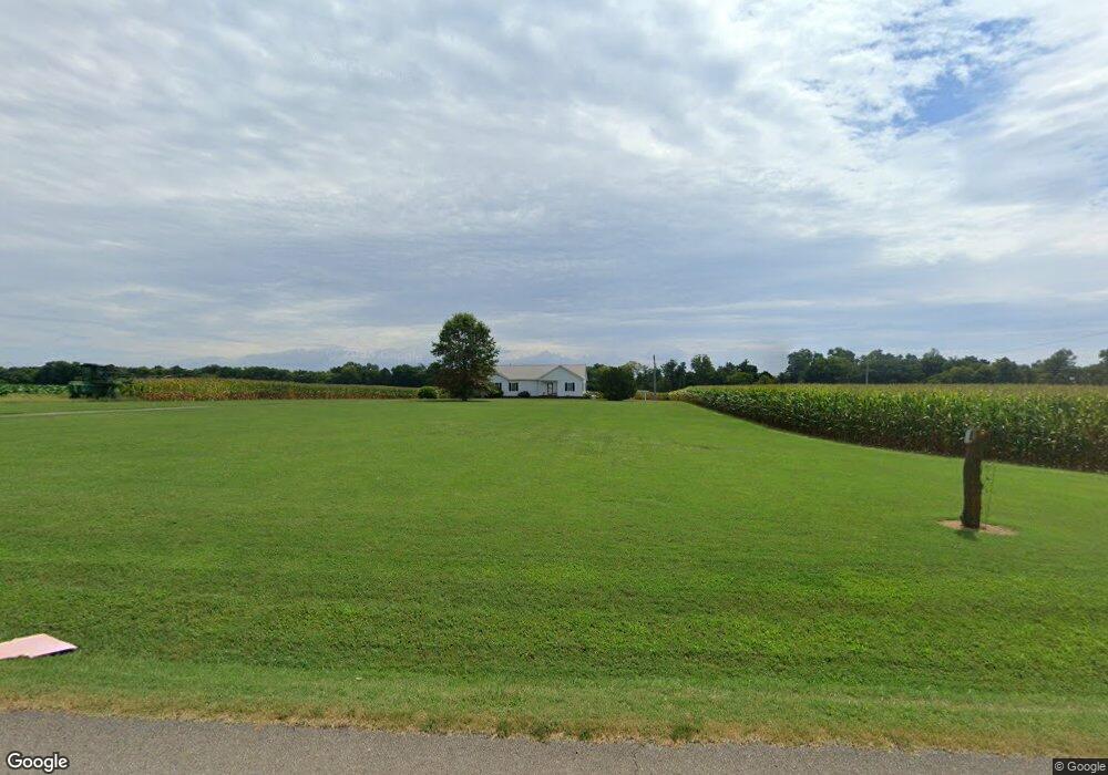
This home is located at 6285 State Line Rd, Adams, TN 37010 and is currently estimated at $360,412, approximately $239 per square foot. 6285 State Line Rd is a home located in Robertson County with nearby schools including Jo Byrns Elementary School and Jo Byrns High School.
Ownership History
Date
Name
Owned For
Owner Type
Purchase Details
Closed on
Jan 7, 2013
Sold by
Powell Bradley S
Bought by
Moseley Jonathan E Cathry
Current Estimated Value
Home Financials for this Owner
Home Financials are based on the most recent Mortgage that was taken out on this home.
Original Mortgage
$119,000
Outstanding Balance
$82,075
Interest Rate
3.35%
Mortgage Type
Commercial
Estimated Equity
$278,337
Purchase Details
Closed on
Mar 24, 2004
Sold by
Powell Grace S
Bought by
Powell Bradley S
Create a Home Valuation Report for This Property
The Home Valuation Report is an in-depth analysis detailing your home's value as well as a comparison with similar homes in the area
Home Values in the Area
Average Home Value in this Area
Purchase History
| Date | Buyer | Sale Price | Title Company |
|---|---|---|---|
| Moseley Jonathan E Cathry | $140,000 | -- | |
| Powell Bradley S | $11,000 | -- |
Source: Public Records
Mortgage History
| Date | Status | Borrower | Loan Amount |
|---|---|---|---|
| Open | Moseley Jonathan E Cathry | $119,000 |
Source: Public Records
Tax History Compared to Growth
Tax History
| Year | Tax Paid | Tax Assessment Tax Assessment Total Assessment is a certain percentage of the fair market value that is determined by local assessors to be the total taxable value of land and additions on the property. | Land | Improvement |
|---|---|---|---|---|
| 2025 | $1,201 | $66,725 | $0 | $0 |
| 2024 | $1,201 | $66,725 | $7,350 | $59,375 |
| 2023 | $1,201 | $66,725 | $7,350 | $59,375 |
| 2022 | $1,003 | $38,950 | $3,675 | $35,275 |
| 2021 | $1,003 | $38,950 | $3,675 | $35,275 |
| 2020 | $1,003 | $38,950 | $3,675 | $35,275 |
| 2019 | $1,003 | $38,950 | $3,675 | $35,275 |
| 2018 | $914 | $38,950 | $3,675 | $35,275 |
| 2017 | $963 | $31,200 | $3,125 | $28,075 |
| 2016 | $963 | $31,200 | $3,125 | $28,075 |
| 2015 | $924 | $31,200 | $3,125 | $28,075 |
| 2014 | $924 | $31,200 | $3,125 | $28,075 |
Source: Public Records
Map
Nearby Homes
- 0 W State Line Rd Unit RTC3033861
- 1 J Bourne Rd
- 1047 Landing Lane Lot 3
- 1035 Landing Lane Lot 2
- 1015 Landing Lane Lot 1
- 7898 Highway 41 N
- 205 Maple St
- 0 Keysburg Rd Unit 42351
- 0 W Bellar Rd
- 104 E Pond St
- 1986 Route 76
- 9 Sturgeon Creek Rd
- 9b Sturgeon Creek Rd
- 6 Sturgeon Creek Rd
- 4591 Pineywoods Rd
- 511 Snardon Mill Rd
- 2 Smith Rd
- 1 Smith Rd
- 0 Smith Rd
- 286 Tower St
- 6267 State Line Rd
- 3 State Line Rd
- 6 State Line Rd
- 6259 State Line Rd
- 0 W State Line Rd Unit 1956679
- 0 W State Line Rd Unit RTC2823059
- 2242 Hoopers Hollow Rd
- 2208 Hoopers Hollow Rd
- 6207 State Line Rd
- 2226 Hoopers Hollow Rd
- 2219 Hoopers Hollow Rd
- 0 Hoopers Hollow Rd
- 2060 Hoopers Hollow Rd
- 2040 Hoopers Hollow Rd
- 2028 Hoopers Hollow Rd
- 2102 Powell Ln
- 5035 State Line Rd
- 2030 Hoopers Hollow Rd
- 2030 Hoopers Hollow Rd
- 300 Church Ln