Estimated Value: $167,000 - $387,320
2
Beds
1
Bath
780
Sq Ft
$316/Sq Ft
Est. Value
About This Home
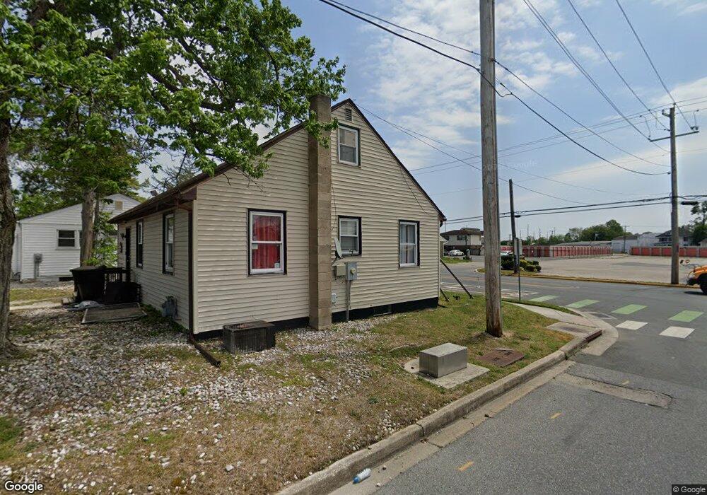
This home is located at 629 W Division St, Dover, DE 19904 and is currently estimated at $246,107, approximately $315 per square foot. 629 W Division St is a home located in Kent County with nearby schools including Booker T. Washington Elementary School, William Henry Middle School, and Central Middle School.
Ownership History
Date
Name
Owned For
Owner Type
Purchase Details
Closed on
Dec 22, 2022
Sold by
Anderson Iolano and Anderson Cathy
Bought by
Faithwork Llc
Current Estimated Value
Home Financials for this Owner
Home Financials are based on the most recent Mortgage that was taken out on this home.
Original Mortgage
$232,500
Outstanding Balance
$225,037
Interest Rate
6.58%
Mortgage Type
FHA
Estimated Equity
$21,070
Purchase Details
Closed on
Sep 27, 2000
Bought by
Anderson Tolano and King Grace Elisabeth
Create a Home Valuation Report for This Property
The Home Valuation Report is an in-depth analysis detailing your home's value as well as a comparison with similar homes in the area
Home Values in the Area
Average Home Value in this Area
Purchase History
| Date | Buyer | Sale Price | Title Company |
|---|---|---|---|
| Faithwork Llc | -- | -- | |
| Anderson Tolano | $77,000 | -- |
Source: Public Records
Mortgage History
| Date | Status | Borrower | Loan Amount |
|---|---|---|---|
| Open | Faithwork Llc | $232,500 |
Source: Public Records
Tax History Compared to Growth
Tax History
| Year | Tax Paid | Tax Assessment Tax Assessment Total Assessment is a certain percentage of the fair market value that is determined by local assessors to be the total taxable value of land and additions on the property. | Land | Improvement |
|---|---|---|---|---|
| 2025 | $2,537 | $446,900 | $374,300 | $72,600 |
| 2024 | $2,537 | $446,900 | $374,300 | $72,600 |
| 2023 | $450 | $15,300 | $3,500 | $11,800 |
| 2022 | $435 | $15,300 | $3,500 | $11,800 |
| 2021 | $419 | $15,300 | $3,500 | $11,800 |
| 2020 | $405 | $15,300 | $3,500 | $11,800 |
| 2019 | $383 | $15,300 | $3,500 | $11,800 |
| 2018 | $350 | $15,300 | $3,500 | $11,800 |
| 2017 | $344 | $15,300 | $0 | $0 |
| 2016 | $345 | $15,300 | $0 | $0 |
| 2015 | $345 | $15,300 | $0 | $0 |
| 2014 | $346 | $15,300 | $0 | $0 |
Source: Public Records
Map
Nearby Homes
- 862 Forest St
- 420 W Division St
- 411 W Reed St
- 118 N Queen St
- 130 N Queen St
- 109 S Queen St
- 735 W North St
- 305 W Reed St
- 134 Reese St
- 214 W Division St
- 34 N Governors Ave
- 217 W Reed St
- 54 S Governors Ave
- 8 S Governors Ave
- 949 Lincoln St
- 30 N Governors Ave
- 56 S Governors Ave
- 225 N New St
- 40 S Bradford St
- 122 S Bradford St
- 627 W Division St
- 717 W Division St
- 621 W Division St
- 624 W Division St
- 721 W Division St
- 731 W Division St
- 726 W Division St
- 801 W Division St
- 815 Forest St
- 641 Fulton St
- 623 Fulton St
- 810 Forest St
- 601 Fulton St
- 730 Forest St
- 726 Forest St
- 1 Weston Dr
- 722 Forest St
- 7 N West St
- 806 Forest St
- 718 Forest St