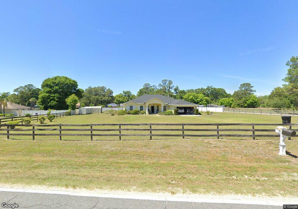
6290 W Anthony Rd Ocala, FL 34479
Northeast Ocala NeighborhoodEstimated Value: $421,000 - $477,000
4
Beds
2
Baths
2,230
Sq Ft
$201/Sq Ft
Est. Value
About This Home
This home is located at 6290 W Anthony Rd, Ocala, FL 34479 and is currently estimated at $448,494, approximately $201 per square foot. 6290 W Anthony Rd is a home located in Marion County with nearby schools including Shady Hill Elementary School, Howard Middle School, and Vanguard High School.
Ownership History
Date
Name
Owned For
Owner Type
Purchase Details
Closed on
Aug 14, 2015
Sold by
Pauls John A
Bought by
Pauls Judy
Current Estimated Value
Purchase Details
Closed on
Oct 3, 2007
Sold by
Bailey Kelly and Bailey Jamie
Bought by
Pauls John A and Pauls Judy
Home Financials for this Owner
Home Financials are based on the most recent Mortgage that was taken out on this home.
Original Mortgage
$182,000
Outstanding Balance
$113,697
Interest Rate
6.49%
Mortgage Type
Purchase Money Mortgage
Estimated Equity
$334,797
Purchase Details
Closed on
Jul 2, 2004
Sold by
Smith Joseph W
Bought by
Bailey Kelly and Bailey Jamie
Home Financials for this Owner
Home Financials are based on the most recent Mortgage that was taken out on this home.
Original Mortgage
$27,000
Interest Rate
5%
Mortgage Type
Purchase Money Mortgage
Create a Home Valuation Report for This Property
The Home Valuation Report is an in-depth analysis detailing your home's value as well as a comparison with similar homes in the area
Home Values in the Area
Average Home Value in this Area
Purchase History
| Date | Buyer | Sale Price | Title Company |
|---|---|---|---|
| Pauls Judy | -- | None Available | |
| Pauls John A | $257,000 | Attorney | |
| Bailey Kelly | $30,000 | Affiliated Title |
Source: Public Records
Mortgage History
| Date | Status | Borrower | Loan Amount |
|---|---|---|---|
| Open | Pauls John A | $182,000 | |
| Previous Owner | Bailey Kelly | $27,000 |
Source: Public Records
Tax History
| Year | Tax Paid | Tax Assessment Tax Assessment Total Assessment is a certain percentage of the fair market value that is determined by local assessors to be the total taxable value of land and additions on the property. | Land | Improvement |
|---|---|---|---|---|
| 2025 | $2,793 | $188,592 | -- | -- |
| 2024 | $2,542 | $183,277 | -- | -- |
| 2023 | $2,476 | $177,939 | $0 | $0 |
| 2022 | $2,407 | $172,756 | $0 | $0 |
| 2021 | $2,402 | $167,724 | $0 | $0 |
| 2020 | $2,381 | $165,408 | $0 | $0 |
| 2019 | $2,344 | $161,689 | $0 | $0 |
| 2018 | $2,223 | $158,674 | $0 | $0 |
| 2017 | $2,182 | $155,410 | $0 | $0 |
| 2016 | $2,141 | $152,214 | $0 | $0 |
| 2015 | $2,153 | $151,156 | $0 | $0 |
| 2014 | $2,025 | $149,956 | $0 | $0 |
Source: Public Records
Map
Nearby Homes
- HWY 441 and W Anthony Rd
- 6497 W Anthony Rd
- 590 NE 63rd St
- 2227 NW 23rd Rd
- 2303 NW 23rd Rd
- 2211 NW 23rd Rd
- 285 NW 65th St
- 393 NE 58th St
- 208 NE 70th St
- 767 NW 66th Place
- 450 NE 55th St
- 7101 W Anthony Rd Unit 16
- 7101 W Anthony Rd Unit Lot 56
- 7101 W Anthony Rd Unit Lot 54
- 7101 W Anthony Rd Unit 19
- 7101 W Anthony Rd Unit 49
- 7101 W Anthony Rd Unit 65
- 7101 W Anthony Rd Unit 35
- 7101 W Anthony Rd Unit 27
- TBD NE 70th St
- 95 NE 62nd St
- 201 NE 63rd St
- 79 NE 62nd St Unit 71
- 100 NE 62nd St
- 170 NE 63rd St
- 6211 W Anthony Rd Unit NE
- 6305 W Anthony Rd
- 335 NE 63rd St
- 80 NE 62 St
- 80 NE 62nd St
- 111 NE 63rd St
- 6368 W Anthony Rd
- 330 NE 63rd St
- 100 NE 63rd St
- 8595 W Anthony Rd
- 701 W Anthony Rd Unit 4
- 701 W Anthony Rd Unit 30
- 701 W Anthony Rd Unit 74
- 6713 W Anthony Rd
- 701 W Anthony Rd Unit 6
Your Personal Tour Guide
Ask me questions while you tour the home.