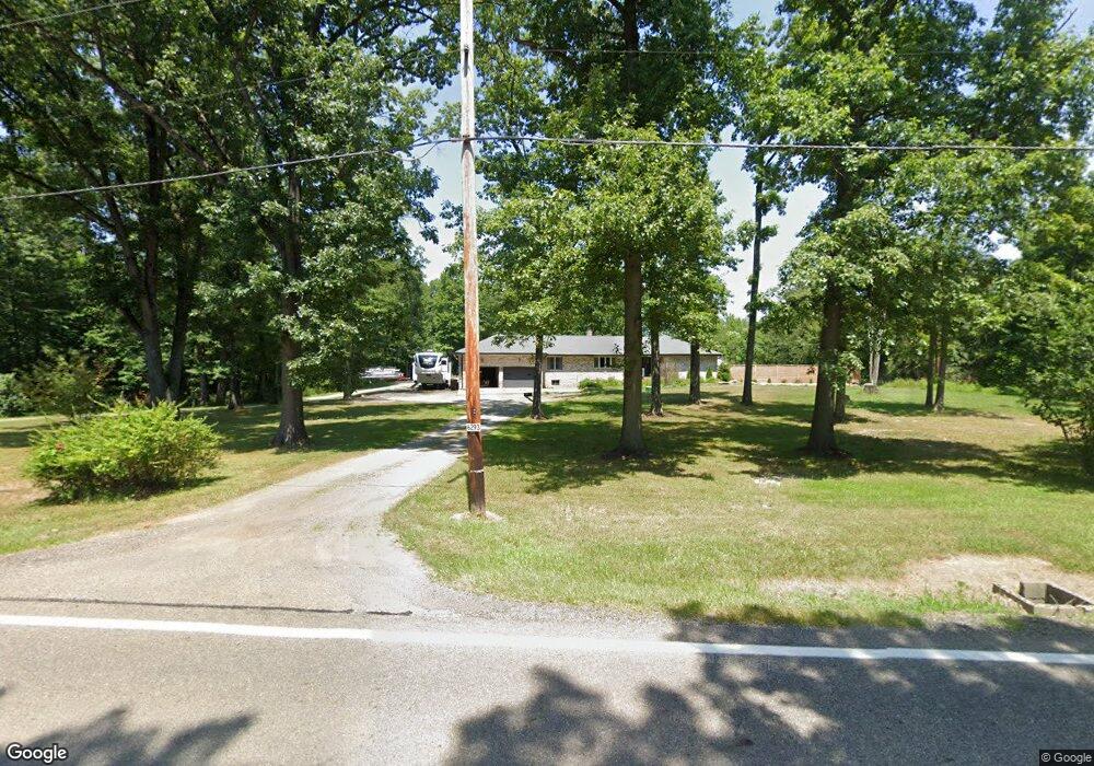
6293 State Route 305 Fowler, OH 44418
Estimated Value: $237,000 - $299,000
3
Beds
2
Baths
2,108
Sq Ft
$132/Sq Ft
Est. Value
About This Home
This home is located at 6293 State Route 305, Fowler, OH 44418 and is currently estimated at $277,445, approximately $131 per square foot. 6293 State Route 305 is a home located in Trumbull County with nearby schools including Badger Elementary School, Badger Middle School, and Badger High School.
Ownership History
Date
Name
Owned For
Owner Type
Purchase Details
Closed on
Nov 1, 2018
Sold by
Pettitt Michael and Pettitt Elizabeth A
Bought by
Love Michael G
Current Estimated Value
Home Financials for this Owner
Home Financials are based on the most recent Mortgage that was taken out on this home.
Original Mortgage
$138,842
Outstanding Balance
$122,084
Interest Rate
4.8%
Mortgage Type
New Conventional
Estimated Equity
$155,361
Purchase Details
Closed on
Jan 1, 1990
Bought by
Ronald Ronald E and Ronald Phyllis A
Create a Home Valuation Report for This Property
The Home Valuation Report is an in-depth analysis detailing your home's value as well as a comparison with similar homes in the area
Purchase History
| Date | Buyer | Sale Price | Title Company |
|---|---|---|---|
| Love Michael G | $146,200 | None Available | |
| Ronald Ronald E | -- | -- |
Source: Public Records
Mortgage History
| Date | Status | Borrower | Loan Amount |
|---|---|---|---|
| Open | Love Michael G | $138,842 |
Source: Public Records
Tax History
| Year | Tax Paid | Tax Assessment Tax Assessment Total Assessment is a certain percentage of the fair market value that is determined by local assessors to be the total taxable value of land and additions on the property. | Land | Improvement |
|---|---|---|---|---|
| 2024 | $3,391 | $79,870 | $2,660 | $77,210 |
| 2023 | $3,422 | $79,870 | $2,660 | $77,210 |
| 2022 | $3,157 | $66,540 | $2,380 | $64,160 |
| 2021 | $2,728 | $57,540 | $2,380 | $55,160 |
| 2020 | $2,747 | $57,540 | $2,380 | $55,160 |
| 2019 | $2,545 | $50,160 | $2,210 | $47,950 |
| 2018 | $2,106 | $50,160 | $2,210 | $47,950 |
| 2017 | $2,101 | $50,160 | $2,210 | $47,950 |
| 2016 | $1,936 | $47,120 | $2,210 | $44,910 |
| 2015 | $1,858 | $47,120 | $2,210 | $44,910 |
| 2014 | $1,857 | $47,120 | $2,210 | $44,910 |
| 2013 | $1,949 | $47,120 | $2,210 | $44,910 |
Source: Public Records
Map
Nearby Homes
- 7109 Spencer Clark Rd
- 2486 Waynewood Dr NE
- 7620 Thompson Sharpsville Rd NE
- 4875 Cadwallader-Sonk Rd
- 2009 Sodom Hutchings Rd NE
- 7965 State Route 609
- 2482 Youngstown Kingsville Rd NE
- 4274 Cadwallader-Sonk Rd
- 3912 Orangeville Rd
- 0 Warner Rd
- 1565 Sodom Hutchings Rd NE
- 1555 Sodom Hutchings Rd NE
- 7529 State Line
- 40 Bradley Brownlee Rd
- 2601 Orangeville Rd
- 3740 Wilson Sharpsville Rd
- 10 Bradley Brownlee Rd
- 5955 Bushnell Campbell Rd
- 20 Rd
- 1440 Youngstown Kingsville Rd
- 6293 Wilson Sharpsville Rd
- 1 Wilson Sharpsville
- 6201 State Route 305
- 6385 State Route 305
- 6183 State Route 305
- 3342 Bushnell Campbell Rd
- 3408 Bushnell Campbell Rd
- 6426 State Route 305
- 3334 Bushnell Campbell Rd
- 3372 Bushnell Campbell Rd
- 3460 Bushnell Campbell Rd
- 6406 State Route 305
- 6436 State Route 305
- 6406 Wilson Sharpsville Rd
- 3326 Bushnell Campbell Rd
- 3393 Bushnell Campbell Rd
- 6094 Bushnell Campbell Rd
- 6456 State Route 305
- 3524 Bushnell Campbell Rd
- 6464 State Route 305
Your Personal Tour Guide
Ask me questions while you tour the home.