Estimated Value: $980,244 - $1,181,000
4
Beds
3
Baths
2,408
Sq Ft
$437/Sq Ft
Est. Value
About This Home
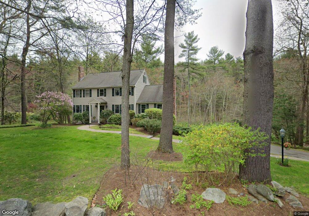
This home is located at 63 Charter Rd, Acton, MA 01720 and is currently estimated at $1,053,061, approximately $437 per square foot. 63 Charter Rd is a home located in Middlesex County with nearby schools including Acton-Boxborough Regional High School.
Ownership History
Date
Name
Owned For
Owner Type
Purchase Details
Closed on
Nov 15, 1991
Sold by
Sudame Prafulla S and Sudame Snehlata P
Bought by
Goodridge Lester E and Goodridge Regina E
Current Estimated Value
Home Financials for this Owner
Home Financials are based on the most recent Mortgage that was taken out on this home.
Original Mortgage
$130,000
Interest Rate
8.8%
Mortgage Type
Purchase Money Mortgage
Create a Home Valuation Report for This Property
The Home Valuation Report is an in-depth analysis detailing your home's value as well as a comparison with similar homes in the area
Home Values in the Area
Average Home Value in this Area
Purchase History
| Date | Buyer | Sale Price | Title Company |
|---|---|---|---|
| Goodridge Lester E | $235,000 | -- |
Source: Public Records
Mortgage History
| Date | Status | Borrower | Loan Amount |
|---|---|---|---|
| Closed | Goodridge Lester E | $125,000 | |
| Closed | Goodridge Lester E | $44,000 | |
| Closed | Goodridge Lester E | $130,000 |
Source: Public Records
Tax History
| Year | Tax Paid | Tax Assessment Tax Assessment Total Assessment is a certain percentage of the fair market value that is determined by local assessors to be the total taxable value of land and additions on the property. | Land | Improvement |
|---|---|---|---|---|
| 2025 | $14,850 | $865,900 | $313,500 | $552,400 |
| 2024 | $13,851 | $830,900 | $313,500 | $517,400 |
| 2023 | $13,749 | $783,000 | $285,100 | $497,900 |
| 2022 | $13,000 | $668,400 | $247,900 | $420,500 |
| 2021 | $12,704 | $628,000 | $229,600 | $398,400 |
| 2020 | $11,877 | $617,300 | $229,600 | $387,700 |
| 2019 | $11,295 | $583,100 | $229,600 | $353,500 |
| 2018 | $11,085 | $572,000 | $229,600 | $342,400 |
| 2017 | $10,797 | $566,500 | $229,600 | $336,900 |
| 2016 | $10,575 | $549,900 | $229,600 | $320,300 |
| 2015 | $10,605 | $556,700 | $229,600 | $327,100 |
| 2014 | $10,213 | $525,100 | $229,600 | $295,500 |
Source: Public Records
Map
Nearby Homes
- 79 Charter Rd
- 20 Joseph Reed Ln
- 5 Perkins Ln
- 18 Hayward Rd
- 246 Main St Unit 2
- 235 Arlington St
- 96 Newtown Rd
- 11 Braebrook
- 7 Kelley Rd
- 60 Nashoba Rd
- 46 Taylor Rd
- 631 Massachusetts Ave Unit 631
- 4 Littlefield Rd
- 33 Meadowbrook Rd
- 184 Main St Unit 3
- 491 Main St
- 27 Forest Rd
- 92 Willow St Unit 3
- 92 Willow St Unit 2
- 25 Nylander Way
Your Personal Tour Guide
Ask me questions while you tour the home.