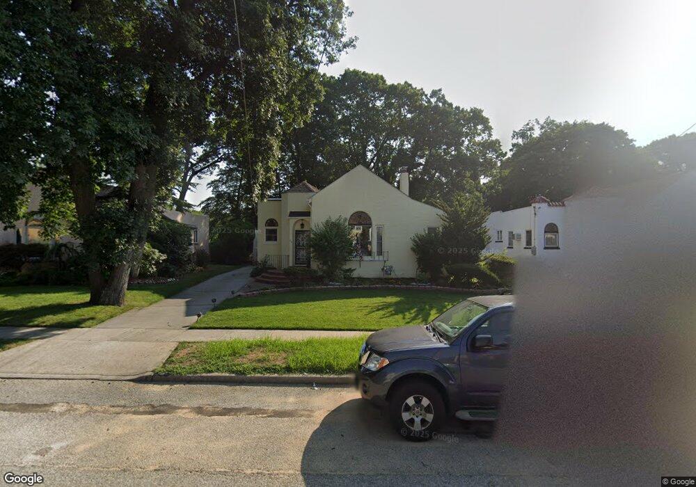
63 Henry St Merrick, NY 11566
Estimated Value: $697,000 - $814,039
3
Beds
2
Baths
1,784
Sq Ft
$423/Sq Ft
Est. Value
About This Home
This home is located at 63 Henry St, Merrick, NY 11566 and is currently estimated at $755,520, approximately $423 per square foot. 63 Henry St is a home located in Nassau County with nearby schools including Merrick Avenue Middle School, Sanford H Calhoun High School, and St. Elizabeth Ann Seton Regional School.
Ownership History
Date
Name
Owned For
Owner Type
Purchase Details
Closed on
Jul 13, 2017
Sold by
Perone Gene and Giobbe Claire
Bought by
Olivo Efrain E and Olivo Maria E
Current Estimated Value
Home Financials for this Owner
Home Financials are based on the most recent Mortgage that was taken out on this home.
Original Mortgage
$337,500
Outstanding Balance
$279,880
Interest Rate
3.91%
Mortgage Type
New Conventional
Estimated Equity
$475,640
Create a Home Valuation Report for This Property
The Home Valuation Report is an in-depth analysis detailing your home's value as well as a comparison with similar homes in the area
Home Values in the Area
Average Home Value in this Area
Purchase History
| Date | Buyer | Sale Price | Title Company |
|---|---|---|---|
| Olivo Efrain E | $450,000 | None Available | |
| Olivo Efrain E | $450,000 | None Available | |
| Olivo Efrain E | $450,000 | None Available |
Source: Public Records
Mortgage History
| Date | Status | Borrower | Loan Amount |
|---|---|---|---|
| Open | Olivo Efrain E | $337,500 | |
| Closed | Olivo Efrain E | $337,500 |
Source: Public Records
Tax History Compared to Growth
Tax History
| Year | Tax Paid | Tax Assessment Tax Assessment Total Assessment is a certain percentage of the fair market value that is determined by local assessors to be the total taxable value of land and additions on the property. | Land | Improvement |
|---|---|---|---|---|
| 2025 | $14,636 | $509 | $272 | $237 |
| 2024 | $3,299 | $508 | $272 | $236 |
| 2023 | $13,765 | $542 | $290 | $252 |
| 2022 | $13,765 | $527 | $282 | $245 |
| 2021 | $17,586 | $541 | $289 | $252 |
| 2020 | $14,797 | $630 | $453 | $177 |
| 2019 | $3,139 | $675 | $485 | $190 |
| 2018 | $8,920 | $1,072 | $0 | $0 |
| 2017 | $12,335 | $1,072 | $770 | $302 |
| 2016 | $16,923 | $1,072 | $770 | $302 |
| 2015 | $4,254 | $1,072 | $770 | $302 |
| 2014 | $4,254 | $1,072 | $770 | $302 |
| 2013 | $4,025 | $1,072 | $770 | $302 |
Source: Public Records
Map
Nearby Homes
- 103 Frankel Blvd
- 114 Frankel Blvd
- 163 Wynsum Ave
- 16 Ocean Ave
- 2355 Mitchell Place
- 1360-1370 Merrick Rd
- 123 Mitchell St
- 715 Farmers Ave
- 105 Howell St
- 119 Ocean Ave
- 217 Bayview Ave
- 204 Howell St
- 205 Howell St
- 23 Bay St
- 601 Hughes St
- 204 Hewlett Ave
- 201 Argyle Place
- 2083 Elm Place
- 5 Oak Brook Ln
- 2492 Lefferts Place