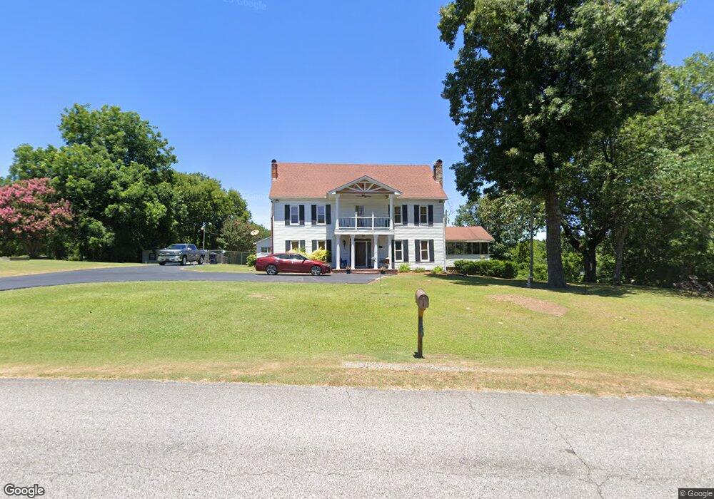
63 Kay Rd Laceys Spring, AL 35754
Estimated Value: $347,000 - $477,000
--
Bed
--
Bath
3,190
Sq Ft
$127/Sq Ft
Est. Value
About This Home
This home is located at 63 Kay Rd, Laceys Spring, AL 35754 and is currently estimated at $404,954, approximately $126 per square foot. 63 Kay Rd is a home located in Morgan County with nearby schools including Laceys Spring Elementary School and Albert P. Brewer High School.
Ownership History
Date
Name
Owned For
Owner Type
Purchase Details
Closed on
May 4, 2023
Sold by
Hough Joey R and Hough Dianne W
Bought by
Hough Walter Vann and Hough Cathy S
Current Estimated Value
Purchase Details
Closed on
Mar 3, 2008
Sold by
Hough Wesley Steven and Hough Katie Lou
Bought by
Hough Joey R and Hough Dianne W
Home Financials for this Owner
Home Financials are based on the most recent Mortgage that was taken out on this home.
Original Mortgage
$321,500
Interest Rate
6.08%
Mortgage Type
Unknown
Create a Home Valuation Report for This Property
The Home Valuation Report is an in-depth analysis detailing your home's value as well as a comparison with similar homes in the area
Home Values in the Area
Average Home Value in this Area
Purchase History
| Date | Buyer | Sale Price | Title Company |
|---|---|---|---|
| Hough Walter Vann | $85,500 | None Listed On Document | |
| Hough Joey R | -- | None Available |
Source: Public Records
Mortgage History
| Date | Status | Borrower | Loan Amount |
|---|---|---|---|
| Previous Owner | Hough Joey R | $321,500 |
Source: Public Records
Tax History Compared to Growth
Tax History
| Year | Tax Paid | Tax Assessment Tax Assessment Total Assessment is a certain percentage of the fair market value that is determined by local assessors to be the total taxable value of land and additions on the property. | Land | Improvement |
|---|---|---|---|---|
| 2024 | $746 | $29,140 | $3,200 | $25,940 |
| 2023 | $746 | $28,350 | $3,340 | $25,010 |
| 2022 | $648 | $26,450 | $3,040 | $23,410 |
| 2021 | $729 | $22,150 | $2,610 | $19,540 |
| 2020 | $729 | $40,170 | $2,610 | $37,560 |
| 2019 | $729 | $20,920 | $0 | $0 |
| 2015 | $629 | $18,240 | $0 | $0 |
| 2014 | $629 | $18,240 | $0 | $0 |
| 2013 | -- | $16,800 | $0 | $0 |
Source: Public Records
Map
Nearby Homes
- 227 Kay Rd
- 194 Bartee Rd
- 9 Acres Hough Rd
- 583 Bell Point Rd
- 479 Bell Point Rd
- 2 acres +/- Highway 231
- 1.05 Highway 231
- 01 Highway 231
- 226 Sherbrook Dr
- 115 Beebe St
- 44 Beebe St
- 145 Dogwood Dr
- 174 Heather St
- Lot 0 Huskey Mountain Rd
- 14 Acres Beaver Creek Rd
- 536 Dry Creek Cove Rd
- 1144 McCutcheon Loop Rd
- 1122 McCutcheon Loop Rd
- 1100 McCutcheon Loop Rd
- 1078 McCutcheon Loop Rd