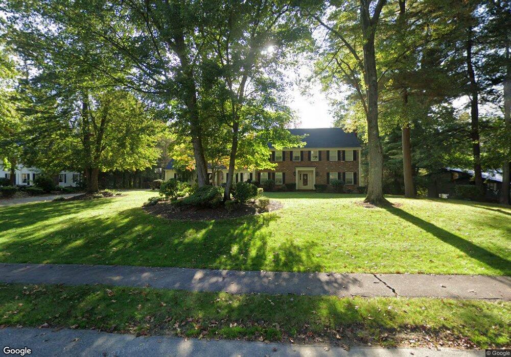
63 Longmeadow Rd Milton, MA 02186
Milton Center NeighborhoodEstimated Value: $2,419,775 - $3,786,000
5
Beds
4
Baths
4,305
Sq Ft
$652/Sq Ft
Est. Value
About This Home
This home is located at 63 Longmeadow Rd, Milton, MA 02186 and is currently estimated at $2,805,444, approximately $651 per square foot. 63 Longmeadow Rd is a home located in Norfolk County with nearby schools including Milton High School, Delphi Academy, and St. Mary of the Hills School.
Ownership History
Date
Name
Owned For
Owner Type
Purchase Details
Closed on
Aug 9, 2000
Sold by
Carroll Tr Mitchell and Carroll Dorothy T
Bought by
Dragon Edmond L and Dragon Barbara J
Current Estimated Value
Home Financials for this Owner
Home Financials are based on the most recent Mortgage that was taken out on this home.
Original Mortgage
$650,000
Interest Rate
8.21%
Mortgage Type
Purchase Money Mortgage
Create a Home Valuation Report for This Property
The Home Valuation Report is an in-depth analysis detailing your home's value as well as a comparison with similar homes in the area
Home Values in the Area
Average Home Value in this Area
Purchase History
| Date | Buyer | Sale Price | Title Company |
|---|---|---|---|
| Dragon Edmond L | $1,154,000 | -- |
Source: Public Records
Mortgage History
| Date | Status | Borrower | Loan Amount |
|---|---|---|---|
| Open | Dragon Edmond L | $675,000 | |
| Closed | Dragon Edmond L | $620,000 | |
| Closed | Dragon Edmond L | $650,000 |
Source: Public Records
Tax History
| Year | Tax Paid | Tax Assessment Tax Assessment Total Assessment is a certain percentage of the fair market value that is determined by local assessors to be the total taxable value of land and additions on the property. | Land | Improvement |
|---|---|---|---|---|
| 2025 | $23,006 | $2,074,500 | $717,400 | $1,357,100 |
| 2024 | $22,313 | $2,043,300 | $683,400 | $1,359,900 |
| 2023 | $21,033 | $1,845,000 | $650,700 | $1,194,300 |
| 2022 | $19,723 | $1,581,600 | $650,700 | $930,900 |
| 2021 | $19,905 | $1,516,000 | $626,600 | $889,400 |
| 2020 | $19,719 | $1,503,000 | $626,500 | $876,500 |
| 2019 | $19,231 | $1,459,100 | $608,200 | $850,900 |
| 2018 | $18,947 | $1,372,000 | $529,000 | $843,000 |
| 2017 | $17,743 | $1,308,500 | $503,800 | $804,700 |
| 2016 | $16,600 | $1,229,600 | $440,800 | $788,800 |
| 2015 | $16,407 | $1,177,000 | $409,300 | $767,700 |
Source: Public Records
Map
Nearby Homes
- 7 Preacher Rd
- 4 Farmer Rd
- 403405 Reedsdale Rd
- 6 Brewster Rd
- 485 Blue Hills Pkwy Unit 10
- 485 Blue Hills Pkwy Unit 12
- 485 Blue Hills Pkwy Unit 33
- 485 Blue Hills Pkwy Unit 13
- 485 Blue Hills Pkwy Unit 2
- 485 Blue Hills Pkwy Unit 49
- 485 Blue Hills Pkwy Unit 6
- 111-113 Pleasant St
- 610 Harland St
- 7 Parkway Crescent
- 58 Adanac Rd
- 161 Sassamon Ave
- 350 Blue Hill Ave
- 200 Robbins St
- 73 Hudson St
- 424 Brook Rd
- 71 Longmeadow Rd
- 55 Longmeadow Rd
- 70 Longmeadow Rd
- 91 Longmeadow Rd
- 35 Longmeadow Rd
- 60 Longmeadow Rd
- 48 Longmeadow Rd
- 48 Longmeadow Rd
- 48 Longmeadow Rd Unit 48
- 48 Longmeadow Rd
- 111 Longmeadow Rd
- 27 Longmeadow Rd
- 12 Pinehurst Dr
- 100 Longmeadow Rd
- 28 Longmeadow Rd
- 19 Pinehurst Dr
- 15 Longmeadow Rd
- 241 Old Farm Rd
- 16 Longmeadow Rd
- 231 Old Farm Rd
Your Personal Tour Guide
Ask me questions while you tour the home.