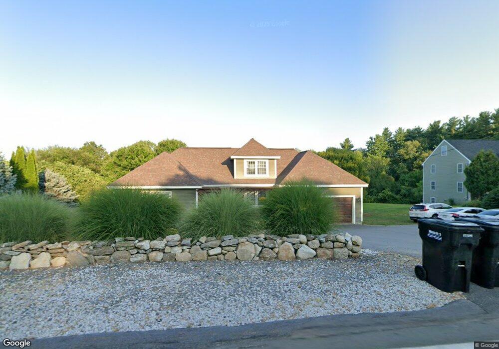
63 Powers Rd Littleton, MA 01460
Estimated Value: $898,207 - $1,121,000
4
Beds
3
Baths
2,698
Sq Ft
$366/Sq Ft
Est. Value
About This Home
This home is located at 63 Powers Rd, Littleton, MA 01460 and is currently estimated at $987,802, approximately $366 per square foot. 63 Powers Rd is a home located in Middlesex County with nearby schools including Shaker Lane Elementary School, Russell Street Elementary School, and Littleton Middle School.
Ownership History
Date
Name
Owned For
Owner Type
Purchase Details
Closed on
Jun 28, 2005
Sold by
Nordhausen Beth and Pease Christopher P
Bought by
Nordhausen Erik and Nordhausen Beth
Current Estimated Value
Home Financials for this Owner
Home Financials are based on the most recent Mortgage that was taken out on this home.
Original Mortgage
$359,600
Interest Rate
5.82%
Mortgage Type
Purchase Money Mortgage
Purchase Details
Closed on
Jul 28, 2000
Sold by
Francis William A and Francis Rosemarie
Bought by
Pease Christopher
Home Financials for this Owner
Home Financials are based on the most recent Mortgage that was taken out on this home.
Original Mortgage
$273,750
Interest Rate
8.18%
Mortgage Type
Purchase Money Mortgage
Purchase Details
Closed on
Jan 10, 1997
Sold by
Merrimack Dr Dev T and Barnes George H
Bought by
Francis William A and Francis Rosemarie
Create a Home Valuation Report for This Property
The Home Valuation Report is an in-depth analysis detailing your home's value as well as a comparison with similar homes in the area
Home Values in the Area
Average Home Value in this Area
Purchase History
| Date | Buyer | Sale Price | Title Company |
|---|---|---|---|
| Nordhausen Erik | $570,000 | -- | |
| Pease Christopher | $365,000 | -- | |
| Francis William A | $245,080 | -- |
Source: Public Records
Mortgage History
| Date | Status | Borrower | Loan Amount |
|---|---|---|---|
| Open | Francis William A | $330,000 | |
| Closed | Nordhausen Erik | $359,600 | |
| Previous Owner | Francis William A | $273,750 | |
| Previous Owner | Francis William A | $10,000 | |
| Previous Owner | Francis William A | $190,000 |
Source: Public Records
Tax History Compared to Growth
Tax History
| Year | Tax Paid | Tax Assessment Tax Assessment Total Assessment is a certain percentage of the fair market value that is determined by local assessors to be the total taxable value of land and additions on the property. | Land | Improvement |
|---|---|---|---|---|
| 2025 | $111 | $750,300 | $227,100 | $523,200 |
| 2024 | $10,404 | $701,100 | $220,700 | $480,400 |
| 2023 | $11,463 | $705,400 | $225,000 | $480,400 |
| 2022 | $10,599 | $598,500 | $225,000 | $373,500 |
| 2021 | $10,365 | $585,600 | $212,100 | $373,500 |
| 2020 | $10,017 | $563,700 | $195,500 | $368,200 |
| 2019 | $9,819 | $538,300 | $165,800 | $372,500 |
| 2018 | $9,901 | $545,800 | $170,000 | $375,800 |
| 2017 | $9,752 | $537,300 | $161,500 | $375,800 |
| 2016 | $9,176 | $518,700 | $161,500 | $357,200 |
| 2015 | $8,938 | $493,800 | $140,300 | $353,500 |
Source: Public Records
Map
Nearby Homes
- 84 Powers Rd
- 25 Grist Mill Rd
- 3 Mill Park Place
- 3 Mill Park Place Unit 3
- 5 Mill Park Place
- 5 Mill Park Place Unit 5
- 16 Fletcher Ln
- 18 Long Lake Rd
- 35 Queen Rd
- 4 Mars Place
- 115 Goldsmith St
- 140 Butternut Hollow Unit 140
- 517 Tumbling Hawk
- 601 Old Stone Brook
- 237 Brown Bear Crossing Unit 237
- 484 Great Road -3
- 484 Great Road -4
- 484 Great Road -6
- 55 Jennifer St
- 12 Paula Beth St