Estimated Value: $751,673 - $1,192,000
Studio
--
Bath
3,048
Sq Ft
$333/Sq Ft
Est. Value
About This Home
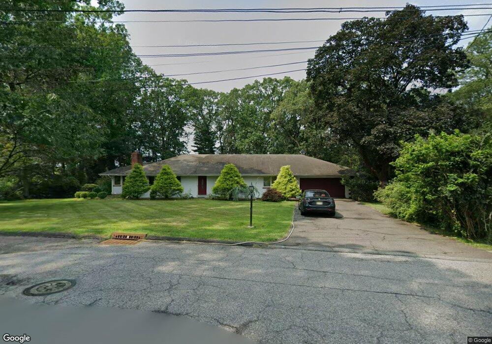
This home is located at 63 Surrey Dr, Wayne, NJ 07470 and is currently estimated at $1,014,918, approximately $332 per square foot. 63 Surrey Dr is a home located in Passaic County with nearby schools including Albert P. Terhune Elementary School, Schuyler-Colfax Middle School, and Wayne Hills High School.
Ownership History
Date
Name
Owned For
Owner Type
Purchase Details
Closed on
Oct 17, 2014
Sold by
Anfuso Jay M and Anfuso Deborah E
Bought by
Devito Robert M and Sommers Kristin T
Current Estimated Value
Home Financials for this Owner
Home Financials are based on the most recent Mortgage that was taken out on this home.
Original Mortgage
$400,000
Outstanding Balance
$307,446
Interest Rate
4.17%
Mortgage Type
New Conventional
Estimated Equity
$707,472
Purchase Details
Closed on
Sep 24, 1998
Sold by
Marino Louis S and Marino Donata M
Bought by
Anfuso Jay M and Anfuso Deborah E
Home Financials for this Owner
Home Financials are based on the most recent Mortgage that was taken out on this home.
Original Mortgage
$245,600
Interest Rate
6.74%
Create a Home Valuation Report for This Property
The Home Valuation Report is an in-depth analysis detailing your home's value as well as a comparison with similar homes in the area
Home Values in the Area
Average Home Value in this Area
Purchase History
| Date | Buyer | Sale Price | Title Company |
|---|---|---|---|
| Devito Robert M | $500,000 | None Available | |
| Anfuso Jay M | $327,500 | -- |
Source: Public Records
Mortgage History
| Date | Status | Borrower | Loan Amount |
|---|---|---|---|
| Open | Devito Robert M | $400,000 | |
| Previous Owner | Anfuso Jay M | $245,600 |
Source: Public Records
Tax History
| Year | Tax Paid | Tax Assessment Tax Assessment Total Assessment is a certain percentage of the fair market value that is determined by local assessors to be the total taxable value of land and additions on the property. | Land | Improvement |
|---|---|---|---|---|
| 2025 | $15,329 | $257,800 | $134,800 | $123,000 |
| 2024 | $14,741 | $257,800 | $134,800 | $123,000 |
| 2022 | $14,576 | $257,800 | $134,800 | $123,000 |
| 2021 | $14,561 | $257,800 | $134,800 | $123,000 |
| 2020 | $14,496 | $257,800 | $134,800 | $123,000 |
| 2019 | $14,215 | $257,800 | $134,800 | $123,000 |
| 2018 | $14,089 | $257,800 | $134,800 | $123,000 |
| 2017 | $13,960 | $257,800 | $134,800 | $123,000 |
| 2016 | $13,764 | $257,800 | $134,800 | $123,000 |
| 2015 | $13,599 | $257,800 | $134,800 | $123,000 |
| 2014 | $13,215 | $257,800 | $134,800 | $123,000 |
Source: Public Records
Map
Nearby Homes
- 648 Black Oak Ridge Rd
- 38 Dalewood Dr
- 20 Parkside Ct
- 1666 Hamburg Turnpike
- 1690 Hamburg Turnpike
- 25 Nathan Way
- 30 Perrin Dr
- 4 Jeffrey Rd
- 48 Deerfield Rd
- 96 Lions Head Dr W
- 75 Longport Rd
- 104 Lionshead Dr W
- 24 Peterson Rd
- 168 Levinberg Ln
- 138 Levinberg Ln
- 96 Lions Head Dr E
- 37 Farmingdale Rd
- 19 Dave Espie Way
- 27 Grandview Dr
- 36 Yellow Brick Rd
Your Personal Tour Guide
Ask me questions while you tour the home.