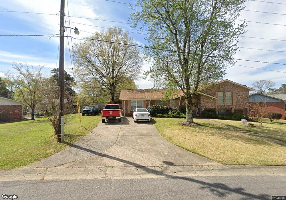
63 W Greenleaf Dr Birmingham, AL 35214
Estimated Value: $142,000 - $222,000
3
Beds
2
Baths
1,590
Sq Ft
$117/Sq Ft
Est. Value
About This Home
This home is located at 63 W Greenleaf Dr, Birmingham, AL 35214 and is currently estimated at $185,420, approximately $116 per square foot. 63 W Greenleaf Dr is a home with nearby schools including Minor Middle School, Minor High School, and Gloryland Christian Academy.
Ownership History
Date
Name
Owned For
Owner Type
Purchase Details
Closed on
Jun 8, 2010
Sold by
First Properties L L C
Bought by
Givan Juandalyn D
Current Estimated Value
Purchase Details
Closed on
May 13, 2005
Sold by
Murphee Norris E
Bought by
Givan Junandalyn D
Purchase Details
Closed on
Mar 17, 2000
Sold by
Murphree Norris E
Bought by
Murphree Norris E and Givan Juandalynn D
Purchase Details
Closed on
Dec 17, 1999
Sold by
Gayle Sissom Roy and Gayle Faye Wanda
Bought by
Murphree Norris E
Home Financials for this Owner
Home Financials are based on the most recent Mortgage that was taken out on this home.
Original Mortgage
$94,951
Interest Rate
7.68%
Mortgage Type
Purchase Money Mortgage
Create a Home Valuation Report for This Property
The Home Valuation Report is an in-depth analysis detailing your home's value as well as a comparison with similar homes in the area
Home Values in the Area
Average Home Value in this Area
Purchase History
| Date | Buyer | Sale Price | Title Company |
|---|---|---|---|
| Givan Juandalyn D | -- | None Available | |
| Givan Junandalyn D | -- | -- | |
| Murphree Norris E | -- | -- | |
| Murphree Norris E | $95,000 | -- |
Source: Public Records
Mortgage History
| Date | Status | Borrower | Loan Amount |
|---|---|---|---|
| Previous Owner | Murphree Norris E | $94,951 |
Source: Public Records
Tax History
| Year | Tax Paid | Tax Assessment Tax Assessment Total Assessment is a certain percentage of the fair market value that is determined by local assessors to be the total taxable value of land and additions on the property. | Land | Improvement |
|---|---|---|---|---|
| 2024 | $714 | $15,300 | -- | -- |
| 2023 | $321 | $15,300 | $2,100 | $13,200 |
| 2022 | $731 | $15,630 | $2,100 | $13,530 |
| 2021 | $530 | $11,630 | $2,100 | $9,530 |
| 2020 | $525 | $11,540 | $2,100 | $9,440 |
| 2019 | $525 | $11,540 | $0 | $0 |
| 2018 | $468 | $10,400 | $0 | $0 |
| 2017 | $468 | $10,400 | $0 | $0 |
| 2016 | $463 | $10,300 | $0 | $0 |
| 2015 | $463 | $10,300 | $0 | $0 |
| 2014 | $1,057 | $9,380 | $0 | $0 |
| 2013 | $1,057 | $9,380 | $0 | $0 |
Source: Public Records
Map
Nearby Homes
- 50 W Carriage Dr
- 2151 Veterans Memorial Dr
- 2349 Pershing Rd
- 2215 Arcadia Rd
- 2150 & 2140 Veterans Memorial Dr
- 2116 Arcadia Rd
- 2108 Maywood Dr
- 2352 Pershing Place Loop
- 2361 Pershing Place Loop
- 405 Blackmon Cir
- 2012 Arcadia Rd
- 2441 Forest Hill Dr
- 517 Tamrandon Ln
- 71 Swindle Dr
- 2904 Crestlane Dr
- 3013 Crestlane Dr
- 228 Gober Dr
- 2300 Roberta Rd
- 2036 Pershing Rd
- 549 Collette St
- 59 Greenleaf Cir W
- 2432 Crossbow Dr
- 2501 Lancelot Dr
- 2428 Crossbow Dr
- 55 Greenleaf Cir W
- 2500 Crossbow Dr
- 60 Greenleaf Cir W
- 2424 Crossbow Dr
- 2505 Lancelot Dr
- 2504 Lancelot Dr
- 2504 Crossbow Dr
- 2433 Crossbow Dr
- 56 Greenleaf Cir W
- 52 Greenleaf Cir W
- 51 Greenleaf Cir W
- 2429 Crossbow Dr
- 2429 Crossbow Dr Unit 1
- 2505 Crossbow Dr
- 2420 Crossbow Dr
- 2509 Lancelot Dr
Your Personal Tour Guide
Ask me questions while you tour the home.