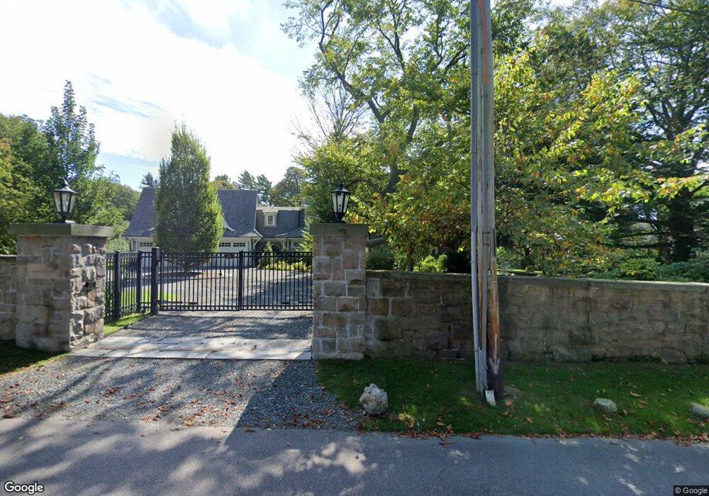
63 Webster St Newport, RI 02840
Bellevue Avenue and Estates NeighborhoodEstimated Value: $4,257,000 - $6,679,000
3
Beds
4
Baths
5,475
Sq Ft
$971/Sq Ft
Est. Value
About This Home
This home is located at 63 Webster St, Newport, RI 02840 and is currently estimated at $5,316,360, approximately $971 per square foot. 63 Webster St is a home located in Newport County with nearby schools including Rogers High School, St Michael's Country Day School, and All Saints STEAM Academy.
Ownership History
Date
Name
Owned For
Owner Type
Purchase Details
Closed on
Aug 15, 2013
Sold by
Swanhurst Theater Inc
Bought by
Weintz Karl F and Weintz Teryn B
Current Estimated Value
Create a Home Valuation Report for This Property
The Home Valuation Report is an in-depth analysis detailing your home's value as well as a comparison with similar homes in the area
Home Values in the Area
Average Home Value in this Area
Purchase History
| Date | Buyer | Sale Price | Title Company |
|---|---|---|---|
| Weintz Karl F | $950,000 | -- |
Source: Public Records
Mortgage History
| Date | Status | Borrower | Loan Amount |
|---|---|---|---|
| Open | Weintz Karl F | $250,000 |
Source: Public Records
Tax History Compared to Growth
Tax History
| Year | Tax Paid | Tax Assessment Tax Assessment Total Assessment is a certain percentage of the fair market value that is determined by local assessors to be the total taxable value of land and additions on the property. | Land | Improvement |
|---|---|---|---|---|
| 2025 | $53,316 | $6,136,000 | $2,007,500 | $4,128,500 |
| 2024 | $50,438 | $6,136,000 | $2,007,500 | $4,128,500 |
| 2023 | $34,751 | $3,503,100 | $1,017,200 | $2,485,900 |
| 2022 | $33,488 | $3,484,700 | $1,017,200 | $2,467,500 |
| 2021 | $32,512 | $3,484,700 | $1,017,200 | $2,467,500 |
| 2020 | $31,882 | $3,101,400 | $916,500 | $2,184,900 |
| 2019 | $31,882 | $3,101,400 | $916,500 | $2,184,900 |
| 2018 | $30,983 | $3,101,400 | $916,500 | $2,184,900 |
| 2017 | $25,318 | $2,258,500 | $805,100 | $1,453,400 |
| 2016 | $24,685 | $2,258,500 | $805,100 | $1,453,400 |
| 2015 | $19,872 | $1,862,400 | $805,100 | $1,057,300 |
| 2014 | $6,235 | $517,000 | $508,500 | $8,500 |
Source: Public Records
Map
Nearby Homes
- 66 Webster St Unit 9
- 0 Meikle Ave
- 17 Meikle Ave Unit 19
- 39 Connection St
- 604 Thames & 4 Dixon St
- 6 Sharon Ct
- 26 Atlantic St
- 63 Coggeshall Ave
- 364 Bellevue Ave Unit A1
- 364 Bellevue Ave Unit D7
- 70 Carroll Ave Unit 510
- 13 Dean Ave
- 57 Clinton St Unit 57C
- 91 Houston Ave
- 8 Sylvan St
- 30 S Baptist St
- 207 Ruggles Ave
- 20 Berkeley Ave Unit 2
- 73 Old Fort Rd Unit 75
- 19 Slocum St
- 63 Webster St Unit 67
- 63 Webster Ave
- 416418 Spring St
- 2 Coggeshall Ave
- 575 Spring St Unit 577
- 271273 Spring St
- 573 Spring St
- 4 Howe Ave Unit 4
- 4 Howe Ave Unit U
- 577 Spring St
- 571 Spring St Unit 2
- 67 Webster St
- 569 Spring St Unit 3
- 569 Spring St Unit 2
- 569 Spring St Unit 1N
- 569 Spring St Unit 1S
- 569 Spring St Unit 2&3
- 569 Spring St Unit 4
- 4 Coggeshall Ave
- 54 Morton Ave