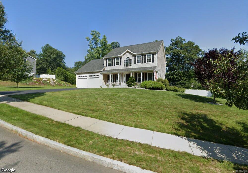
63 Wilson St Northbridge, MA 01534
Estimated Value: $745,930 - $902,000
4
Beds
4
Baths
2,220
Sq Ft
$359/Sq Ft
Est. Value
About This Home
This home is located at 63 Wilson St, Northbridge, MA 01534 and is currently estimated at $797,483, approximately $359 per square foot. 63 Wilson St is a home with nearby schools including Northbridge Elementary School, Northbridge Middle School, and Northbridge High School.
Ownership History
Date
Name
Owned For
Owner Type
Purchase Details
Closed on
Dec 27, 2012
Sold by
Presidential Farms Inc
Bought by
Startton Christopher J and Startton Lynette C
Current Estimated Value
Home Financials for this Owner
Home Financials are based on the most recent Mortgage that was taken out on this home.
Original Mortgage
$483,565
Outstanding Balance
$333,994
Interest Rate
3.38%
Mortgage Type
Purchase Money Mortgage
Estimated Equity
$463,489
Create a Home Valuation Report for This Property
The Home Valuation Report is an in-depth analysis detailing your home's value as well as a comparison with similar homes in the area
Home Values in the Area
Average Home Value in this Area
Purchase History
| Date | Buyer | Sale Price | Title Company |
|---|---|---|---|
| Startton Christopher J | $496,126 | -- | |
| Startton Christopher J | $496,126 | -- |
Source: Public Records
Mortgage History
| Date | Status | Borrower | Loan Amount |
|---|---|---|---|
| Open | Startton Christopher J | $483,565 | |
| Closed | Startton Christopher J | $483,565 |
Source: Public Records
Tax History
| Year | Tax Paid | Tax Assessment Tax Assessment Total Assessment is a certain percentage of the fair market value that is determined by local assessors to be the total taxable value of land and additions on the property. | Land | Improvement |
|---|---|---|---|---|
| 2025 | $8,087 | $685,900 | $200,400 | $485,500 |
| 2024 | $7,722 | $638,700 | $200,400 | $438,300 |
| 2023 | $7,458 | $575,500 | $177,300 | $398,200 |
| 2022 | $6,995 | $508,000 | $136,400 | $371,600 |
| 2021 | $7,100 | $490,000 | $129,900 | $360,100 |
| 2020 | $6,562 | $474,100 | $129,900 | $344,200 |
| 2019 | $5,947 | $458,500 | $129,900 | $328,600 |
| 2018 | $5,780 | $446,700 | $123,600 | $323,100 |
| 2017 | $5,676 | $419,500 | $123,600 | $295,900 |
| 2016 | $5,702 | $414,700 | $117,200 | $297,500 |
| 2015 | $5,206 | $389,100 | $117,200 | $271,900 |
| 2014 | $5,159 | $389,100 | $117,200 | $271,900 |
Source: Public Records
Map
Nearby Homes
- 240 Roosevelt Dr
- 220 Alana Dr
- 86 Mikes Way Unit 86
- 24 Mcquades Ln
- 191 Hartness Rd
- 7 Central Turnpike
- 2294 Providence Rd
- 35 School St Unit 35
- 0 Emond St Unit 1
- 0 Emond St Unit 73480228
- 2248 Providence Rd
- 69-71 Providence Rd
- 557 Fowler Rd
- 79 Fisherville Terrace
- 53 Fisherville Terrace
- 55 Fisherville Terrace
- 44 Fisherville Terrace
- 58 Fisherville Terrace
- 64 Fisherville Terrace
- 62 Fisherville Terrace
- 529 Roosevelt Dr
- 35 Wilson St
- 52 Wilson St
- 86 Wilson St
- 28 Wilson St
- 98 Wilson St
- 547 Roosevelt Dr
- 192 Lincoln Cir
- 524 Roosevelt Dr
- 16 Wilson St
- 565 Roosevelt Dr
- 224 Lincoln Cir
- LOT 87 Kennedy Cir
- 106 Lincoln Cir
- 516 Roosevelt Dr
- L55 Roosevelt Dr
- 573 Roosevelt Dr
- 19 Kennedy Cir
- 183 Roosevelt Dr
- 26 Kennedy Cir
Your Personal Tour Guide
Ask me questions while you tour the home.