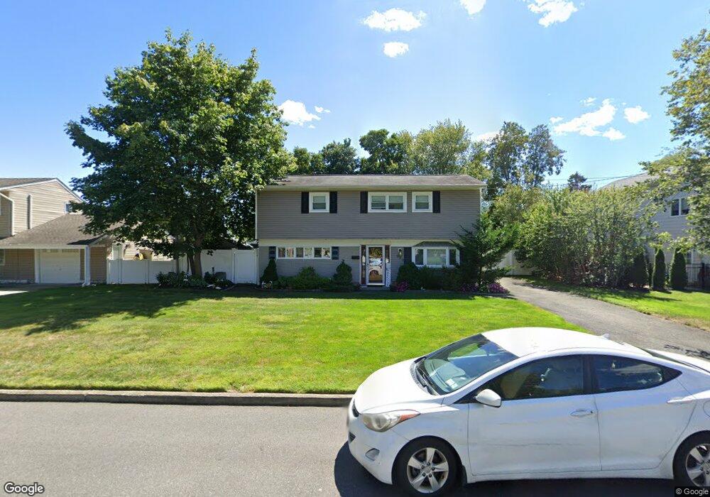
630 Morrison St Babylon, NY 11702
Estimated Value: $663,875 - $911,000
3
Beds
2
Baths
1,425
Sq Ft
$525/Sq Ft
Est. Value
About This Home
This home is located at 630 Morrison St, Babylon, NY 11702 and is currently estimated at $748,219, approximately $525 per square foot. 630 Morrison St is a home located in Suffolk County with nearby schools including Babylon Elementary School, Babylon Memorial Grade School, and Babylon High School.
Ownership History
Date
Name
Owned For
Owner Type
Purchase Details
Closed on
Nov 27, 2017
Sold by
Dilauro Paul and Dilauro Adda
Bought by
Obrien Nicholas and Obrien Christin
Current Estimated Value
Home Financials for this Owner
Home Financials are based on the most recent Mortgage that was taken out on this home.
Original Mortgage
$389,250
Interest Rate
3.94%
Mortgage Type
Purchase Money Mortgage
Purchase Details
Closed on
Sep 8, 2005
Sold by
Harrington Joyce
Bought by
Dilauro Paul
Create a Home Valuation Report for This Property
The Home Valuation Report is an in-depth analysis detailing your home's value as well as a comparison with similar homes in the area
Home Values in the Area
Average Home Value in this Area
Purchase History
| Date | Buyer | Sale Price | Title Company |
|---|---|---|---|
| Obrien Nicholas | $432,500 | -- | |
| Dilauro Paul | $415,000 | Marcelo Buitrago |
Source: Public Records
Mortgage History
| Date | Status | Borrower | Loan Amount |
|---|---|---|---|
| Closed | Obrien Nicholas | $389,250 |
Source: Public Records
Tax History
| Year | Tax Paid | Tax Assessment Tax Assessment Total Assessment is a certain percentage of the fair market value that is determined by local assessors to be the total taxable value of land and additions on the property. | Land | Improvement |
|---|---|---|---|---|
| 2022 | $9,147 | $3,060 | $360 | $2,700 |
| 2021 | $9,147 | $3,060 | $360 | $2,700 |
| 2020 | $10,457 | $3,060 | $360 | $2,700 |
| 2019 | $10,437 | $0 | $0 | $0 |
Source: Public Records
Map
Nearby Homes
- 519 Gwynn St
- 418 Old Farmingdale Rd
- 91 Beverly Rd
- 1 Freedom Ct
- 188 Ralph Ave
- 9 Hinton Ave
- 104 Hawthorne Ave
- 7 Lico Place
- 9 Hamilton Ave
- 30 Jenkins Ave
- 104 Frederick Ave
- 43 Springwood Dr
- 42 Springwood Dr
- 359 Park Ave
- 118 Terrace Ave
- 204 Millard Ave Unit 204
- 967 Sunrise Hwy
- 771 Peconic Ave
- 109 Vesper Ct
- 51 Edmunton Dr Unit F17
- 634 Morrison St
- 626 Morrison St
- 93 Pilcher St
- 87 Pilcher St
- 222 Morrison St
- 99 Pilcher St
- 622 Morrison St
- 629 Morrison St
- 638 Morrison St
- 633 Morrison St
- 625 Morrison St
- 81 Pilcher St
- 5 Morrison St Unit Right
- 105 Pilcher St
- 637 Morrison St
- 621 Morrison St
- 618 Morrison St
- 642 Morrison St
- 75 Pilcher St
- 111 Pilcher St
Your Personal Tour Guide
Ask me questions while you tour the home.