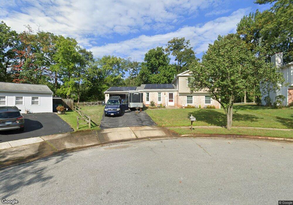
6302 Sandy St Laurel, MD 20707
West Laurel NeighborhoodEstimated Value: $524,000 - $563,000
4
Beds
3
Baths
1,738
Sq Ft
$309/Sq Ft
Est. Value
About This Home
This home is located at 6302 Sandy St, Laurel, MD 20707 and is currently estimated at $537,589, approximately $309 per square foot. 6302 Sandy St is a home located in Prince George's County with nearby schools including Bond Mill Elementary, Martin Luther King Jr. Middle School, and Laurel High School.
Ownership History
Date
Name
Owned For
Owner Type
Purchase Details
Closed on
Jan 20, 2012
Sold by
Wilson Loren E
Bought by
Wilson Loren E and Wilson Jennifer R
Current Estimated Value
Home Financials for this Owner
Home Financials are based on the most recent Mortgage that was taken out on this home.
Original Mortgage
$294,200
Outstanding Balance
$201,115
Interest Rate
3.92%
Mortgage Type
VA
Estimated Equity
$336,474
Purchase Details
Closed on
Oct 4, 2010
Sold by
Gilner Harry R
Bought by
Wilson Loren E
Home Financials for this Owner
Home Financials are based on the most recent Mortgage that was taken out on this home.
Original Mortgage
$293,150
Interest Rate
4.36%
Mortgage Type
VA
Purchase Details
Closed on
Apr 29, 2009
Sold by
Gilner Harry R Jr Etal
Bought by
Gilner Harry R
Purchase Details
Closed on
Jun 9, 1994
Sold by
Wood Craig A
Bought by
Willard Harry R
Create a Home Valuation Report for This Property
The Home Valuation Report is an in-depth analysis detailing your home's value as well as a comparison with similar homes in the area
Home Values in the Area
Average Home Value in this Area
Purchase History
| Date | Buyer | Sale Price | Title Company |
|---|---|---|---|
| Wilson Loren E | -- | None Available | |
| Wilson Loren E | $287,000 | -- | |
| Gilner Harry R | -- | -- | |
| Willard Harry R | $153,250 | -- |
Source: Public Records
Mortgage History
| Date | Status | Borrower | Loan Amount |
|---|---|---|---|
| Open | Wilson Loren E | $294,200 | |
| Closed | Wilson Loren E | $293,150 |
Source: Public Records
Tax History Compared to Growth
Tax History
| Year | Tax Paid | Tax Assessment Tax Assessment Total Assessment is a certain percentage of the fair market value that is determined by local assessors to be the total taxable value of land and additions on the property. | Land | Improvement |
|---|---|---|---|---|
| 2025 | $5,764 | $427,400 | $141,400 | $286,000 |
| 2024 | $5,764 | $399,933 | -- | -- |
| 2023 | $5,530 | $372,467 | $0 | $0 |
| 2022 | $5,238 | $345,000 | $101,400 | $243,600 |
| 2021 | $5,039 | $335,000 | $0 | $0 |
| 2020 | $4,960 | $325,000 | $0 | $0 |
| 2019 | $4,853 | $315,000 | $100,700 | $214,300 |
| 2018 | $4,704 | $301,867 | $0 | $0 |
| 2017 | $4,585 | $288,733 | $0 | $0 |
| 2016 | -- | $275,600 | $0 | $0 |
| 2015 | $4,401 | $275,600 | $0 | $0 |
| 2014 | $4,401 | $275,600 | $0 | $0 |
Source: Public Records
Map
Nearby Homes
- 6406 Sandy St
- 6003 Windham Rd
- 6918 Scotch Dr
- 7004 Fitzpatrick Dr
- 7019 Fitzpatrick Dr
- 1016 Flester Ln
- 7018 Redmiles Rd
- 7019 Redmiles Rd
- 1027 Overlook Way
- 1106 Overlook Way
- 1023 Flester Ln
- 6304 Forest Mill Ln
- 4402 Regalwood Terrace
- 14706 Saddle Creek Dr
- 16140 Kenny Rd
- 4302 Regalwood Terrace
- 15708 Dorset Rd Unit 203
- 15708 Dorset Rd Unit 304
- 15708 Dorset Rd Unit 202
- 14717 Exbury Ln