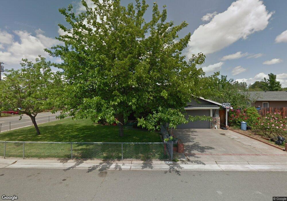
6303 David Ave Loomis, CA 95650
Estimated Value: $373,000 - $517,000
3
Beds
2
Baths
1,056
Sq Ft
$427/Sq Ft
Est. Value
About This Home
This home is located at 6303 David Ave, Loomis, CA 95650 and is currently estimated at $451,312, approximately $427 per square foot. 6303 David Ave is a home located in Placer County with nearby schools including Del Oro High School, Loomis Basin Charter School, and Holy Cross Lutheran Academy.
Ownership History
Date
Name
Owned For
Owner Type
Purchase Details
Closed on
Jun 12, 2025
Sold by
Strong Robert and Strong Kristen
Bought by
Robert And Kristen Strong Family Trust and Strong
Current Estimated Value
Purchase Details
Closed on
Mar 21, 2016
Sold by
Strong Robert
Bought by
Strong Robert and Strong Kristen
Home Financials for this Owner
Home Financials are based on the most recent Mortgage that was taken out on this home.
Original Mortgage
$180,000
Interest Rate
3.65%
Mortgage Type
New Conventional
Purchase Details
Closed on
Oct 21, 2009
Sold by
Strong Kristen D
Bought by
Strong Robert
Home Financials for this Owner
Home Financials are based on the most recent Mortgage that was taken out on this home.
Original Mortgage
$140,000
Interest Rate
5.05%
Mortgage Type
New Conventional
Purchase Details
Closed on
Oct 26, 2001
Sold by
Darosa Maciel Antonio M and Darosa Maciel Rosalina
Bought by
Maciel Antonio and Maciel Rosalina
Create a Home Valuation Report for This Property
The Home Valuation Report is an in-depth analysis detailing your home's value as well as a comparison with similar homes in the area
Home Values in the Area
Average Home Value in this Area
Purchase History
| Date | Buyer | Sale Price | Title Company |
|---|---|---|---|
| Robert And Kristen Strong Family Trust | -- | None Listed On Document | |
| Strong Robert | -- | Stewart Title | |
| Strong Robert | -- | Stewart Title Of Placer | |
| Strong Robert | $175,000 | Stewart Title Of Placer | |
| Maciel Antonio | -- | -- |
Source: Public Records
Mortgage History
| Date | Status | Borrower | Loan Amount |
|---|---|---|---|
| Previous Owner | Strong Robert | $180,000 | |
| Previous Owner | Strong Robert | $140,000 |
Source: Public Records
Tax History
| Year | Tax Paid | Tax Assessment Tax Assessment Total Assessment is a certain percentage of the fair market value that is determined by local assessors to be the total taxable value of land and additions on the property. | Land | Improvement |
|---|---|---|---|---|
| 2025 | $2,768 | $225,880 | $103,260 | $122,620 |
| 2023 | $2,768 | $217,110 | $99,251 | $117,859 |
| 2022 | $2,704 | $212,854 | $97,305 | $115,549 |
| 2021 | $2,631 | $208,682 | $95,398 | $113,284 |
| 2020 | $2,595 | $206,543 | $94,420 | $112,123 |
| 2019 | $2,548 | $202,494 | $92,569 | $109,925 |
| 2018 | $2,419 | $198,524 | $90,754 | $107,770 |
| 2017 | $2,374 | $194,632 | $88,975 | $105,657 |
| 2016 | $2,320 | $190,817 | $87,231 | $103,586 |
| 2015 | $2,270 | $187,952 | $85,921 | $102,031 |
| 2014 | $2,233 | $184,271 | $84,238 | $100,033 |
Source: Public Records
Map
Nearby Homes
- 6318 David Ave
- 0 Webb St
- 5760 Webb St
- 6154 S Walnut St Unit 40
- 3360 Cherokee Trail
- 4051 Pauline Cir
- 6348 Horseshoe Bar Rd
- 3955 Stonegate Ct
- 5932 Angelo Dr
- 5567 Myrtle Dr
- 5585 Tudor Way
- 3428 Colvin Dr
- 3420 Grove Cir
- 3293 Stone Field Way
- 3301 Stone Field Way
- 7102 Orchard Cir
- 7077 Orchard Cir
- 7084 Orchard Cir
- 6980 High Cliff Rd
- 3130 Penryn Rd
Your Personal Tour Guide
Ask me questions while you tour the home.