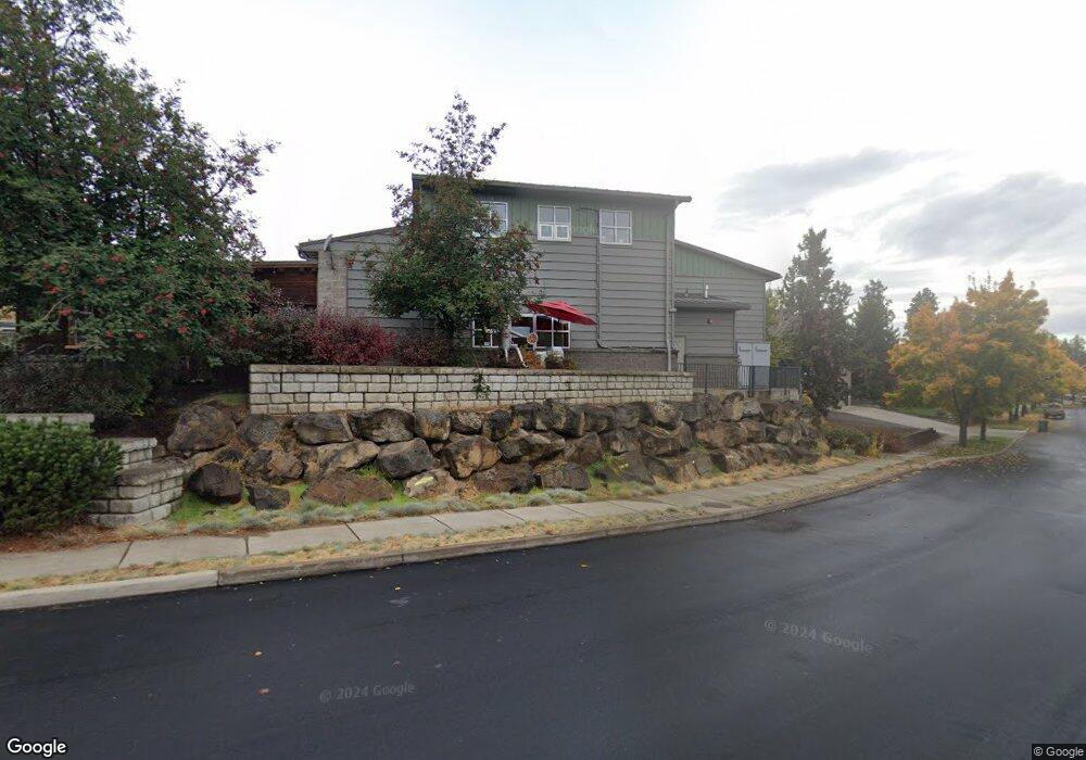
63063 Layton Ave Bend, OR 97701
Boyd Acres Neighborhood
Studio
--
Bath
2,986
Sq Ft
--
Built
About This Home
This home is located at 63063 Layton Ave, Bend, OR 97701. 63063 Layton Ave is a home located in Deschutes County with nearby schools including Lava Ridge Elementary School, Sky View Middle School, and Mountain View Senior High School.
Ownership History
Date
Name
Owned For
Owner Type
Purchase Details
Closed on
Jul 14, 2017
Sold by
Cummins Troy and Cummins Denise
Bought by
High Desert Enterprises Llc
Home Financials for this Owner
Home Financials are based on the most recent Mortgage that was taken out on this home.
Original Mortgage
$350,000
Outstanding Balance
$71,456
Interest Rate
3.89%
Mortgage Type
Commercial
Purchase Details
Closed on
Sep 21, 2005
Sold by
Crystal Clear Investment Llc
Bought by
Crystal Clear Investments Llc
Create a Home Valuation Report for This Property
The Home Valuation Report is an in-depth analysis detailing your home's value as well as a comparison with similar homes in the area
Home Values in the Area
Average Home Value in this Area
Purchase History
| Date | Buyer | Sale Price | Title Company |
|---|---|---|---|
| High Desert Enterprises Llc | -- | Amerititle | |
| Cummins Troy | -- | Amerititle | |
| Allycat Llc | -- | Amerititle | |
| Mcconnell Melvin | -- | Amerititle | |
| Crystal Clear Investments Llc | -- | -- |
Source: Public Records
Mortgage History
| Date | Status | Borrower | Loan Amount |
|---|---|---|---|
| Open | Cummins Troy | $350,000 |
Source: Public Records
Tax History
| Year | Tax Paid | Tax Assessment Tax Assessment Total Assessment is a certain percentage of the fair market value that is determined by local assessors to be the total taxable value of land and additions on the property. | Land | Improvement |
|---|---|---|---|---|
| 2025 | $11,525 | $682,090 | -- | -- |
| 2024 | $11,088 | $662,230 | -- | -- |
| 2023 | $10,279 | $642,950 | $0 | $0 |
| 2022 | $9,590 | $592,050 | $0 | $0 |
| 2021 | $9,383 | $574,810 | $0 | $0 |
| 2020 | $8,901 | $574,810 | $0 | $0 |
| 2019 | $8,653 | $558,070 | $0 | $0 |
| 2018 | $7,901 | $509,070 | $0 | $0 |
| 2017 | $7,669 | $494,250 | $0 | $0 |
| 2016 | $7,313 | $479,860 | $0 | $0 |
| 2015 | $7,111 | $465,890 | $0 | $0 |
| 2014 | $6,902 | $452,330 | $0 | $0 |
Source: Public Records
Map
Nearby Homes
- 63150 Peale St
- 20668 Blanca Dr
- 20583 Sierra Dr
- 20560 Boyd Ct
- 63106 NE Sophwith Ln
- 63153 NE Hadley Place
- 20551 Gloucester Ln
- 63169 NE Hadley Place
- 20677 NE Comet Ct
- 20695 Town Dr Unit LOT 81
- 20695 Town Dr
- 63182 Iner Loop
- 20532 NE Empire Ave
- 63190 Carly Ln
- 63197 Carly Ln
- 20530 NE Empire Ave
- 20528 NE Empire Ave
- 20779 Boulderfield Ave
- 63206 Carly Ln
- 20514 NE Empire Ave
- 63083 Layton Ave
- 63107 Layton Ave
- 63070 Layton Ave
- 63082 Layton Ave
- 63094 Layton Ave
- 63095 Pikes Ct
- 63096 Pikes Ct
- 63119 Layton Ave
- 63075 NE Plateau Ct
- 63117 Turret Ct
- 63113 Turret Ct
- 63121 Turret
- 63118 Layton Ave
- 63125 Layton Ave
- 63102 Pikes Ct
- 63125 Turret Ct
- 63109 Turret Ct
- 63129 Turret Ct
- 63130 Layton Ave
Your Personal Tour Guide
Ask me questions while you tour the home.