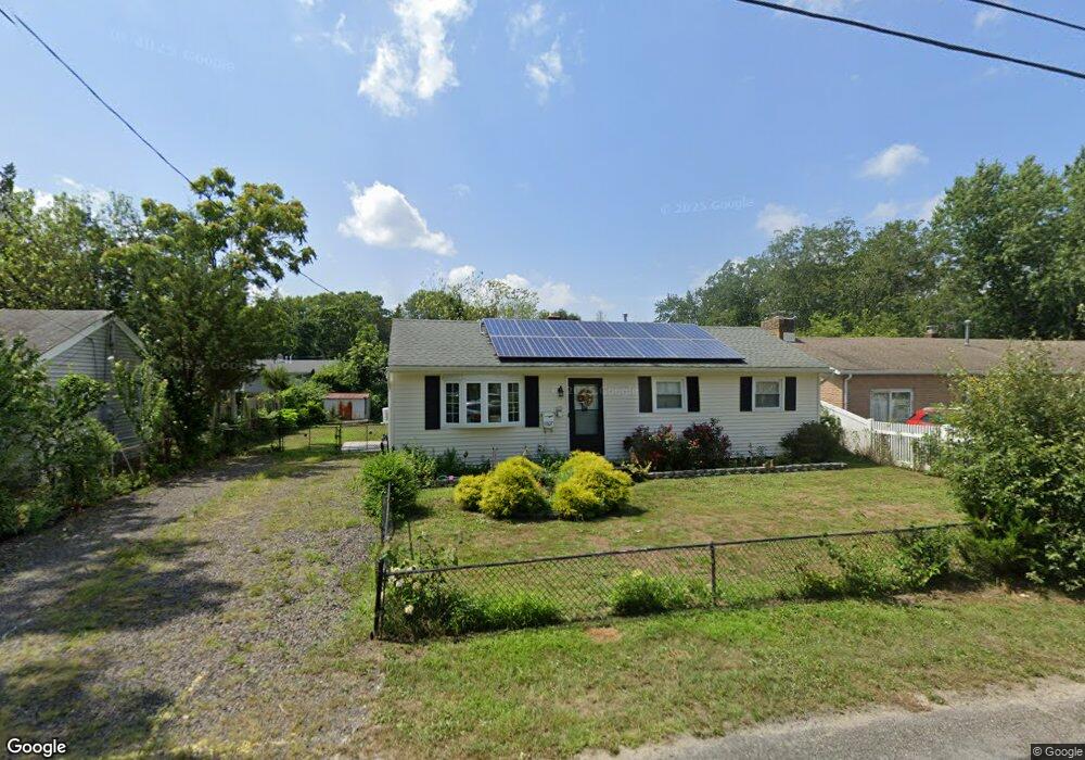
6307 Knight Ave Mays Landing, NJ 08330
Estimated Value: $208,000 - $241,000
3
Beds
1
Bath
800
Sq Ft
$286/Sq Ft
Est. Value
About This Home
This home is located at 6307 Knight Ave, Mays Landing, NJ 08330 and is currently estimated at $229,077, approximately $286 per square foot. 6307 Knight Ave is a home located in Atlantic County with nearby schools including Joseph Shaner School, George L. Hess Educational Complex, and William Davies Middle School.
Ownership History
Date
Name
Owned For
Owner Type
Purchase Details
Closed on
Dec 16, 2002
Sold by
Astenberg John
Bought by
Mesidor Therese
Current Estimated Value
Home Financials for this Owner
Home Financials are based on the most recent Mortgage that was taken out on this home.
Original Mortgage
$89,300
Outstanding Balance
$38,193
Interest Rate
6.18%
Estimated Equity
$190,884
Purchase Details
Closed on
Mar 16, 2001
Sold by
Ware Gayle and Littley Sharon R
Bought by
Astenberg John A
Create a Home Valuation Report for This Property
The Home Valuation Report is an in-depth analysis detailing your home's value as well as a comparison with similar homes in the area
Home Values in the Area
Average Home Value in this Area
Purchase History
| Date | Buyer | Sale Price | Title Company |
|---|---|---|---|
| Mesidor Therese | $94,000 | -- | |
| Astenberg John A | $56,000 | -- |
Source: Public Records
Mortgage History
| Date | Status | Borrower | Loan Amount |
|---|---|---|---|
| Open | Mesidor Therese | $89,300 |
Source: Public Records
Tax History Compared to Growth
Tax History
| Year | Tax Paid | Tax Assessment Tax Assessment Total Assessment is a certain percentage of the fair market value that is determined by local assessors to be the total taxable value of land and additions on the property. | Land | Improvement |
|---|---|---|---|---|
| 2025 | $3,620 | $105,500 | $38,200 | $67,300 |
| 2024 | $3,620 | $105,500 | $38,200 | $67,300 |
| 2023 | $3,323 | $103,000 | $38,200 | $64,800 |
| 2022 | $3,323 | $103,000 | $38,200 | $64,800 |
| 2021 | $3,316 | $103,000 | $38,200 | $64,800 |
| 2020 | $3,316 | $103,000 | $38,200 | $64,800 |
| 2019 | $3,324 | $103,000 | $38,200 | $64,800 |
| 2018 | $3,207 | $103,000 | $38,200 | $64,800 |
| 2017 | $3,157 | $103,000 | $38,200 | $64,800 |
| 2016 | $3,068 | $103,000 | $38,200 | $64,800 |
| 2015 | $2,964 | $103,000 | $38,200 | $64,800 |
| 2014 | $3,208 | $122,100 | $46,200 | $75,900 |
Source: Public Records
Map
Nearby Homes
- 6310 Phillips Ave
- 6301 Knight Ave
- 6314 Lance Ave
- 6301 Roberts Ave
- 6206 Roberts Ave
- 0 Harding Hwy Unit NJAC2019438
- 0 Harding Hwy Unit 597638
- 37 Delancy Ct
- 6140 Robin Dr
- 80 Mill St
- 5 Camac Ave
- 6062 Main St
- 715 Park Rd
- 16 Holly Ct
- 24 Holly Ct
- 565 Park Rd
- 850 Morningside Dr
- 535 Park Rd
- 955 McGeary Place
- 6015 Main St
- 6305 Knight Ave
- 6309 Knight Ave
- 6308 Phillips Ave
- 6306 Phillips Ave
- 6303 Knight Ave
- 6311 Knight Ave
- 6312 Phillips Ave
- 6308 Knight Ave
- 6310 Knight Ave
- 6304 Phillips Ave
- 6306 Knight Ave
- 6312 Knight Ave
- 6313 Knight Ave
- 6304 Knight Ave
- 6314 Phillips Ave
- 6302 Phillips Ave
- 6314 Knight Ave
- 6302 Knight Ave
- 6307 Lance Ave
- 6307 Phillips Ave