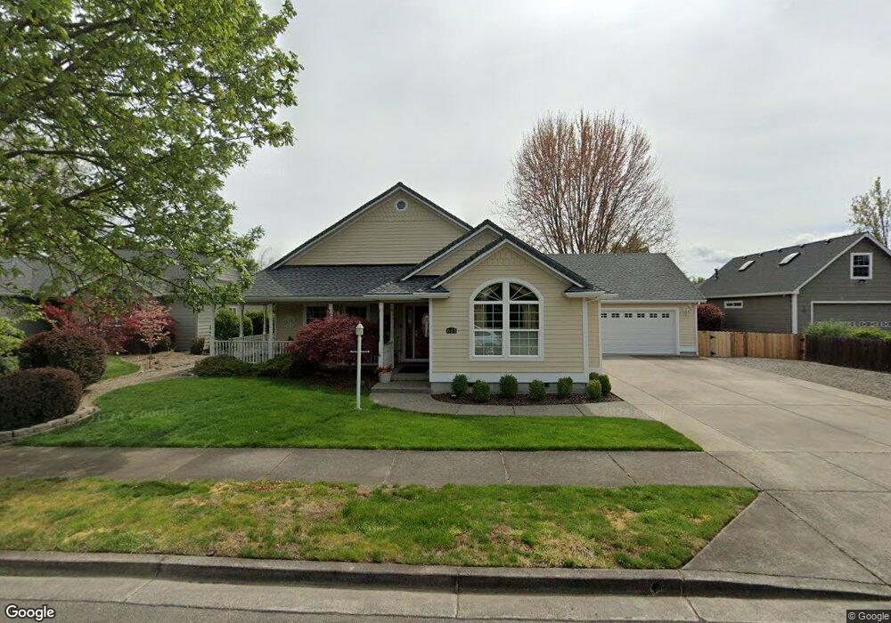
631 Black Oak Dr Central Point, OR 97502
Estimated Value: $552,469 - $620,000
3
Beds
2
Baths
2,371
Sq Ft
$248/Sq Ft
Est. Value
About This Home
This home is located at 631 Black Oak Dr, Central Point, OR 97502 and is currently estimated at $588,617, approximately $248 per square foot. 631 Black Oak Dr is a home located in Jackson County with nearby schools including Richardson Elementary School, Scenic Middle School, and Crater High School.
Ownership History
Date
Name
Owned For
Owner Type
Purchase Details
Closed on
May 6, 2024
Sold by
Blenkush Arlen J and Blenkush Deborah L
Bought by
Blenkush Arlen J and Blenkush Deborah L
Current Estimated Value
Purchase Details
Closed on
Mar 2, 2001
Sold by
W L Moore Construction Llc
Bought by
Blenkush Arlen J and Blenkush Deborah L
Home Financials for this Owner
Home Financials are based on the most recent Mortgage that was taken out on this home.
Original Mortgage
$163,200
Interest Rate
7.12%
Create a Home Valuation Report for This Property
The Home Valuation Report is an in-depth analysis detailing your home's value as well as a comparison with similar homes in the area
Home Values in the Area
Average Home Value in this Area
Purchase History
| Date | Buyer | Sale Price | Title Company |
|---|---|---|---|
| Blenkush Arlen J | -- | None Listed On Document | |
| Blenkush Arlen J | $204,000 | Key Title Company |
Source: Public Records
Mortgage History
| Date | Status | Borrower | Loan Amount |
|---|---|---|---|
| Previous Owner | Blenkush Arlen J | $163,200 |
Source: Public Records
Tax History Compared to Growth
Tax History
| Year | Tax Paid | Tax Assessment Tax Assessment Total Assessment is a certain percentage of the fair market value that is determined by local assessors to be the total taxable value of land and additions on the property. | Land | Improvement |
|---|---|---|---|---|
| 2025 | $5,669 | $341,000 | $137,430 | $203,570 |
| 2024 | $5,669 | $331,070 | $133,420 | $197,650 |
| 2023 | $5,487 | $321,430 | $129,530 | $191,900 |
| 2022 | $5,359 | $321,430 | $129,530 | $191,900 |
| 2021 | $5,206 | $312,070 | $125,760 | $186,310 |
| 2020 | $5,054 | $302,990 | $122,100 | $180,890 |
| 2019 | $4,929 | $285,610 | $115,100 | $170,510 |
| 2018 | $4,779 | $277,300 | $111,750 | $165,550 |
| 2017 | $4,659 | $277,300 | $111,750 | $165,550 |
| 2016 | $4,523 | $261,390 | $105,340 | $156,050 |
| 2015 | $4,334 | $261,390 | $105,340 | $156,050 |
| 2014 | $4,223 | $246,390 | $99,300 | $147,090 |
Source: Public Records
Map
Nearby Homes
- 626 Griffin Oaks Dr
- 407 Silver Creek Dr
- 619 Palo Verde Way
- 1134 Steamboat Dr
- 1135 Shake Dr
- 349 W Pine St
- 1159 Rustler Peak St
- 420 Mayberry Ln
- 1167 Boulder Ridge St
- 25 Donna Way
- 905 Comet Ave
- 342 Hazel St
- 429 Mayberry Ln
- 21 Hickory Ln
- 55 Crater Ln
- 526 Stone Pointe Dr
- 431 N 5th St
- 629 Bridge Creek Dr
- 4626 N Pacific Hwy
- 570 Bachand Cir
- 525 Black Oak Dr
- 637 Black Oak Dr
- 418 Oakley St
- 517 Red Oak St
- 519 Black Oak Dr
- 518 Oakley St
- 410 Oakley St
- 2130 Taylor Rd
- 427 Oakley St
- 527 Red Oak St
- 513 Black Oak Dr
- 528 Oakley St
- 518 Black Oak Dr
- 402 Oakley St
- 419 Oakley St
- 475 Valley Oak Blvd
- 519 Oakley St
- 411 Oakley St
- 759 Black Oak Dr
- 532 Red Oak St