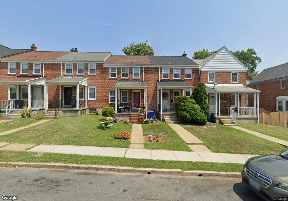
631 Braeside Rd Baltimore, MD 21229
Estimated Value: $224,693 - $266,000
Studio
2
Baths
1,116
Sq Ft
$216/Sq Ft
Est. Value
About This Home
This home is located at 631 Braeside Rd, Baltimore, MD 21229 and is currently estimated at $241,173, approximately $216 per square foot. 631 Braeside Rd is a home located in Baltimore County with nearby schools including Westowne Elementary, Catonsville Middle School, and Catonsville High School.
Ownership History
Date
Name
Owned For
Owner Type
Purchase Details
Closed on
Nov 9, 1999
Sold by
Roney Brian L
Bought by
Harris Margaret A
Current Estimated Value
Purchase Details
Closed on
Aug 31, 1993
Sold by
Nenard M D
Bought by
Roney Brian L
Home Financials for this Owner
Home Financials are based on the most recent Mortgage that was taken out on this home.
Original Mortgage
$80,031
Interest Rate
7.06%
Purchase Details
Closed on
Oct 6, 1988
Sold by
Coates Mark A
Bought by
Menard Matthew David
Create a Home Valuation Report for This Property
The Home Valuation Report is an in-depth analysis detailing your home's value as well as a comparison with similar homes in the area
Home Values in the Area
Average Home Value in this Area
Purchase History
| Date | Buyer | Sale Price | Title Company |
|---|---|---|---|
| Harris Margaret A | $79,900 | -- | |
| Roney Brian L | $79,500 | -- | |
| Menard Matthew David | $72,000 | -- |
Source: Public Records
Mortgage History
| Date | Status | Borrower | Loan Amount |
|---|---|---|---|
| Previous Owner | Roney Brian L | $80,031 |
Source: Public Records
Tax History
| Year | Tax Paid | Tax Assessment Tax Assessment Total Assessment is a certain percentage of the fair market value that is determined by local assessors to be the total taxable value of land and additions on the property. | Land | Improvement |
|---|---|---|---|---|
| 2025 | $2,761 | $160,433 | -- | -- |
| 2024 | $2,761 | $152,400 | $48,000 | $104,400 |
| 2023 | $1,425 | $150,567 | $0 | $0 |
| 2022 | $2,644 | $148,733 | $0 | $0 |
| 2021 | $2,485 | $146,900 | $48,000 | $98,900 |
| 2020 | $1,659 | $136,900 | $0 | $0 |
| 2019 | $1,538 | $126,900 | $0 | $0 |
| 2018 | $2,324 | $116,900 | $46,400 | $70,500 |
| 2017 | $2,174 | $116,900 | $0 | $0 |
| 2016 | $1,943 | $116,900 | $0 | $0 |
| 2015 | $1,943 | $118,600 | $0 | $0 |
| 2014 | $1,943 | $118,600 | $0 | $0 |
Source: Public Records
Map
Nearby Homes
- 619 Aldershot Rd
- 6 Cromarty Rd
- 809 Braeside Rd
- 603 Stamford Rd
- 513 Stamford Rd
- 5413 Channing Rd
- 402 Westgate Rd
- 425 Overbrook Rd
- 5022 Westhills Rd
- 829 N Chapel Gate Ln
- 5438 Masefield Rd
- 4905 Briarclift Rd
- 410 Lambeth Rd
- 918 Cooks Ln
- 241 Medwick Garth E
- 4814 Briarclift Rd
- 4809 Briarclift Rd
- 1102 Harwall Rd
- 1603 N Forest Park Ave
- 331 Whitfield Rd
- 633 Braeside Rd
- 629 Braeside Rd
- 635 Braeside Rd
- 627 Braeside Rd
- 637 Braeside Rd
- 625 Braeside Rd
- 623 Braeside Rd
- 621 Braeside Rd
- 619 Braeside Rd
- 617 Braeside Rd
- 5221 Garmouth Rd
- 5219 Garmouth Rd
- 5223 Garmouth Rd
- 5217 Garmouth Rd
- 628 Braeside Rd
- 5225 Garmouth Rd
- 626 Braeside Rd
- 615 Braeside Rd
- 632 Braeside Rd
- 624 Braeside Rd
Your Personal Tour Guide
Ask me questions while you tour the home.