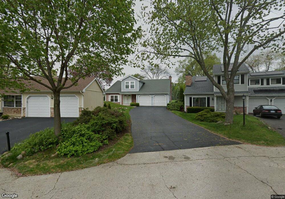
631 Dixon Ct Gurnee, IL 60031
Estimated Value: $348,000 - $355,060
3
Beds
3
Baths
1,785
Sq Ft
$197/Sq Ft
Est. Value
About This Home
This home is located at 631 Dixon Ct, Gurnee, IL 60031 and is currently estimated at $351,015, approximately $196 per square foot. 631 Dixon Ct is a home located in Lake County with nearby schools including Woodland Primary School, Woodland Elementary School, and Woodland Intermediate School.
Ownership History
Date
Name
Owned For
Owner Type
Purchase Details
Closed on
May 9, 2025
Sold by
Hill Kathleen A
Bought by
Kathleen Ann Hill Trust and Hill
Current Estimated Value
Purchase Details
Closed on
May 12, 2008
Sold by
Menotti Lisa
Bought by
Hill Kathleen A
Purchase Details
Closed on
Jul 27, 2005
Sold by
Gaskin Ann M
Bought by
Menotti Lisa
Home Financials for this Owner
Home Financials are based on the most recent Mortgage that was taken out on this home.
Original Mortgage
$175,100
Interest Rate
7.87%
Mortgage Type
Stand Alone First
Create a Home Valuation Report for This Property
The Home Valuation Report is an in-depth analysis detailing your home's value as well as a comparison with similar homes in the area
Home Values in the Area
Average Home Value in this Area
Purchase History
| Date | Buyer | Sale Price | Title Company |
|---|---|---|---|
| Kathleen Ann Hill Trust | -- | None Listed On Document | |
| Hill Kathleen A | $219,500 | None Available | |
| Menotti Lisa | $206,000 | Ticor |
Source: Public Records
Mortgage History
| Date | Status | Borrower | Loan Amount |
|---|---|---|---|
| Previous Owner | Menotti Lisa | $175,100 |
Source: Public Records
Tax History Compared to Growth
Tax History
| Year | Tax Paid | Tax Assessment Tax Assessment Total Assessment is a certain percentage of the fair market value that is determined by local assessors to be the total taxable value of land and additions on the property. | Land | Improvement |
|---|---|---|---|---|
| 2024 | $7,708 | $101,716 | $10,039 | $91,677 |
| 2023 | $7,076 | $94,435 | $9,320 | $85,115 |
| 2022 | $7,076 | $78,599 | $9,532 | $69,067 |
| 2021 | $6,122 | $72,544 | $8,798 | $63,746 |
| 2020 | $5,919 | $70,761 | $8,582 | $62,179 |
| 2019 | $5,748 | $68,707 | $8,333 | $60,374 |
| 2018 | $5,354 | $64,557 | $3,652 | $60,905 |
| 2017 | $5,235 | $62,707 | $3,547 | $59,160 |
| 2016 | $5,182 | $59,915 | $3,389 | $56,526 |
| 2015 | $5,035 | $56,824 | $3,214 | $53,610 |
| 2014 | $5,903 | $54,811 | $3,171 | $51,640 |
| 2012 | $5,600 | $66,502 | $3,195 | $63,307 |
Source: Public Records
Map
Nearby Homes
- 638 Dordan Ct
- 651 White Ct
- 690 Chandler Rd Unit 207
- 690 Chandler Rd Unit 305
- 741 Colby Ct Unit U42
- 711 Creekside Cir Unit 103
- 600 Creekside Cir Unit 85
- 640 Wilbur Ct
- 776 Chandler Rd
- 6121 Brookstone Place
- 6161 Oakmont Ln
- 6191 Oakmont Ln
- 917 Vose Dr Unit 304
- 6141 Crossland Blvd
- 6296 Doral Dr
- 920 Vose Dr Unit 304
- 920 Vose Dr Unit 106
- 920 Vose Dr Unit 105
- 914 Vose Dr
- 6402 Barn Swallow Ct
- 633 Dixon Ct
- 629 Dixon Ct
- 635 Dixon Ct
- 630 Dixon Ct
- 637 Dixon Ct
- 632 Dixon Ct
- 629 Dunham Rd Unit U341
- 621 Chip Ct
- 628 Dunham Rd Unit U343
- 619 Chip Ct
- 634 Dixon Ct
- 639 Dixon Ct
- 626 Dunham Rd Unit U344
- 627 Dunham Rd Unit U342
- 625 Chip Ct Unit U273
- 623 Chip Ct
- 637 Dunham Rd
- 620 Dunham Rd Unit U329
- 629 Chip Ct Unit U271
- 624 Dunham Rd Unit U339