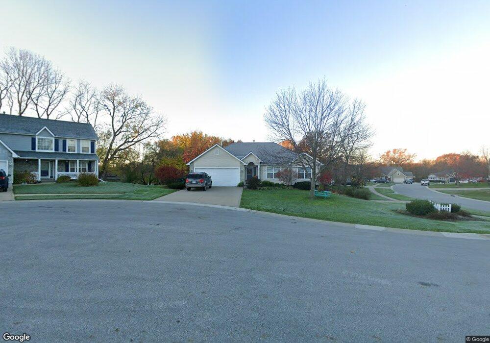
631 Hillcrest Cir Lansing, KS 66043
Estimated Value: $391,331 - $427,000
4
Beds
3
Baths
1,832
Sq Ft
$222/Sq Ft
Est. Value
About This Home
This home is located at 631 Hillcrest Cir, Lansing, KS 66043 and is currently estimated at $405,833, approximately $221 per square foot. 631 Hillcrest Cir is a home located in Leavenworth County with nearby schools including Lansing Elementary School, Lansing Middle 6-8, and Lansing High 9-12.
Ownership History
Date
Name
Owned For
Owner Type
Purchase Details
Closed on
Jun 1, 2003
Bought by
Easterling Clay and Easterling Deborah N
Current Estimated Value
Home Financials for this Owner
Home Financials are based on the most recent Mortgage that was taken out on this home.
Original Mortgage
$155,500
Outstanding Balance
$988
Interest Rate
5.31%
Mortgage Type
New Conventional
Estimated Equity
$404,846
Create a Home Valuation Report for This Property
The Home Valuation Report is an in-depth analysis detailing your home's value as well as a comparison with similar homes in the area
Home Values in the Area
Average Home Value in this Area
Purchase History
| Date | Buyer | Sale Price | Title Company |
|---|---|---|---|
| Easterling Clay | $219,000 | -- |
Source: Public Records
Mortgage History
| Date | Status | Borrower | Loan Amount |
|---|---|---|---|
| Open | Easterling Clay | $155,500 |
Source: Public Records
Tax History Compared to Growth
Tax History
| Year | Tax Paid | Tax Assessment Tax Assessment Total Assessment is a certain percentage of the fair market value that is determined by local assessors to be the total taxable value of land and additions on the property. | Land | Improvement |
|---|---|---|---|---|
| 2025 | $5,794 | $44,590 | $5,826 | $38,764 |
| 2024 | $5,368 | $42,876 | $5,826 | $37,050 |
| 2023 | $5,368 | $41,226 | $5,826 | $35,400 |
| 2022 | $5,162 | $37,479 | $5,471 | $32,008 |
| 2021 | $4,862 | $33,730 | $5,471 | $28,259 |
| 2020 | $4,788 | $32,683 | $5,471 | $27,212 |
| 2019 | $4,704 | $32,074 | $5,471 | $26,603 |
| 2018 | $4,324 | $29,522 | $5,471 | $24,051 |
| 2017 | $4,197 | $28,601 | $5,471 | $23,130 |
| 2016 | $4,200 | $28,601 | $5,471 | $23,130 |
| 2015 | $4,344 | $29,659 | $5,471 | $24,188 |
| 2014 | $4,089 | $28,520 | $5,471 | $23,049 |
Source: Public Records
Map
Nearby Homes
- 542 Creekside Ct
- 415 Fairlane St
- 610 Meadowlark Rd
- 218 Oak Hill St
- 268 Holiday Dr
- 129 Crestview Ct
- 129 Brookwood St
- 728 Eisenhower Rd
- 124 S Main St
- 202 S Main St
- 401 W Olive St
- 527 S Valley Dr
- 1102 N Main St
- 4915 Parkway Dr
- 4 Eisenhower Rd
- 813 Glenview St
- 1100 N 4th St
- 1102 N 4th St
- 218 E Kay St
- 000 4-H Rd
- 897 Hillcrest Ln
- 633 Hillcrest Cir
- 811 Englewood St
- 899 Hillcrest Ln
- 809 Englewood St
- 894 Hillcrest Ln
- 813 Englewood St
- 896 Hillcrest Ln
- 634 Hillcrest Cir
- 807 Englewood St
- 630 Hillcrest Cir
- 815 Englewood St
- 632 Hillcrest Cir
- 892 Hillcrest Ln
- 898 Hillcrest Ln
- 901 Hillcrest Ln
- 805 Englewood St
- 817 Englewood St
- 900 Hillcrest Ln
- 815 Highview Ct