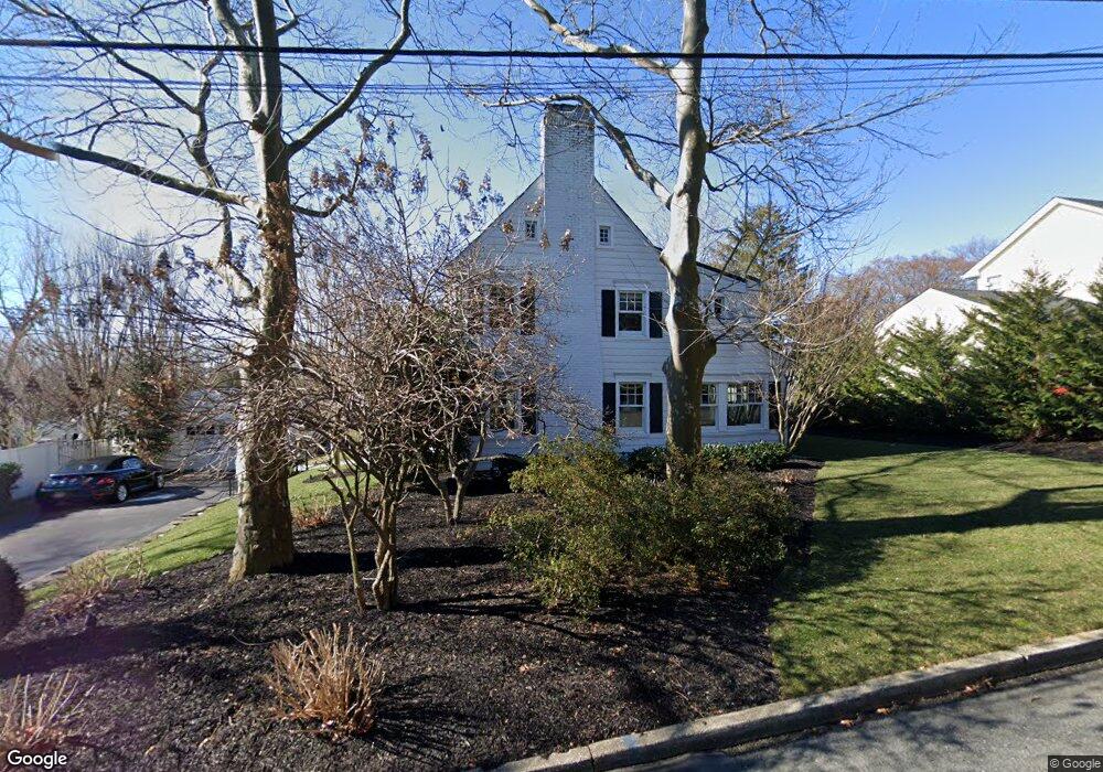
631 Rankin Rd Brielle, NJ 08730
Estimated Value: $1,264,713 - $1,340,000
3
Beds
3
Baths
2,088
Sq Ft
$629/Sq Ft
Est. Value
About This Home
This home is located at 631 Rankin Rd, Brielle, NJ 08730 and is currently estimated at $1,312,428, approximately $628 per square foot. 631 Rankin Rd is a home located in Monmouth County with nearby schools including Brielle Elementary School and St. Peter School.
Ownership History
Date
Name
Owned For
Owner Type
Purchase Details
Closed on
Aug 1, 2006
Sold by
Good Harry W
Bought by
Fabean Michael and Fabean Mary
Current Estimated Value
Home Financials for this Owner
Home Financials are based on the most recent Mortgage that was taken out on this home.
Original Mortgage
$515,000
Outstanding Balance
$311,209
Interest Rate
6.88%
Mortgage Type
New Conventional
Estimated Equity
$1,001,219
Create a Home Valuation Report for This Property
The Home Valuation Report is an in-depth analysis detailing your home's value as well as a comparison with similar homes in the area
Home Values in the Area
Average Home Value in this Area
Purchase History
| Date | Buyer | Sale Price | Title Company |
|---|---|---|---|
| Fabean Michael | $792,000 | -- |
Source: Public Records
Mortgage History
| Date | Status | Borrower | Loan Amount |
|---|---|---|---|
| Open | Fabean Michael | $515,000 |
Source: Public Records
Tax History Compared to Growth
Tax History
| Year | Tax Paid | Tax Assessment Tax Assessment Total Assessment is a certain percentage of the fair market value that is determined by local assessors to be the total taxable value of land and additions on the property. | Land | Improvement |
|---|---|---|---|---|
| 2025 | $13,616 | $1,158,400 | $525,000 | $633,400 |
| 2024 | $15,182 | $1,097,200 | $501,800 | $595,400 |
| 2023 | $15,182 | $1,181,500 | $610,000 | $571,500 |
| 2022 | $12,060 | $909,700 | $430,000 | $479,700 |
| 2021 | $12,719 | $786,700 | $360,000 | $426,700 |
| 2020 | $12,719 | $777,000 | $360,000 | $417,000 |
| 2019 | $12,494 | $774,600 | $360,000 | $414,600 |
| 2018 | $12,587 | $770,300 | $375,000 | $395,300 |
| 2017 | $11,881 | $718,300 | $335,000 | $383,300 |
| 2016 | $11,699 | $708,600 | $335,000 | $373,600 |
| 2015 | $11,505 | $691,800 | $335,000 | $356,800 |
| 2014 | $12,075 | $775,000 | $525,000 | $250,000 |
Source: Public Records
Map
Nearby Homes
- 642 Rankin Rd
- 816 Rathjen Rd
- 846 William Dr
- 20 Maple Ln Unit D
- 29 Mulberry Ct Unit D
- 41 Poplar Ct Unit C
- 806 Riverview Dr
- Kensington Plan at The Monmouth - The Villas 55+
- 406 Brown St
- 1307 W Union Ln Unit A4
- 142 Oval Rd
- 651 Oceanview Rd
- 308 South St
- 2578 Collier Rd
- 664 Valley Rd
- 2573 Curriers Place
- 907 Riverview Dr
- 300 Union Ave
- 619 Park Ave
- 542 Woodland Ave